|
 |
 |
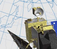
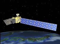
After lift-off, it takes about four days to deploy the satellite and set up the radar and antenna. These first four days are the most intense since, when necessary, the satellite has to be controlled manually. Once the satellite is set up, we will spend three months testing all its hardware, including back-up instruments. We definitely will not be able to relax during this period.
Once this is done, the satellite is proven to function as designed, and starts collecting data. But there is one more step for an Earth observation satellite to clear. The performance of on-board sensors must pass what we call calibration and verification. Calibration means checking the precision of measuring devices in engineering terms. If there is an error, it will be corrected using standard scales. We also verify the sensors from physical and empirical points of view, which takes another five months.
By the time the data are finally ready to be distributed to end-users, it will have been eight months since Daichi’s launch. But since many research institutes around the world have been greatly looking forward to Daichi’s data, we plan to start to give the information to our collaborating research institutions three months after the launch, and to evaluate it together with them.
The data from Daichi will all be transmitted to EOC, the Earth Observation Center. But when special analyses or processes are required, it will be published only after additional evaluation and analysis are done at EORC, the Earth Observation Research and Application Center.
Daichi is registered with the International Charter “Space and Major Disasters.” If a large-scale disaster happens somewhere in the world, upon request, the satellite will conduct the necessary observations even during its trial operation.
|

Tadataka Ino, who lived almost 200 years ago in the era of Edo, traveled across Japan on foot and made the first map of Japan using actual measurements. Later, in the late 20th century, maps were made with the help of airplanes. And with the further development of technology, now, in the 21st century, Daichi is going to map from space. Whether measuring on the ground, from the sky, or from space, my longing for making precise maps is the same as Tadataka Ino’s 200 years ago. His spirit will continue on through us.
|
|
 |