|
 |
|
I must say that today's infrared satellite images are not so good. I hear that the next satellite will have a new infrared sensor, and I am hoping they will make it possible to discern three-dimensional structures more accurately, with clear infrared and optical images.
Also, doing observations every 30 minutes instead of every hour will give us much greater precision. This will be a benefit to weather forecasting.
|
 |
|
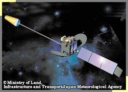
MTSAT-1R(Multi-functional Transport Satellite 1 Replacement) is designed for air-traffic control and weather observation. The project is led by the Japanese Ministry of Land, Infrastructure and Transport, and will succeed the weather satellite Himawari-5(GMS-5). MTSAT-1R will provide more frequent observations(every 30 minutes instead of every hour), and more precise images. Also, thanks to its additional infrared sensor, low-level clouds will be easier to detect at night. |
|
|
|
 |
|
Data from meteorological satellites is the most important thing for weather forecasting. Radar gives valuable information on rain activity, but with satellite images of cloud formations we can get a better idea of how the weather will develop. I would say that satellites allow us to do about 70 per cent of the job of weather forecasting. If it were not for them, we could not forecast or report on weather nearly as well.
People used to say that fishermen knew how to predict weather, as they were accustomed to reading the sky and cloud formations. With the unaided eye, humans can see, at most, 20 to 30 kilometers of sky. A weather satellite like Himawari(GMS) can scan several thousand kilometers. So satellites are several hundred times better than us at observation; their precision is much greater. People used to predict weather based on their experience, by observing nature. Today, we can do the same thing by looking at images taken by weather satellites.
|
|
|
|
|
|
|