
 After cyclones, earthquakes and flooding, wildfires and drought are probably the next most serious types of natural disasters in the region. Especially during the dry season, they are also becoming a very serious problem in terms of air pollution. In Australia alone, which has only 20 million people, it is estimated that the damage caused by wildfires is in the order of $77 million every year. So, you can imagine that for a much larger region like the Asia-Pacific, this is a very serious type of disaster.
Sentinel Asia has strong potential in the near future to act as a community information system for the region, to distribute disaster information not just about fires, but about many, many types of disasters that we can be detected with satellites. It is a great tool to show how valuable space technologies can become to anybody. And it also has great potential to become part of a global system under the Global Earth Observation System of Systems (GEOSS) plan. So we have strong interest in making sure that Sentinel Asia not only works for the region, but also acts as a good example of what can be done at a global level.
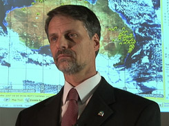
The Australian system is also called Sentinel. Presently, we use two NASA satellites, called Terra and Aqua, that have thermal sensors on board called MODIS. And we also use other satellites from the National Oceanic Administration (NOAA) of the United States, which also have thermal capabilities, specifically, sensors called the AVHRR. Using these thermal sensors, we detect wildfires from satellites, then the data is overlaid onto maps through a Web-based mapping system, and transmitted. The data processing is fully automated, and it allows rapid information dissemination, within one hour after the satellite overpass.
From an Australian perspective, we would like to maintain our involvement in Sentinel Asia, with our Sentinel wildfire-monitoring system being a node of Sentinel Asia. Over time, we hope to add more services and data sources, including additional information about other disasters such as flooding, drought monitoring and other types of disasters that are, of course, important from an Australian perspective, but also important from a regional point of view.