Image data acquired by the AVNIR-2 onboard the "Daichi"
Japan Aerospace Exploration Agency (JAXA)
The Japan Aerospace Exploration Agency (JAXA) would like to announce that image data was successfully acquired by the Advanced Visible and Near Infrared Radiometer type-2 (AVNIR-2) onboard the Advanced Land Observing Satellite "Daichi," which was launched on January 24, 2006 (Japan Standard Time, JST.) The data was acquired as part of the initial functional verification test.
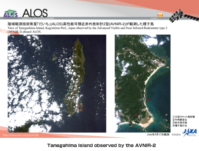
The attached image of the Tanegashima area was observed by the AVNIR-2 at 10:50 a.m. on Feb. 17 (JST), and later received at the Earth Observation Center (in Hatoyama-cho, Hiki-gun, Saitama Pref.)
The Daichi is the only satellite that can perform high resolution observations of one specific area with both light and radio frequency by using both the Advanced Visible and Near Infrared Radiometer type 2 (AVNIR-2) and the Phased Array type L-band Synthetic Aperture Rader (PALSER) simultaneously. Through this ability, it can identify the earth's surface more precisely.
|
|
Note: Spatial resolution indicates the physical size of an object that can be distinguished in an image.
The diagram is image data on Tanegashima Island in Kagoshima Prefecture observed by the Advanced Visible and Near Infrared Radiometer type-2 (AVNIR-2) onboard the Advanced Land Observing Satellite "Daichi" during the day time (around 10:50 a.m.) on February 17, 2006 (JST). The color of the image is close to what the human eye can see, and the spatial resolution is 10 meters. For example, you can identify sand beaches and shallows along the seashores, vegetation and buildings. The Takesaki Observation Deck in Minami-tane cho and the Osaki Launch Complex from which the H-IIA Launch Vehicle will be launched tomorrow are also clearly seen. By combining information of four observation bands from visible light to near infrared light, we can learn the health of agricultural products and forests, land usage, and local environmental conditions.
+ Tanegahima Island observed by the AVNIR-2 (Movie) [ MPEG 5.9MB ]
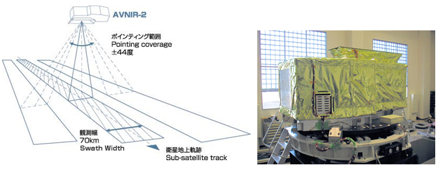
Advanced Visible Near Infrared Radiometer type-2 (AVNIR-2)
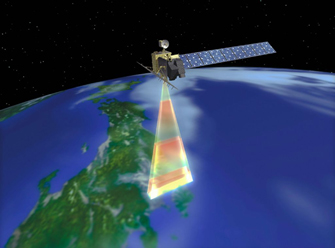 |
The AVNIR-2 is an upgraded AVNIR on the Advanced Earth Observing Satellite (ADEOS) with high resolution. It will contribute to create maps for categorizing land usage or vegetations by observing mainly land and coastal areas using visible and near infrared bands. The AVNIR-2 is equipped with a pointing function by which it can shift its observation area perpendicular to the ALOS's moving direction. This function is expected to be also useful for monitoring and understanding the situation of a disaster stricken area. |
 |
|
 |
|
For inquiries:
JAXA Earth Observation Research and Application Center
Tel: + 81-3-6221-9008
Fax: +81-3-6221-9191