Observation Results of the Advanced Land Observing Satellite 'Daichi' (ALOS) relating to 2007 Niigata-ken Chuetsu Offshore Earthquake
Japan Aerospace Exploration Agency (JAXA)
A huge earthquake occurred off Jyo-chuetsu, Niigata Prefecture (60 kilometers south-west of the city of Niigata), at about a depth of 17 kilometers at 10:13 a.m. on July 16, 2007 Japan Standard Time (All the following dates and times in this release are Japan Standard Time.) The earthquake was named the “2007 Niigata-ken Chuetsu Offshore Earthquake.” The Japan Aerospace Exploration Agency (JAXA) analyzed observation images acquired by the Advanced Land Observing Satellite “Daichi” (ALOS) on July 19 and confirmed the pattern of diastrophism.
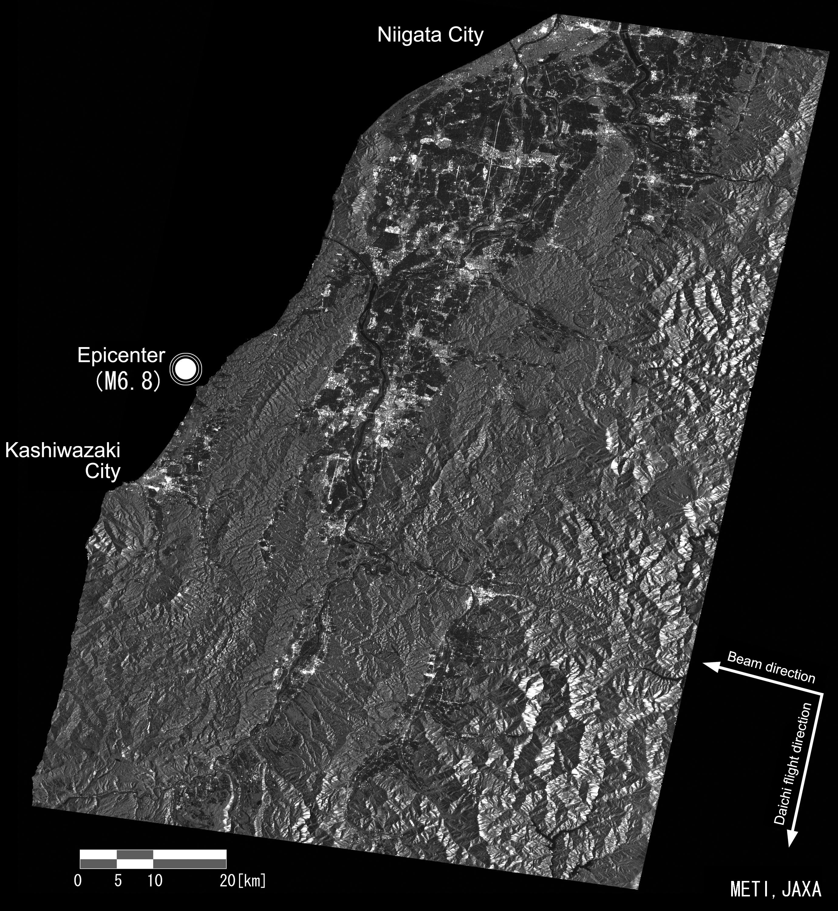
[Figure 1] shows diastrophism by processing the image data [Figure 2] taken by one of the Daichi onboard sensors, the PALSAR*1, at 10:13 a.m. on July 19, 2007, and one also taken by the PALSAR on January 16, 2007 using the differential interferometric method*2. The change in the distance between the Daichi and the Earth in about six months between Jan. 16 and July 19 is indicated by the two-dimensional colors in the image. We observed that the distance has been got closer (shrunk) by about 30 centimeters (maximum) in the land area at the immediate east of the epicenter. This means diastrophism, including a rise, took place there. Further south from that area, the distance between the Daichi and the land got further (longer) by about 15 cm. This indicates diastrophism, including a subsidence, occurred there.
- *1 PALSAR,
- Phased Array type L-band Synthetic Aperture Radar, is a microwave sensor receiving radio wave reflections transmitted from the satellite. It can acquire image data regardless of the weather and time of day.
- *2 Differential interferometric process:
- Radars measure the distance to the Earth; therefore, we can find a rise or a cave-in caused by a subsidence of the land by the difference in distance between two observations.
|
|
[Figure 1] Diastrophism in Chuetsu Region, Niigata
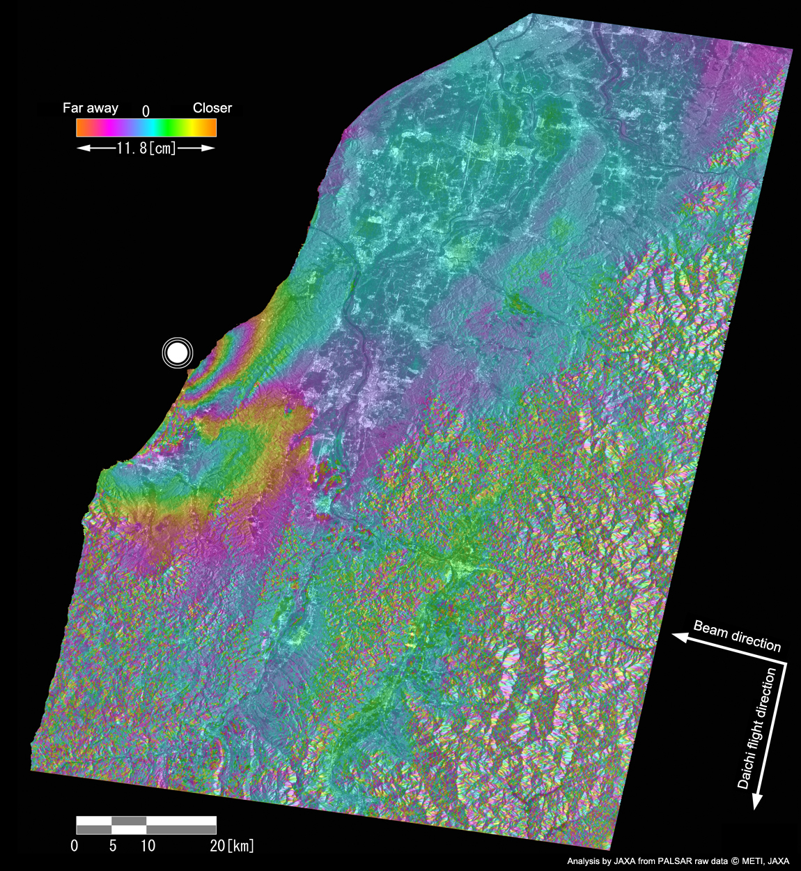
- (1) The land area immediately east of the epicenter
- One cycle of colors (starting from blue, then green, yellow, red and blue again) indicates 11.8 centimeters of diastrophism. The color change in the above order shows that the land comes closer to the Daichi (or diastrophism with a rising factor occurred in most cases because the Daichi is flying over land.)
- (2) Land area further south
- The other color change order starting from blue, red, yellow, green and blue (= one cycle is 11.8 cm) indicates that the land recedes from the Daichi. It means diastrophism with a subsidence factor occurred in most cases as explained above.
[How to Look at Diastrophism Image]
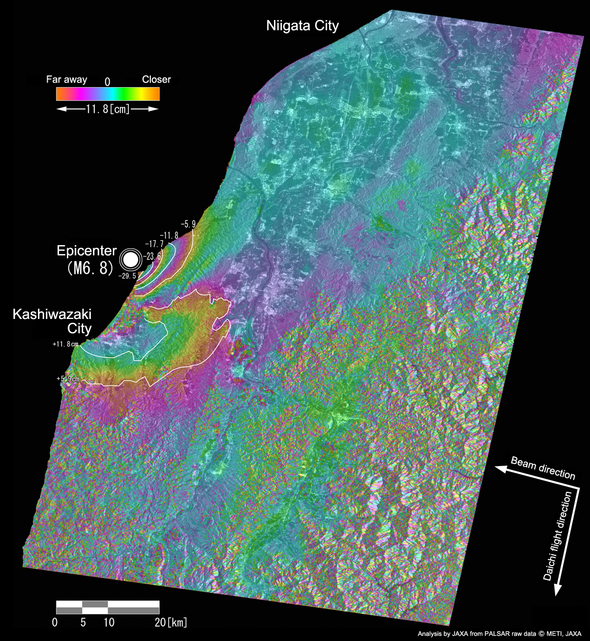
-11.8 cm indicates that the distance between the Daichi and the land got closer (shrunk) or diastrophism with a rise took place.
+11.8 cm indicates that the distance between the Daichi and the land got further (longer) or diastrophism with a subsidence took place.
[Figure 2] Image of Chuetsu Region, Nigata, Observed by the PALSAR on July 19