

 India is a vast country of 328 million hectares. We have a coastline of 7,500 kilometers. Out of that, 5,700 kilometers of coastline is very cyclone prone. Sixty-eight per cent of our territory is drought-prone, 20 per cent is affected by severe droughts. And about 20 per cent of our geographical area is very much flood-prone. Out of that, about nine to 10 million hectares are affected by floods every year. And a good bit of our land mass is also prone to landslides, which is again in the north, in the Himalayan region and in the Western Ghats, the western part of India. We have deciduous forests in northern, central and southwestern regions that are prone to forest fires. So, basically, we can say that India is one of the very, very highly disaster-prone regions of the world.
We have generated a basic database integrating satellite images and related information, for example about land use, land cover, infrastructure, and village boundaries. So satellite data can be quickly put to use in disaster management. We superimpose the satellite data over these basic layers and quickly prepare maps showing the communities affected. We provide these maps to disaster managers, and they use them very effectively.
We need both optical and microwave data. The low-resolution satellite data with wide coverage is useful in disaster surveillance as well as monitoring. So in India, we receive data from the advanced wide field (low-resolution) camera on our satellite every two days. But if the area is covered by clouds, we cannot get good images. In such cases, we very much want to have radar observation data.
Now we are in the process of registering the advanced wide-field sensor data with the Sentinel Asia system. This covers a good part of the Asian region. And then if there is a specific request from a member country from the Asia-Pacific region, we would try to acquire higher-resolution data using our satellite. We are also prepared to carry out the analysis. Then we supply the data to the country that requested it.
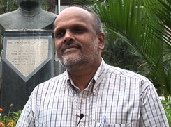
We are certainly very happy that the expertise we have in India can be used to help our neighboring countries. Similarly, we also expect that we will derive benefit from space agencies such as JAXA because there are areas that our satellites cannot cover as quickly as we’d like to. Quick response is crucial when disaster strikes. So it is desirable to have as many space agencies as possible joining hands. It would be beneficial to all member countries.