Observation Results of the 2007 Noto Peninsular Earthquake
by the Advanced Land Observing Satellite "Daichi"
Japan Aerospace Exploration Agency (JAXA)
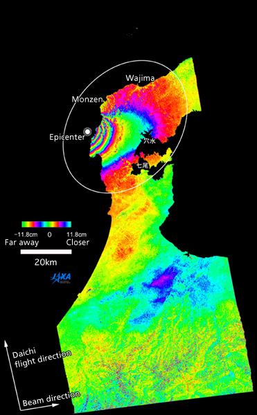
At around 9:42 a.m. on March 25, 2007, Japan Standard Time (JST, all dates and times hereinafter are in JST,) a major earthquake, later named the "2007 Noto Peninsular Earthquake," hit the Noto region of Japan. The epicenter was offshore from the Noto Peninsular (about 40 km west-south-west of the city of Wajima.) The Japan Aerospace Exploration Agency (JAXA) detected a rise in the surface of the land due to the earthquake by analyzing observation images acquired by the Advanced Land Observing Satellite "Daichi" on April 10.
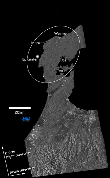
Figure 1 shows the diastrophism by processing the image taken by one of the Daichi onboard sensors, the PALSAR*1, at 10:27 p.m. on April 10 and one also taken by the PALSAR on February 23, 2007, (Figure 2) using the differential interferometric method*2. The change of distance between the Daichi and the Earth in 47 days between Feb. 23 and April 10 is indicated by the two-dimensional colors in the image. We can observe a maximum of 45 centimeters of rise mainly in the western part of Monzen Town in the city of Wajima. The rises were concentrated within about a 40 km radius around the town. The Geographical Survey Institution of Japan also detected the diastrophism through GPS observations of a gap in a fault and other methods, and we were able to support their detection through data acquisition by the Daichi.
Japan Aerospace Exploration Agency (Tsukuba Space Center)
General Services Division,
Program Management and Integration Department,
Office of Space Applications
Ms. Sasaki / Ms. Okuda
Tel: 029-868-5277 or 5288
(+81-29-868-5277 or 5288 from overseas)
*1 PALSAR, Phased Array type L-band Synthetic Aperture Radar, is a microwave sensor receiving radio wave reflections transmitted from the satellite. It can acquire image data regardless of the weather and time of day.
*2 Differential interferometric process: Radars measure the distance to the Earth; therefore, we can find a rise or a cave-in caused by a subsidence of the land by the difference in distance between two observations.
|
|
For inquiries:
JAXA Public Affairs Department
Tel: +81-3-6266-6413 to 7, Fax: +81-3-6266-6910

