KAGUYA (SELENE) Last shots captured by the HDTV
Japan Aerospace Exploration Agency
Japan Broadcasting Corporation (NHK)
The Japan Aerospace Exploration Agency (JAXA) and the Japan Broadcasting Corporation (NHK) would like to release the final still images taken by the onboard High Definition Television (HDTV) of the lunar explorer "KAGUYA" just prior to its maneuvered falling to the Moon. The images are attached below. The KAGUYA was launched on September 14, 2007, and was controlled to be dropped to the Moon on June 11, 2009, as its mission was completed.
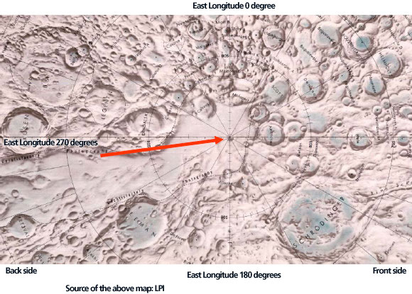
The series of continued shots was taken with an interval of about one minute by the HDTV (Teltephoto) while the KAGUYA was maneuvered to decrease its altitude toward the impact position (around GILL crater.)
We can see the approaching Moon surface as the KAGUYA went closer to it. After the final image, the KAGUYA moved into the shaded area to make its final landing, thus it was pitch dark while taking an image. This is the very final image shooting of the Moon by the KAGUYA HDTV.
You can enjoy images taken by the KAGUYA HDTV through JAXA Digital Archives, the KAGUYA Image Gallery, and the JAXA channel on YouTube.
[JAXA Website Digital Archives]
http://jda.jaxa.jp/jda/p1_e.php
(Search by selecting the following: Subject: Observation Images, Category: Moon and Planet Exploration, Mission: Moon)
[JAXA KAGUYA Image Gallery]
http://wms.selene.jaxa.jp/selene_viewer/index_e.html
[YouTube JAXA Channel]
http://www.youtube.com/jaxachannel
[NHK : Kaguya Archives]
http://www3.nhk.or.jp/kaguya/archive/index_e.html
|
|
The very final images taken by the HDTV (Teltephoto)

Around Drygalski P (Diameter: about 30 km)
At 3:14 a.m. on June 11, 2009 (JST) (Altitude at 20.7 km)
The last clear still image taken by the KAGUYA's HDTV (Teltephoto) when it went into the shaded area from the sunshine area.
You can clearly see the rough surface inside the crater as the sun shone from the back left hand side in the polar area.
| Image No. | Observation time on June 11, 2009 (JST) | Location | Altitude | Note |
|---|---|---|---|---|
| 1 | At 3:11 a.m. | Around at lat.74 deg. S, long. 261 deg. E | 27.8km | Near Zeeman G and BOLTZMANN |
| 2 | At 3:12 a.m. | Around at lat.77 deg. S, long. 261 deg. E | 25.4km | Between BOLTZMANN and Drygalski |
| 3 | At 3:13 a.m. | Around at lat.79 deg. S, long. 261 deg. E | 23.0km | Near side of Drygalski P (Diameter: about 30 km) |
| 4 | At 3:14 a.m. | Around at lat.81 deg. S, long. 261 deg. E | 20.7km | Around Drygalski P |
| 5 | At 3:15 a.m. | Around at lat.83 deg. S, long. 261 deg. E | 18.4km | South of Drygalski |
| 6 | At 3:16 a.m. | Around at lat.86 deg. S, long. 262 deg. E | 16.2km | South of Drygalski |
| 7 | At 3:17 a.m. | Around at lat.89 deg. S, long. 266 deg. E | 14.1km | Around DE GERLACHE (Diameter: about 32 km) |
|
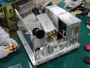
 HDTV general view |
||||||||||
 An arrow shows the location of sequential photo shooting by the HDTV |
|||||||||||