Memorandum of Understanding with NASA
for cooperation in Global Precipitation Measurement Project
Japan Aerospace Exploration Agency (JAXA)
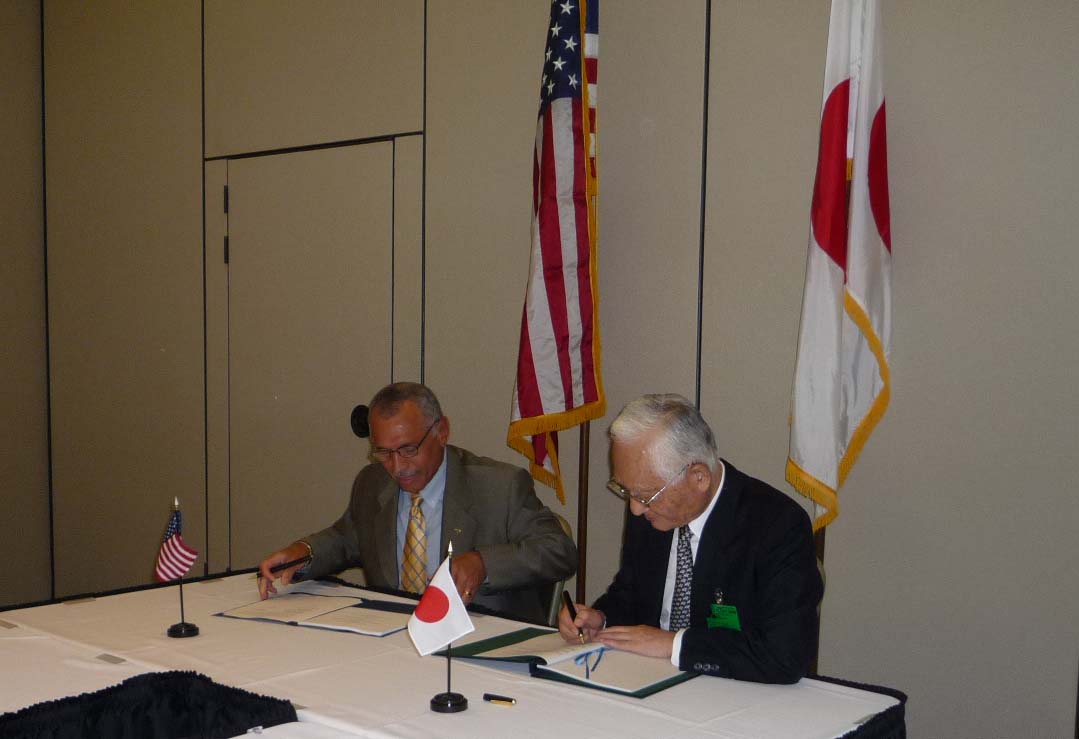
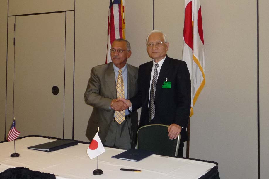
President Keiji Tachikawa of the Japan Aerospace Exploration Agency (JAXA) and Administrator Charles Bolden of the National Aeronautics and Space Administration (NASA) signed a Memorandum of Understanding (MOU) on development and operation activities for the Global Precipitation Measurement (GPM) project to measure precipitation (such as rain and snow) using a multiple number of satellites at the John F Kennedy Space Center in Cape Canaveral, Florida, U.S.A. on July 31, 2009 (Japan Standard Time). With this MOU, the two organizations will further deepen the cooperative relationship and exercise comprehensive leadership utilizing the research and development ability and personnel of the two parties.
To date, JAXA and NASA have cooperatively developed the Tropical Rainfall Measuring Mission “TRMM,” and have been observing tropical rainfall by the TRMM. In the GPM project, we will acquire and analyze data from onboard sensors of multiple satellites in order to contribute to the development of technology to measure precipitation not only in tropical regions but also on a global scale. Moreover, the project is expected to further boost international cooperation in the area of space development and utilization between Japan and the United States. This MOU stipulates the contents of cooperation in the development and operation activities of the GPM core satellite, which is the center of the GPM project.
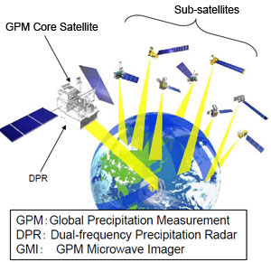
The GPM core satellite carries a Dual-frequency Precipitation Radar (DPR), which has been jointly developed by JAXA and the National Institute of Information and Communications Technology (NICT.) By utilizing observation data of the DPR, the observation accuracy of precipitation by a multiple number of satellites is expected to be increased. Furthermore, we are aiming for more accurate and frequent observation activities. The DPR is a core sensor of the GPM project. For more details, please refer to the attached information below for the GPM project and the characteristics of the DPR.
The global precipitation map to be compiled by the GPM project is expected to contribute to monitoring climate change, evaluation of a climate model, improvement of weather forecast accuracy, and construction of flood warning systems. The GPM core satellite is scheduled to be launched by the H-IIA Launch Vehicle in Japan Fiscal Year 2013.
- Contents of agreed cooperation
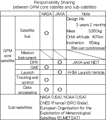
- JAXA’s role
-
- Development of DPR
- GPM core satellite launch
- Data processing
- NASA’s role ?
-
- Development of the GPM core satellite
- Development of GPM Microwave Imager (GMI)
- Tracking and control of the GPM core satellite
- Data processing
|
|
Global Precipitation Measurement Project/Dual-frequency Precipitation Radar (GPM/DPR)
The Global Precipitation Measurement Project (GPM) is an international cooperative mission to measure global precipitation more accurately and frequently for elucidating changes in climate and water circulation using one GPM core satellite with the Dual-frequency Precipitation Radar (DPR) and the GPM Microwave Imager (GMI) onboard and other sub-satellites with either a microwave imager or a microwave sounder onboard. The GPM core satellite has been cooperatively developed by JAXA and NASA, and the DPR has been jointly developed by JAXA and NICT.
‹Signing Ceremony›