Public release of KAGUYA (SELENE) data archives
Japan Aerospace Exploration Agency (JAXA)
The Japan Aerospace Exploration Agency (JAXA) released data from the lunar explorer "KAGUYA" (SELENE) (L2 products) during the nominal operation phase (from December 21, 2007 to October 31, 2008) to the public through the Internet.
L2 products are calibrated/validated processed data from KAGUYA science mission instruments. By using the L2 products, researchers all over the world are expected to advance the scientific analysis and applicability investigation of the Moon.
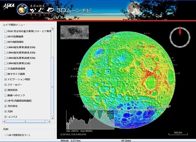
"KAGUYA 3D Moon NAVI" services, which can show KAGUYA data using a three-dimension geographic information system (WebGIS) through the Internet, have also commenced. The developed software is based on NASA "World Wind" and the KAGUYA's images and data can be displayed using the 3D map projection function. It is necessary to download and install the free software. Please refer to the following homepage for details.
L2 products during the extended operational phase (until June 2009) are scheduled to be released after processing and calibration/validation are finished.
[ KAGUYA(SELENE) Data Archive ]
https://www.soac.selene.isas.jaxa.jp/archive/index.html.en
[ KAGUYA 3D Moon NAVI ]
http://wms.selene.jaxa.jp/3dmoon/index.html
|
|
1. Data content and mission of each science mission instrument
| Mission Instrument | Data Content | Mission Overview |
|---|---|---|
| Multi-band Imager (MI) | - Radiance *1 data - Reflectance *2 data |
Mineral distribution is obtained by taking visible and near infrared images of the Moon's surface in nine wavelength bands. |
| Spectral Profiler (SP) | - Radiance, Diffuse reflectance *2 data | The mineral composition of the Moon's surface is obtained by measuring the continuous visible and near infrared spectrum. |
| Terrain Camera (TC) | - Reflectance map(Morning/Evening - DTM/TC Ortho *3 |
High-resolution geographical features are acquired by stereo cameras. |
| Lunar Radar Sounder (LRS) | - Sounder subsurface cross section - Subsurface geologic structure interpretation map - High-frequency wave spectrum - Low-frequency wave spectrum |
The subsurface stratification and tectonic features in the shallow part of the lunar crust (a few km) by high-power RF pulses. |
| Laser Altimeter (LALT) | - Range Data - Time sequential Lunar Global Topographic Data - Global Grid Topographic Data of the Moon(1/16 degree/pixel) *4 - Global Topographic Map of the Moon - Grid Topographic Data of the Lunar North/South Pole - Topographic Image of the Lunar North/South Pole - Spherical Harmonics Coefficients of the Lunar Topography |
To make the lunar topography model, the altitude is precisely measured using high-power laser pulses. |
| Lunar Magnetometer (LMAG) | - Magnetic anomaly grid data - Magnetic anomaly map - Time sequential Magnetic field data - 1D electrical conductivity structure |
The magnetization structure on the Moon is acquired by measuring the lunar and surrounding magnetic field. |
| Charged Particle Spectrometer (CPS) | - Rn intensity map - Po intensity map - Time variation of Rn and Po fluxes - Flux variation of light particles |
Alpha rays from the Moon's surface and an abundance of cosmic ray particles are measured. |
| Plasma energy Angle and Composition Experiment (PACE) | - Magnetic anomaly map (Electron Reflectometer) - Reflected Ion Map - High Resolution Data of Electron/Ion Energy Spectrum |
The three dimensional distribution of low-energy electrons and mass-discriminated low-energy ions around the Moon are measured. |
| Radio science (RS) | - Electron Column Density | The Moon's ionosphere is detected by measuring the small deviation in the phase of RF signals from "OUNA" (VRAD Satellite). |
| Upper-atmosphere and Plasma Imager (UPI) | - TEX plasmasphere image - TVIS image |
Images of the magnetosphere and the ionosphere around the Earth are taken from the Moon to study the behavior of the plasma. |
| Relay Satellite (RSAT) | - Spherical Harmonics Coefficients of Lunar Gravity Model - Covariance Matrix of Lunar Gravity Model - KAGUYA Ephemeris, OKINA Ephemeris - Gravity Field Map - Power Spectrum of Spherical Harmonics Coefficients of Lunar Gravity Model |
Signals from the Main Orbiter in flight on the farside of the Moon are relayed by "OKINA" (Relay Satellite), and the local gravity field data from the farside of the Moon is obtained by measuring the disturbance in the orbit of the Main Orbiter using four-way Doppler measurements. |
| VLBI radio source (VRAD) | - Doubly differenced 1-way range by differential VLBI *5 - OUNA Ephemeris |
The gravity field of the Moon is accurately observed by measuring the orbits of "OKINA" (Relay Satellite) and "OUNA" (VRAD Satellite) using differential VLBI observation of S and X band radio wave sources aboard these satellites. (VLBI: Very Long Baseline Interferometer) |
| X-ray Spectrometer (XRS) | - (Data offer to researchers who need data after consulting with the principal investigator) *6 | The surface elemental composition (Al, Si, Mg, Fe, etc.) is determined through X-ray fluorescence spectrometry by irradiation of solar X-rays. |
| Gamma Ray Spectrometer (GRS) | - Gamma Ray Energy Spectrum - Gamma Ray Intensity Map *7 |
The abundance of key elements is determined by measuring energy spectra of gamma-rays from the lunar surface with high energy resolution. |
| High Definition Television (HDTV) | - The position and time of movie images (only catalog information. HDTV movies can be seen on the JAXA digital archives and YouTube site). | Taking pictures and movies of the Earth and the Moon with high-definition television cameras. |
| Ancillary data | - The position, attitude and time data of satellites |
- *1 Reflection energy of visible/near-infrared light from the surface of the Moon(Unit: [W/m2/μm/sr]).
- *2 Albedo (ratio to diffusely reflected light at the surface of the Moon from light sources such as the Sun).
- *3 Digital Terrain Model (DTM) which expressed geographical features of the lunar surface digitally. Distortion of the image taken from the satellite is ortho-corrected by the orthographic projection.
- *4 Topographic data with the highest resolution (at present).
- *5 Doubly differenced 1-way range by differential VLBI (the distance which correspond to the arrival time interval of the electric wave between two VLBI stations).
- *6 Because the radiation damage of X-rays CCD and low-level solar activity continued, it is impossible to process and calibrate L2 products with the required accuracy. Data is individually offered to researchers who need data after adjustments with the principal investigator as a point of contact.
- *7 Radioactive element (U, K, and Th) etc.
2. Snapshot of "KAGUYA 3D Moon NAVI"