|
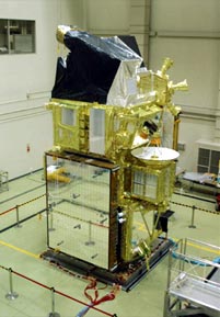
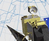
The full view of Daichi
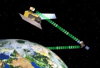
Transmission via the Data Relay Test Satellite Kodama (DRTS)
Daichi in Sun Synchronous Orbit: At about 692 km altitude, about 100 min per cycle |
 |
The major Earth observation satellites are the United States’ Landsat (30 m resolution) and France’s SPOT (10 m resolution), both of which have lower resolution than Daichi’s 2.5 m. Satellites with higher resolution are the American commercial satellites QuickBird and IKONOS (both about 1 m resolution). That puts Daichi right in the middle, with slightly lower precision than the commercial satellites, but more detail than Landsat and SPOT. And Daichi has the added advantage of being able to map the entire planet in just 46 days. With such a profile, Daichi is a unique satellite that reflects Japan’s strength. In the near future, it is likely that users will be able to combine data from all of these satellites. For instance, when a user needs to zoom in and get more precise data on a specific area that Daichi has observed, higher-resolution data taken by a commercial satellite will be available. In contrast, data gathered by a satellite that can monitor a 2,000 km span will be useful for evaluation of wider areas. Different satellite data will be used for different purposes.
Daichi’s most outstanding feature, however, is disaster monitoring, for which speed is very important. Daichi can observe the entire planet with a certain degree of precision in a short time. What makes Daichi unique is its cross-track pointing capability. This will play an important role when urgent observation is required during a natural disaster. Using just one of Daichi’s observation tools, the optical sensor or radar, it takes about two days to spot a target. Japan’s latitude is favorable for observation by Daichi, so in our country, targets can be spotted in one day. Daichi will be a hugely valuable tool in dealing with natural disasters.
|

High-resolution mapping and disaster monitoring are not Daichi’s only objectives. It will also be used to survey natural resources through global-scale observation. Our goal is for the satellite to be broadly used, and to provide data related to everyday life.
For instance, Daichi’s radar can detect ice formations, giving the Japan Coast Guard information on winter ice floes in the Sea of Okhotsk. The Ministry of Agriculture, Forestry and Fisheries of Japan plans to use Daichi data for the management of rice paddies. The Geographical Survey Institute will use it to update maps. In the past, geographical surveys have been done with aerial photos and ground measurements, but Daichi is expected to provide much more precise data.
Although administrative organizations are the main users, data from Daichi will soon impact our daily lives.
Since Daichi is a land-observing satellite, it does not carry sensors for gas or global warming. It does, however, have the capability to recognize forests. Mapping forest distributions on a global scale is one of Daichi’s first tasks, starting with the Asian region.
And because Daichi’s near-infrared sensor can detect the status of urbanization with 10 m spatial resolution, the satellite will be used to monitor environmental degradation caused by urbanization, in order to prevent further environmental pollution.
|

Expectations for Daichi have been rising among developing countries, especially in Asia. Although Japan will have to take the lead to a certain extent, many Asian countries have begun to focus on space development and remote sensing. For example, Thailand’s GISTDA, the Geo-Informatics and Space Technology Development Agency, has expressed an interest in processing and evaluating Daichi’s measurements of that country. We are also discussing collaborative research and data analysis with Indonesia.
In Japan, the maximum scale for maps of the entire nation is 1/25,000. Meanwhile, many other Asian nations still do not have precise maps of large regions of their countries. We would like all Asian countries to use Daichi’s data, as it will carry all the necessary technologies for 1/25,000 mapping, including elevations around the world. Once detailed maps are made, they can be used to plan for land utilization and natural disasters. JAXA is looking forward to continuous cooperation with other nations, giving our Asian neighbors technological support.
|
|
 |