World Elevation Data (30-meter mesh version) is now available
at JAXA's site free of charge!
May 18, 2015 (JST)
Japan Aerospace Exploration Agency (JAXA)
The Japan Aerospace Exploration Agency (JAXA) will begin publishing free of charge an elevation data set that can express undulations of terrain over the world with a resolution of 30 meters horizontally (30-m mesh version). The data set has been compiled with images acquired by the Advanced Land Observing Satellite “DAICHI” (ALOS). As the first step, we will offer the areas in East Asia, including Japan, and South East Asia regions, and will expand the areas to all over the world (within 82 deg. of N/S latitudes). (Please refer to Attachment item 1.)
The data set is published based on the elevation data set (5-meter mesh version) of the “World 3D Topographic Data” (please refer to Attachment item 3), which is the most precise global-scale elevation data at this time, and its elevation precision is also at a world-leading level as a 30-meter mesh version. This data set is expected to be useful for scientific research, education, as well as the private service sector that uses geospatial information. (Please refer to Attachment item 2.)
Related links
(*Note)
The “World 3D Topographic Data” project compiles data set of elevation data (5-meter mesh and images (2.5-meter mesh) of global land areas using 3 million data images of ALOS, then expands services to provide geospatial information. NTT DATA Corporation is in charge of data provision.
Attachment
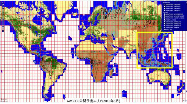
1. PRISM World Elevation Data (30-meter mesh version)
The yellow square indicates the area for the first publication.
2. PRISM World Elevation Data: Examples of expected application by users.
* The following examples are compiled by overlapping ALOS image data on elevation data.
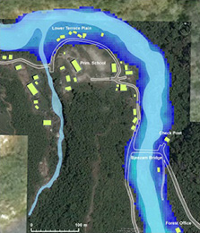
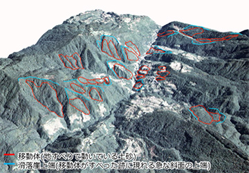
| (a) | Base information for analyzing river runoff or for a hazard map |
|---|---|
| Blue parts are either a river itself or an area which is expected to be inundated in case of runoff. (Lighter blue indicates deeper water depth.) |
| (b) | Tsunami, tidal wave, hazard simulation |
|---|---|
| Blue parts are areas where tsunami is expected to reach under certain conditions. |
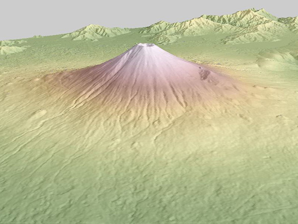
| (c) | Understanding and analyzing terrain |
|---|
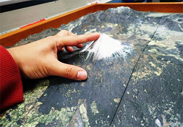
| (d) | Educational use with a 3D model |
|---|
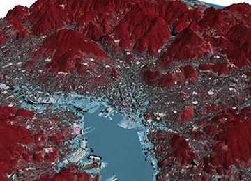
Examples of publishing data (in Tokyo)
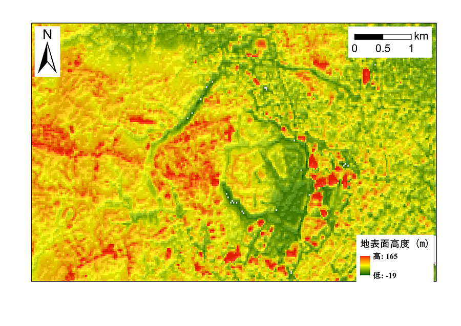
| (a) | World Elevation Data (30-m mesh) to be published |
|---|

| (b) | PRISM world elevation data (5-m mesh) |
|---|

| (c) | (Reference) Image data of the same area acquired by DAICHI (ALOS) |
|---|
3. Digital 3D Topographic Data
Digital 3D topographic data is data that records three dimensional coordinates (horizontal position and height) of terrain. The data consists of two kinds of data namely an ortho rectified image to show a horizontal position and digital elevation data to indicate height. An ortho rectified image is compiled by removing distortion caused by terrain from an image taken from the sky and space, then adding correct information on the image.
Selecting about 3 million less clouded image scenes from all data acquired by the PRISM aboard the DAICHI, JAXA compiles digital elevation models of digital 3D topographic data. Thus the models express the fine details of the world’s first 5-meter resolution and an accuracy of 5-meter height of the terrain over the world.
For your information, other global scale digital elevation models include a 90-meter mesh version published by the United States based on data observed by the Space Shuttle in 2000 (the first publication was in 2003, and a 30-meter mesh version was also started to be published in 2014), and a 30-meter mesh version jointly published by the U.S. and Japan (Ministry of Economy, Trade and Industry) based on images acquired by satellites since 2000 (the first version was published in 2009). They are widely used.