Overview
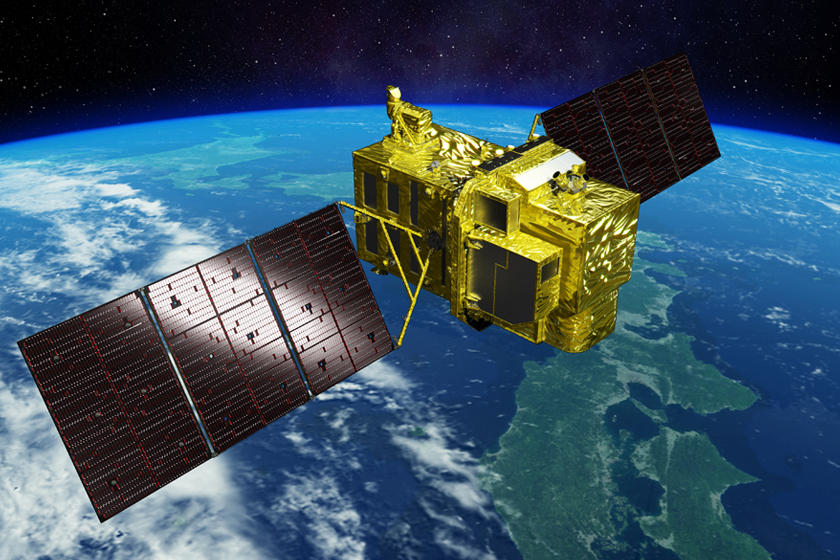 |
Achieving improved optical observation with wide-swath and high-resolution as a successor of optical mission of ALOSAdvanced Land Observing Satellite-3 “DAICHI-3” (ALOS-3) is a successor of the optical mission of Advanced Land Observation Satellite (ALOS). The sensor onboard ALOS-3 is designed for an improved ground resolution (0.8 m) and wide-swath (70 km) simultaneously by expanding the size and upgrading performance compared to that of ALOS. ALOS-3 observations regularly cover all of the land areas of not only Japan but also across the whole world. ALOS-3 aims to become one of the key tools for disaster managements and countermeasures of the central and local governments; therefore, ALOS-3 is always ready for urgent observation of the affected area wherever disaster strikes. In addition to that, the system for product distribution is also developed in order to deliver images for both before and after the disaster to users swiftly. The observed data from ALOS-3 is expected to lead to progress in the various fields due to its unique imaging capabilities; it will make a significant contribution to upgrading global geospatial information and research and application for monitoring of the coastal/vegetation environment. |
|---|
Press Release
index-
- Mar. 7, 2023 (14:15) [report]
- Launch Failure of the First H3 Launch Vehicle and Setting up a Special Task Force
-
- Mar. 7, 2023 (11:30) [report]
- The first information on the result of the first H3 Launch Vehicle (H3 TF1) launch (No.2)
Characteristics
Attaining both “wide-swath” and “high-resolution”
|
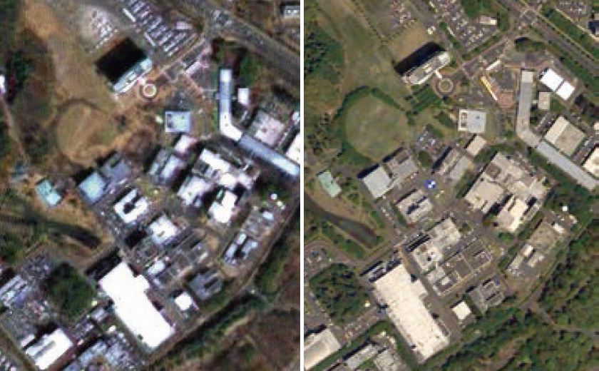
Although high-resolution and wide-swath are the incompatible functions in general, ALOS-3 improves the ground resolution by about three times that of ALOS (2.5 to 0.8 m at nadir) remaining the wide-swath (70 km at nadir).
Images: Around JAXA Tsukuba Space Center, Ibaraki Pref., Japan
|
 |
|---|
Various needs corresponding abundant observation functions
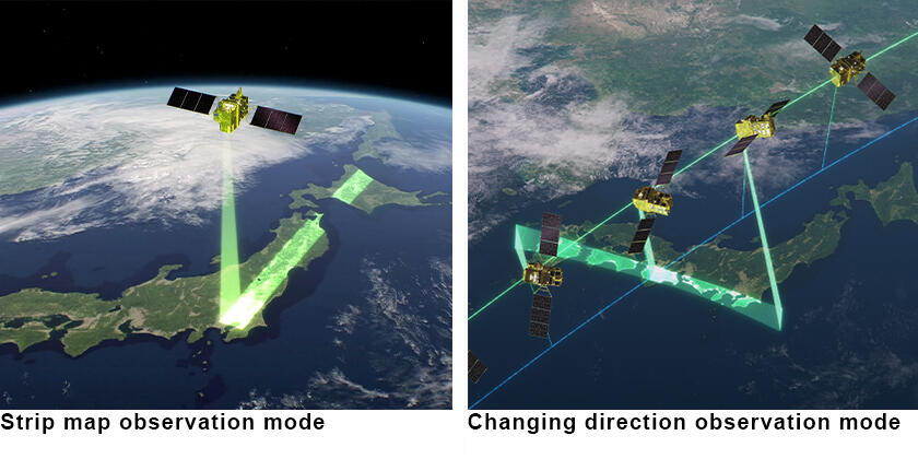
ALOS-3 has capable following observation functions: [Strip map observation mode]The default observation mode. Covering an area of 70 km in width and 4,000 km in the along-track direction per an orbital path. [Stereoscopic observation mode]Acquiring stereo-pair image of a certain ground point from two different directions. [Pointing observation mode]Observing any given point in Japan within 24 hours after receiving the request using pointing function up to 60 degrees in all directions against the satellite nadir. [Wide-area observation mode]Covering a wide-area of over 200 km x 100 km by multiple scan observations during an orbital path. [Changing direction observation mode]Continuously observe an area, even if it is not along the trajectory, by controlling the attitude of the satellite and changing the direction of observation. |
 |
|---|
Specifications
| Mission instrument | Wide-swath and high-resolution optical imager
|
|---|---|
| Data transmission | Direct transmission (Ka band : 1.8 Gbps, X band : 0.8 Gbps) Optical inter-satellite communications: 1.8 Gbps |
| Size | 5.0 m × 16.5 m × 3.6 m |
| Mass | Approx. 3 tons |
| Design life | 7 years |
| Operational orbit | Sun-synchronous subrecurrent orbit at an altitude of 669 km Revisit time 35 days (Sub-cycle: about 3 days*) Local solar time at descending node: 10:30 (a.m.) +/- 15 minutes |
| Launch Vehicle | H3 |
| Launch Date | 7th March, 2023 (Launch failure) |
*Sub-cycle: A number of days between a certain orbit path and the adjacentposter path.