 Leyte Island, the Philippines, as observed by Daichi |
Q. You're monitoring disasters. Do you take action right away when Daichi confirms a disaster somewhere in the world?
That's right. The major objectives of Daichi are: to update maps for Japan and other countries, especially those in the Asia-Pacific region; to carry out regional observation to help ensure that development is in harmony with the environment; to monitor large-scale disasters around the world; and finally, to survey natural resources in Japan and other countries. The top priority during development was cartography and regional observation, but since then these have been replaced by disaster surveying. The number of floods, landslides, earthquakes and fires has been rising in recent years, especially in Southeast Asia. So focusing on disaster rescue has become a global movement, and JAXA has joined the International Disaster Charter, whose core members are the European Space Agency (ESA), the Canadian Space Agency (CSA), the U.S. National Oceanic and Atmospheric Administration (NOAA), and the United States Geological Survey (USGS). Their objective is to contribute to disaster monitoring and recovery by observing the world's large-scale disasters and providing data at no charge. Beyond its high resolution capability, Daichi can conduct observation with two instruments: an optical sensor and an all-weather synthetic aperture radar.
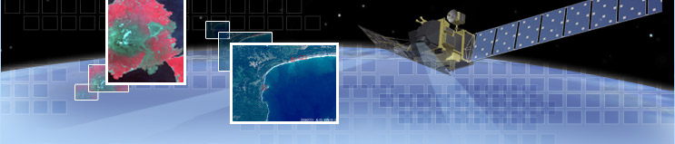
AVNIR-2 and PALSAR observed the landslide on Leyte Island, in the Philippines, on February 17, 2006, when they were still in the early verification period. Daichi has so far performed more than 20 disaster observations, providing data at no cost. We do our best to analyze acquired data and deliver it to the country where the disaster is happening as quickly as possible. For instance, in the case of Thailand, which experiences a lot of floods, their disaster prevention agency analyzed our image data, and was able to take prompt action after confirming flooding locations.
In emergencies such as large-scale disasters, Daichi is contributing on an international level with quick and accurate observations of the Earth.
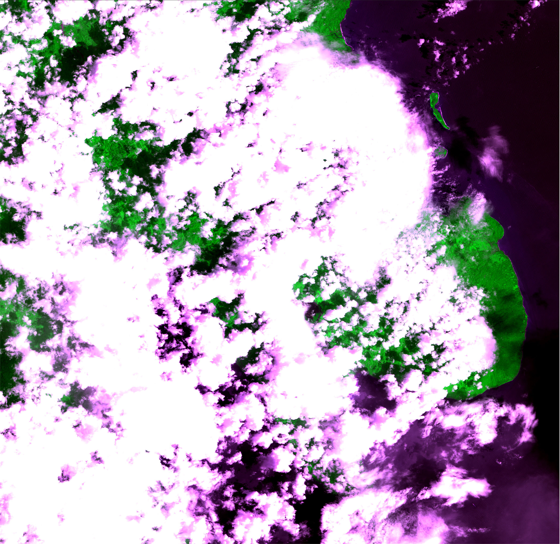
 Flooding in Choele Choel, in central Argentina, observed by Daichi on July 30, 2006. The flooding (dark area) is clearly visible when the image is compared with the photo on the right, taken three months prior. Flooding in Choele Choel, in central Argentina, observed by Daichi on July 30, 2006. The flooding (dark area) is clearly visible when the image is compared with the photo on the right, taken three months prior. |
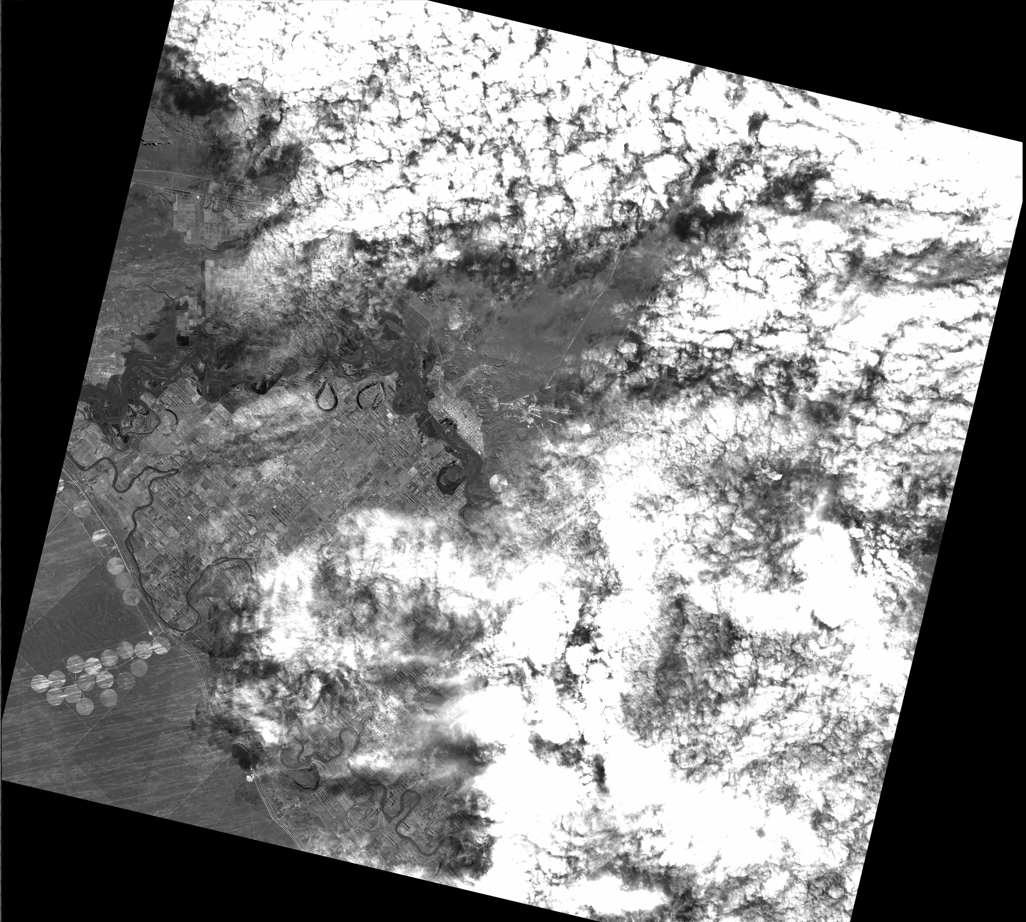
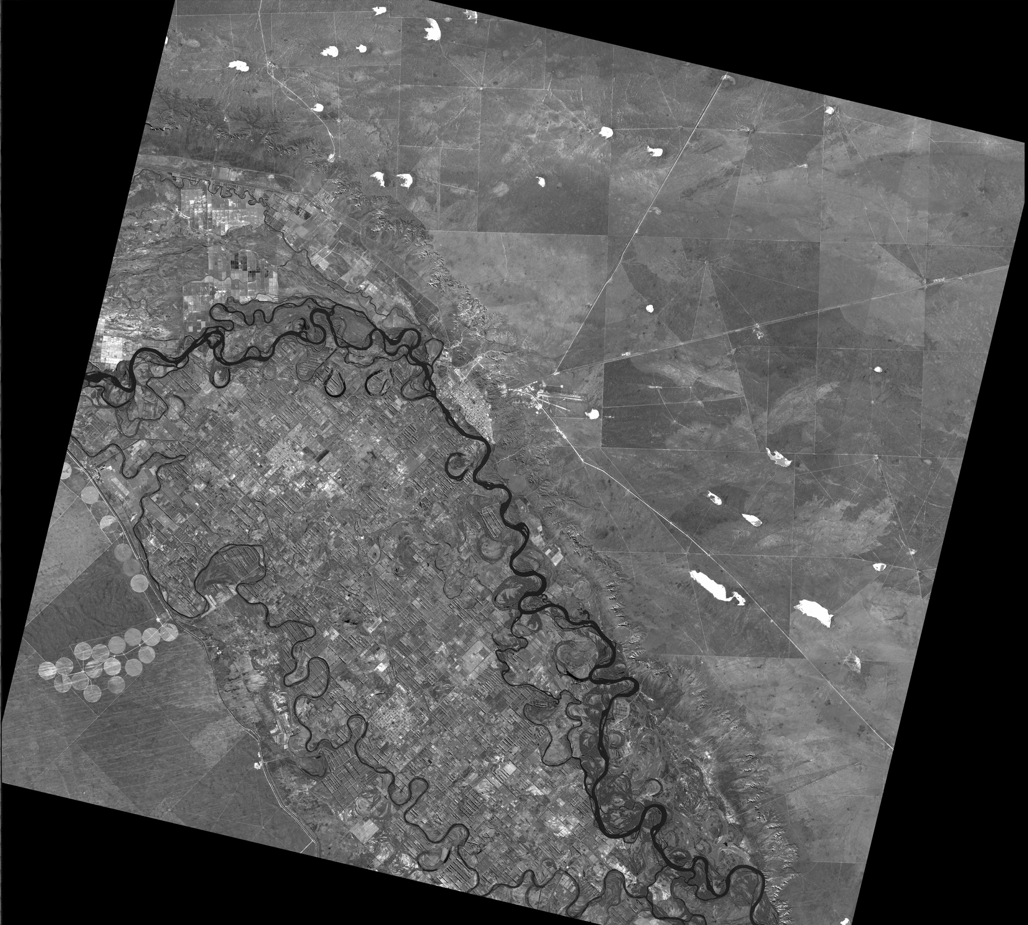 Choele Choel in central Argentina, imaged on April 29, 2006 Choele Choel in central Argentina, imaged on April 29, 2006 |
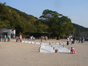 Students of Youzei Elementary School in Satsumasendai City, their teachers, parents, and other local people, laying out the letter Y for the "Be Imaged by Daichi" campaign (courtesy of Youzei Elementary School). 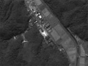 The letter "Y" as seen in a Daichi image 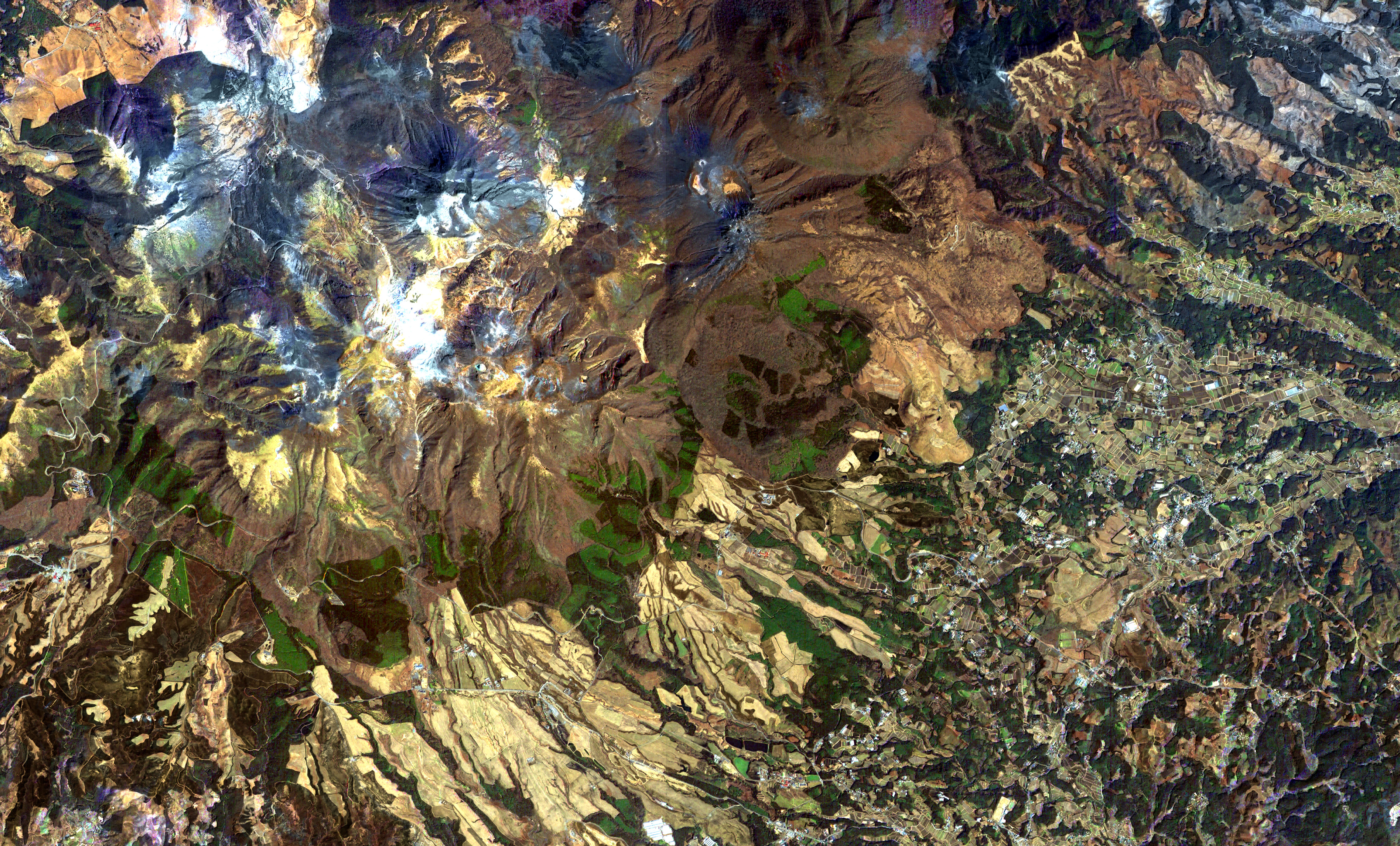 Pan-sharpened image of the Kuju Mountains, Oita prefecture 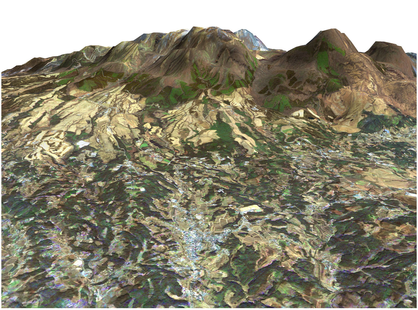 Bird's eye view of the Kuju Mountains, created from a pan-sharpened image layered on a digital elevation model (DEM) of the mountains, generated by PRISM observing in three different directions |
Q. Does Daichi accept observation requests from the private sector ?
Daichi gathers 700 GB of data per day, which is equivalent to the storage volume of about 200 DVDs. However, the satellite is not suitable for piecemeal operation because it takes 1 to 2 minutes to start up the sensors. So we initially decided to set a basic operation plan and gathered users' operation requests, for things such as making world maps, monitoring ice floes, and studying crustal movement. Finally, after sorting these, we have almost finished the satellite operation plan for the next while, but this took a very long time. Frankly speaking, it is difficult to coordinate everyone's requests. So, I think ordering images taken during planned operation is the most efficient. Having said that, if there is room for new observation or if we think the observation is of high priority, it will be adopted. Meanwhile, disaster observation is very important, so in case of emergency, the direction of the satellite is shifted right away to acquire data of the location as quickly as possible. In this situation, a previously arranged plan for monitoring a disaster area might be called off.
The "Be Imaged by Daichi!" campaign was run in October and November 2006, in collaboration between JAXA and the private sector. The idea was for Daichi to take images from space of students who had applied from schools across Japan. I advised on how to set up for their image to be taken, like how the letter E of "Elementary school" needed to be laid out for example. I think it was a good chance for people to learn about Earth observation and I hope that we'll have this type of participatory project again. We used only the optical sensor this time but I'd love to use PALSAR next time, as it is not affected by time or weather.
Q. How do you think Daichi data will benefit the public?
We've only just started publishing the data, so I think it will take some time until we see it being used. PRISM takes black-and-white images with 2.5-meter spatial resolution, and AVNIR-2 provides 10-meter spatial resolution in color. So observing with the two at the same time, we can generate pan-sharpened color images with 2.5-meter spatial resolution. [Pan-sharpened images are high-resolution color images that are composites of high-resolution black-and-white images and low-resolution color images.] If you look at a pan-sharpened image of your town, you will be able to see what you can't see from the ground - for instance, how forests are disappearing, or where there is spring water, or even a recent social problem, such as a truck dumping garbage illegally. So, I think that learning about one's own town will be one way these images are used.
We also shouldn't forget about observing the Earth's environment. This is very important, as global warming is a serious problem today. The 1997 Kyoto Protocol aims to control atmospheric emission of greenhouse gases such as carbon dioxide and methane, which cause global warming, and to stabilize their concentration in the atmosphere. To see whether or not these protocol targets are being met, research has been conducted on how to measure carbon dioxide absorption in forests, oceans and the atmosphere. JAXA/EORC started the Kyoto and Carbon Initiative Project about 10 years ago, seeking to observe carbon emissions on the ground using PALSAR. In collaboration with 21 institutions around the world, we closely observe the Amazon, Alaska, Siberia, Southeast Asia, northern Australia, central Africa, and the Scandinavian peninsula, to study the volume of carbon in forests. The brightness in images taken by PALSAR reflects biomass. However, it is difficult to get accurate measurements when the biomass count is more than 60 tons per hectare. The Amazon, for example, has a great volume of biomass, as much as 500 tons per hectare, so we're looking into developing a new method of analysis. On the other hand, the images allow us to clearly see deforestation, as those areas appear darker. Also, environmental changes are recognizable even without looking at biomass. For instance, heavy rainfall widens rivers in the Amazon basin during the rainy season, from December to February, which results in the death of many plants. This generates methane, which eventually becomes a greenhouse gas. I would like to contribute to the prevention of global warming by measuring environmental changes, such as the yearly cycle of plant growth and exhaustion.
| 1 2 3 4 |