Topics List
May 14, 2026 Updated
JAXA Concludes Modification to the Agreement with the Vietnam National Space Center (VNSC) on Satellite Data Exchange
|
JAXA has concluded a “Modification to the Agreement between the Vietnam National Space Center (VNSC), Vietnam
Academy of Science and Technology, and JAXA on the Exchange of Satellite Data”. 
Source: Prime Minister’s Office of Japan |
Jul. 21, 2023 Updated
Dr. Oki Riko, Director of JAXA/EORC received NASA Administrators Agency Honor Awards, the first Japanese person for this award
|
Dr. Riko Oki, Director of Earth Observation Research Center, Space Technology Directorate I, Japan Aerospace Exploration Agency (JAXA) received the Exceptional Public Service Medal as the NASA Administrators Agency Honor Awards 2022. The awards ceremony was held at the U.S. Embassy in Japan on July 11, 2023. 
The Exceptional Public Service Medal is awarded to individuals who have achieved outstanding performance for NASA missions. Dr.Oki has led the cooperation on precipitation observations for Japan-U.S. collaborative satellites over the years, including serving as a research scientist for the Japan-U.S. joint mission “Tropical Rainfall Measuring Mission (TRMM),” initiating the follow-on joint mission “Global Precipitation Measurement (GPM)” In addition, she served as JAXA TRMM/GPM Program Scientist for the research on precipitation observations. JAXA's precipitation radars onboard the TRMM and the GPM Core Observatory are capable of observing the three-dimensional structure of precipitation with high accuracy, leading to the development of the Global Satellite Mapping of Precipitation (GSMaP), which provides global precipitation estimate in near real time. The GSMaP is widely used in countries of Asia Pacific region and around the world. Furthermore, it is expected that further Japan-U.S. cooperation in the field of Earth observation will continue and develop in the future. In this regards, JAXA is planning a new satellite, the Precipitation Measuring Mission (PMM), expecting to participate in the Atmosphere Observing System (AOS), a next generation mission of NASA. To advance its plan, JAXA launched the PMM Project Team. The awards ceremony for NASA staff and awardee in the U.S. was held at NASA in the U.S. on April 26, 2023. However, the award ceremony for Dr. Oki was specially held at the U.S. Embassy in Japan on the occasion of the visit of the Earth Science Division executives to Japan. At the award ceremony, Dr. Karen St. Germain, Director of Earth Science Division (NASA) handed Dr. Oki a certificate and a medal in the presence of Mr. Raymond F. Greene, Deputy Chief of Mission. Dr. Oki is the first Japanese to win this honorable award. At the award ceremony, she named the researchers and engineers of both in Japan and the U.S. with whom she has cooperated, and said, “I would like to share this award with my colleagues. I hope young researchers will archive more in the future.” Mr. Greene, Deputy Chief of Mission commented “She is the first Japanese person to win the award, but we’re confident she won’t be the last.”
|
May 20, 2022 Updated
Renewal of the Earth Observing Dashboard, Joint analysis website of JAXA, NASA, and ESA using Earth observation data
|
Japan Aerospace Exploration Agency (JAXA), in cooperation with National Aeronautics and Space Administration (NASA) and European Space Agency (ESA), has analyzed changes in the global environment and socio-economic activities using Earth observation satellite data in order to understand the impact of the COVID-19 from space. We have made the results of this joint analysis available on the "Earth Observing Dashboard", the joint website of the three agencies, since June 2020. In order to better contribute to our understanding of global and diverse environmental changes, we have expanded the scope of our website into six new independent fields: Atmosphere, Agriculture, Biomass, Water and Ocean, Cryosphere, and Economy in addition to COVID-19, and have relaunched the Earth Observing Dashboard. Through the Earth Observing Dashboard, we hope that Earth observation satellite data will be utilized as objective perspectives and information for a broader understanding of global-scale issues such as environmental change and climate change, as well as the social and economic impacts caused by them. Earth Observing Dashboard 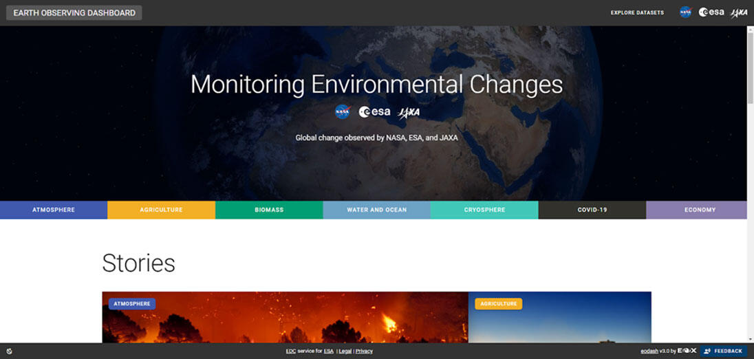
Fig.1:Earth Observation Dashboard Landing Page |
Jan. 14, 2022 Updated
International Workshop on Vegetation LIDAR / High-Precision 3D Mapping from Space 2022
|
Date:February 22, 2022 Venue:Online(Zoom) 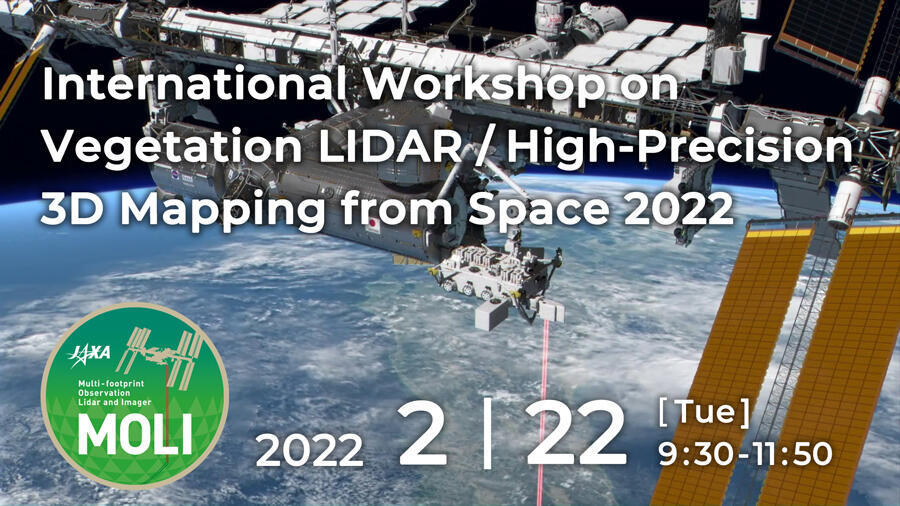
|
Aug. 5, 2021 Updated
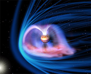
A new map of temperatures in Jupiter’s upper atmosphere reveals a solution to the planet’s “energy crisis”
Overview: the aurora that heats a planetSitting more than five times the distance from the Sun as the Earth, Jupiter is not expected to be particularly warm. Based on the amount of sunlight received, the average temperature in the giant planet’s upper atmosphere should be about 200 K or a chilly -73 Celsius. Instead, the measured value sits around 700 K or 420 Celsius. The source of this global heat has remained elusive for 50 years, causing scientists to refer to the discrepancy as an “energy crisis” for the planet. Now research led by James O’Donoghue (JAXA) has found the likely source of Jupiter’s thermal boost. By creating the highest resolution global maps to date of the temperature of Jupiter’s upper atmosphere, the team has revealed that the main source of the extra heat is Jupiter’s powerful aurora. Movie: Jupiter is first shown in visible light for context before an artistic impression of the Jovian upper atmos-phere's infrared glow is overlaid. The brightness of the upper atmosphere corresponds to temperature. From hot to cold: white, yellow, bright red, dark red. The aurorae are the hottest regions and the animation shows how heat may be carried by winds away from the aurora and cause planet-wide heating. The end of the ani-mation shows the real data with a temperature scale, indicating the observed global temperatures measured in the study. A still image is shown in Figure 3. (Credit: J. O'Donoghue (JAXA)/Hubble/NASA/ESA/A. Simon/J. Schmidt) Auroras occur when charged particles are caught in a planet’s magnetic field. These spiral along the field lines towards the planet’s magnetic poles, striking atoms and molecules in the atmosphere to release light and energy. On Earth, this leads to the characteristic light show that forms the aurora borealis and australis. On Jupiter, the material spewing from its volcanic moon, Io, leads to the most powerful aurora in the Solar System and enormous heating in the polar regions of the planet. Although the Jovian aurorae have been a long-standing candidate heat source for the majority of the planet, observations have previously been unable to confirm or deny this until now. Research detailsThe team observed Jupiter with the 10-metre Keck II telescope on Mauna Kea in Hawai’i for five hours on two separate nights in April 2016 and January 2017. Using the Near-Infrared Spectrometer (NIRSPEC) on the Keck II, emission from H3+ ions in Jupiter’s atmosphere was detected from the planet’s poles down to the equator. H3+ ions are a major constituent of the ionized part of Jupiter’s upper atmosphere and the intensity of the emission can be used to derive the temperature of that region. Previous maps of the upper atmospheric temperature were formed using images consisting of only several pixels. This is not enough resolution to see how the temperature might be changed across the planet, providing few clues as to the origin of the extra heat. In order to improve the situation, the team took a two step approach. The first step was to utilise the power of the Keck II to take many more temperature measurements across the face of the planet. The second step was to only include a temperature measurement in the final map of the atmosphere if the uncertainty in the recorded value was less than 5%. 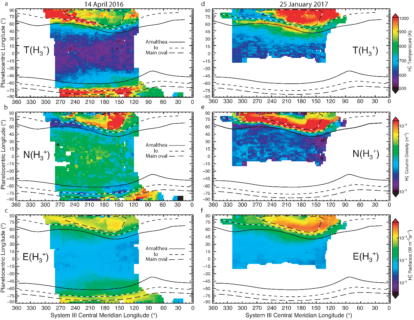
Figure 1: Temperature (top row), density (middle row) and radiance (lower row) of H3+ in Jupiter’s atmosphere (column-integrated). Long-dashed lines show the main region of the aurora, short-dashed line and solid line show the magnetic influence of the moons Io and Amalthea (Taken from O’Donoghue et al, 2021, Nature). To achieve this, the team created five maps of the atmospheric temperature at different spatial resolutions. The highest resolution map had an average temperature measurement for every 2 degrees longitude x 2 degrees latitude of the planet. Lower resolution maps averaged the temperature across regions 4 degrees x 4 degrees, 6 degrees x 6 degrees, 8 degrees x 8 degrees and 10 degrees x 10 degrees. If any temperature measurement in the highest resolution map had too high an uncertainty, the value from a lower resolution map with improved uncertainty would be substituted. The result was a map that combined the highest possible resolution with the lowest uncertainty in the measurements: the best of both worlds for analysis. “It took years of careful work to clean and map out the data and analyse it,” said James O’Donoghue. “The final products were temperature maps that are comprised of over ten thousand individual data points.” A clear trendThe temperature maps of Jupiter's upper atmosphere show clear gradients, with temperatures decreasing from the polar auroral regions to the equator. This demonstrated that Jupiter’s aurora was circulating auroral energy planet-wide, with winds carrying the heated atmosphere to lower latitudes and adjacent longitudes. The idea that the aurora could be the source of Jupiter’s mysterious energy had been proposed previously. However, global models of Jupiter’s upper atmosphere suggested that winds headed to the equator would be overwhelmed and redirected by west-ward winds driven by the planet’s rapid rotation. This would prevent the auroral energy from escaping the polar regions and heating the whole atmosphere. However, this new observational result suggests that such trapping is not occurring, and that the west-ward winds may be relatively weaker than expected compared with equatorward winds. 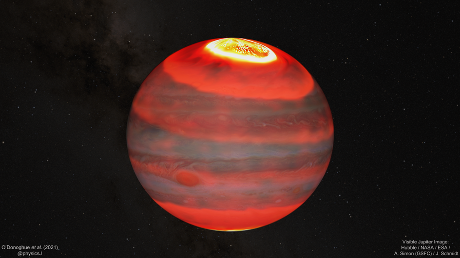
Figure 2: Jupiter is shown in visible light overlaid with an artistic impression of the Jovi-an upper atmosphere's infrared glow. The brightness of the upper atmosphere corre-sponds to temperature. From hot to cold: white, yellow, bright red, dark red. The aurorae are the hottest regions and show how heat may be carried by winds away from the auro-ra and cause planet-wide heating.
From orbit around the Earth, JAXA’s Hisaki satellite has observed the aurora-generating magnetic field around Jupiter since the mission’s launch in 2013. This long term monitoring has revealed that Jupiter’s magnetic field is strongly influenced by the solar wind; a stream of high energy particles that emanates the Sun. The solar wind carries its own magnetic field and when this meets Jupiter’s planetary field, the latter is compressed. Further evidence for this interaction and the resultant heating was found when the team observed an extended high temperature region of gas that appeared to be propagating from the aurora. At the time of observation, pressure from the solar wind was particularly high at Jupiter and the field compression is likely to have created an enhanced aurora. The resulting heat wave was the structure spotted by the team as it began to move away towards lower latitudes. "It was pure luck that we captured this potential heat-shedding event,” notes O’Donoghue. “If we’d observed Jupiter on a different night, when the solar wind pressure had not recently been high, we would have missed it!” The discovery of the temperature gradient extending between Jupiter’s auroral region and equator may end the planet’s “energy crisis”. However, while auroras are expected phenomenon on giant gaseous words, the complex state of their winds may determine how effective the heat source is on different planets. Journal paper informationArticle title: Global upper-atmospheric heating on Jupiter by the polar aurorae Journal title: Nature Date of publication: 5 August 00:00 (JST)
DOI: 10.1038/s41586-021-03706-wExternal Link
Authors:
Links:
|
Mar. 4, 2021 Updated
GSMaP receives "Dr. Roman L. Kintanar Award 2020" for significant contribution to Typhoon Committee's regional flood forecasting
|
The joint team of the International Centre for Water Hazard and Risk Management (ICHARM), the Infrastructure Development Institute (IDI) and JAXA was given the “Dr. Roman L. Kintanar Award for Typhoon-Related Disaster Mitigation - 2020”. The Dr. Roman L. Kintanar Award is given annually to an organization that has made a significant contribution to the activities of the Typhoon Committee, an inter-governmental body established under the United Nations Economic and Social Commission for Asia and the Pacific (ESCAP) and the World Meteorological Organization (WMO) to reduce the damage caused by typhoons. JAXA has developed the Global Satellite Mapping of Precipitation (GSMaP). The GSMaP has contributed significantly to flood prediction in the Typhoon Committee Region. This is the first time that Japanese organizations, other than the Japan Meteorological Agency, got the award. 
Acceptance speech by ICHARM Executive Director KOIKE at the 53rd session of the 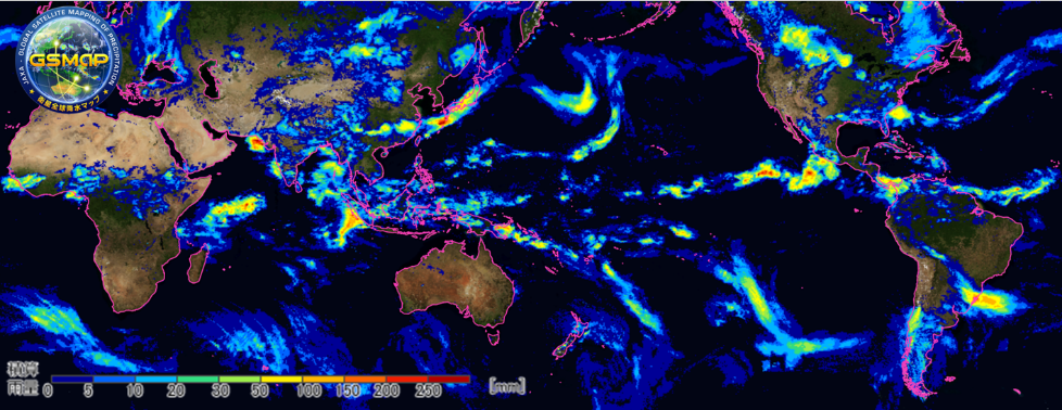
The GSMaP is a global rainfall map developed by combining the multi satellites under the Global Precipitation Measurement (GPM) mission. The users have spread to 138 countries in the world, and the GSMaP is being used in various fields such as precipitation monitoring, flood forecasting, drought monitoring, agriculture, and so on.
|
May 22, 2020 Updated
[HAYABUSA2 PROJECT] Messages from our members overseas
|
When the start of the second ion engine operation on May 12 was announced to Hayabusa2 project members overseas, they showered the local team with messages! As the current situation with the novel coronavirus is creating difficult times worldwide, we would like to share these encouraging replies that uplifted the team here in Japan. |
![[HAYABUSA2 PROJECT] Messages from our members overseas](https://global.jaxa.jp/projects/hayabusa2/images/topics_20200522_hayabusa2.jpg)
|
|---|
Mar. 11, 2020 Updated
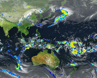
Global Extreme Heavy Rainfall and Drought detected by GSMaP ∼ "JAXA Climate Rainfall Watch" website is now available∼
|
JAXA has been addressing global precipitation-related issues under the Global Precipitation Measurement (GPM) Mission by utilizing the 3D precipitation product "Dual-frequency Precipitation Radar (DPR)" onboard GPM core observatory and multi-satellite precipitation product "Global Satellite Mapping of Precipitation (GSMaP)". 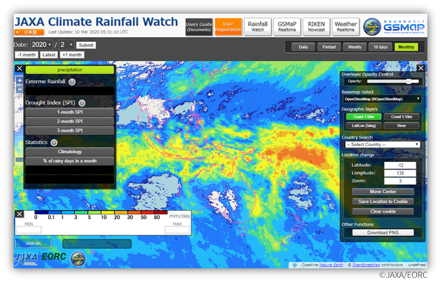
Fig.1 Graphical User Interface of the "JAXA Climate Rainfall Watch" website |
Feb. 18, 2020 Updated
Massive bushfires in Australia seen from Space
|
Australia has naturally faced many droughts and bushfires, but conditions have been unusually severe this time. Sometime around September 2019, the bushfires continuously occurred around the state of New South Wales in southeast Australia. The fires had been spreading on a larger scale, and a number of massive fires had merged into a "Mega Fire" that was out of control. The fires are unlikely to end entirely even at the end of January 2020. 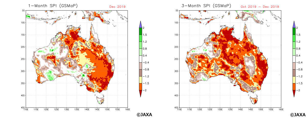
Figure 1 (left) Standardized Precipitation Index (SPI) in Australia calculated by GSMaP precipitation amount in a month (December 2019), (right)SPI calculated by GSMaP precipitation amount in three months (October-December 2019) in a same way. The relations between SPI value, the range of drought and frequency of phenomenon were classified by WMO (2012). In case SPI value becomes "-1.5 to -1.99", it indicates the situation of "Severe dryness" which happens "once in 20 years". In case SPI value becomes less than -2.0, it corresponds "Extreme dryness" which happens "once in 50 years". These condition shows the possibility of severe drought occurrence which leads to a big social impact. |
Dec. 6, 2019 Updated
GPM/DPR observed "Hot tower" in Typhoon Kammuri which hit Philippines
|
JAXA has been addressing global precipitation-related issues under the Global Precipitation Measurement (GPM) Mission by utilizing the 3D precipitation product "Dual-frequency Precipitation Radar (DPR)" onboard GPM core observatory and multi-satellite precipitation product "Global Satellite Mapping of Precipitation (GSMaP)". 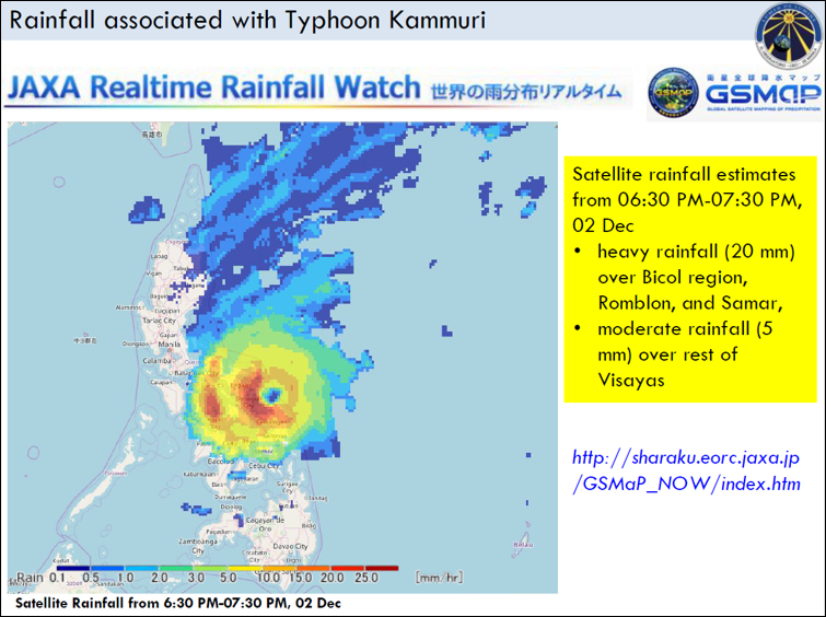
Fig.1 Typhoon Kammuri Report by Manila Observatory |
Apr. 4, 2019 Updated
[HAYABUSA2 PROJECT] SCI (Small Carry-on Impactor) Operation Schedule
|
The Small Carry-on Impactor (SCI) operation will take place between April 3 – 6. This is an impact experiment to create an artificial crater in a designated area. |
![[HAYABUSA2 PROJECT] SCI (Small Carry-on Impactor) Operation Schedule](https://global.jaxa.jp/projects/hayabusa2/images/topics_20190403_sci_schedule_e.jpg)
|
|---|
Mar. 28, 2019 Updated
[HAYABUSA2 PROJECT] Revised illustrations of Hayabusa2
|
At the beginning of the Hayabusa2 Project, realistic illustrations were drawn by Akihiro Ikeshita. These illustrations have now been revised to match the actual asteroid Ryugu. |
![[HAYABUSA2 PROJECT] Revised illustrations of Hayabusa2](https://global.jaxa.jp/projects/hayabusa2/images/topics_20190328_illustration.jpg)
|
|---|
Mar. 20, 2019 Updated
[HAYABUSA2 PROJECT] The Crater Search Operation (Pre-SCI): CRA1
|
Currently, we have scheduled the small carry-on impactor operation (SCI operation) for the first week in April. The purpose of the SCI operation is to create a crater on the surface of Ryugu, and it is important to be able to compare the asteroid surface before and after the SCI operation. Before performing the SCI operation, we therefore decided to observe the area where the crater is likely to be generated. This is the “Crater Search Operation (Pre-SCI)" (CRA1). The same observational procedure will be performed after the SCI operation and denoted “Crater Search Operation (Post SCI)" (CRA2). |
![[HAYABUSA2 PROJECT] The Crater Search Operation (Pre-SCI): CRA1](https://global.jaxa.jp/projects/images/tn_topics_20190316_CRA1_e.jpg)
|
|---|
Mar. 1, 2019 Updated
New Dataset Release: GCOM-C/SGLI
|
JAXA GCOM-C (Global Change Observation Mission - Climate "SHIKISAI") satellite was launched on Dec. 23rd, 2017 to conduct long-term and continuous global observations in order to elucidate the global warming mechanisms related to fluctuations in radiation budget and/or carbon cycles etc. The released products can be downloaded via JAXA G-Portal ( https://gportal.jaxa.jp/ ) 1. Events after the launch
The data was released as scheduled according to the following operations. 2. The overview of Initial calibration and validation operations
To detect tiny climate change signals, higher accuracy products are needed. JAXA performed calibration with GCOM-C function using solar light, internal lamps, black body, lunar light and others, and compared (calibration and validation) GCOM-C observation value with ground observation data acquired in cooperation with ground observation networks (Skynet, AERONET and AsiaFlux) and collaborating research institutes (universities, Meteorological Research Institute, JAMSTEC and NOAA). As a result of the calibration, JAXA confirmed that the accuracy of 29 types of products covering land, atmosphere, ocean and cryosphere is attained to start data utilization. 3. GCOM-C/SGCLI Standard Products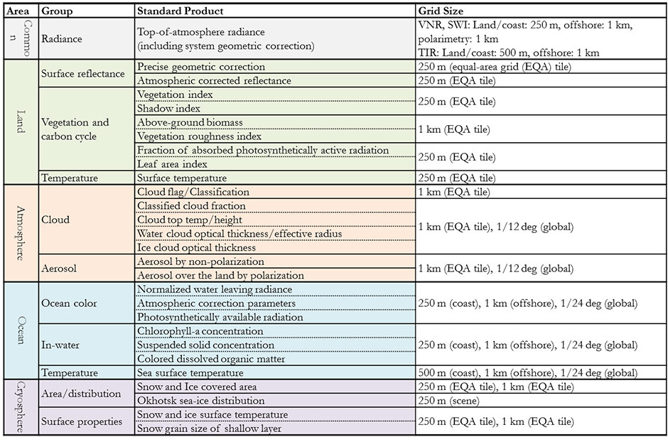
Further information for the definition of the product and sample data is available at; 1) Chlorophyll-a Concentration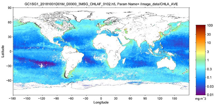
Global chlorophyll-a concentration (average of October 2018) 2) Aerosols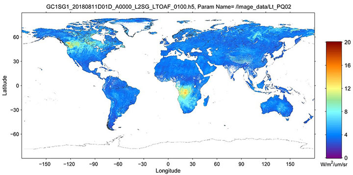
Polarization radiance at 867nm (average from August 11 to 20, 2018) 3) Global vegetation index (NDVI)The image is a map of global normalized difference vegetation index (NDVI) derived from SGLI observation data acquired during January 1st to 9th 2018. NDVI becomes high at active vegetation with high density, indicating the spatial distribution of vegetation on the global scale. 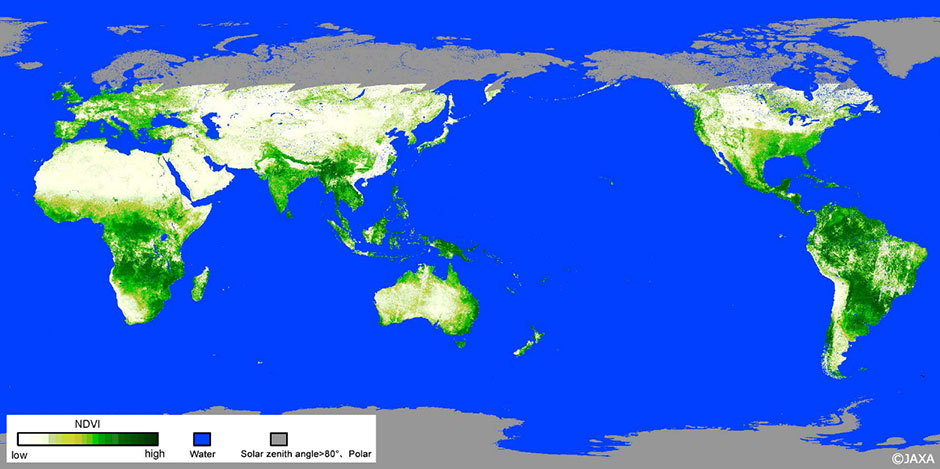
|

Feb. 25, 2019 Updated
[HAYABUSA2 PROJECT] Image from just after touchdown
|
From February 20 to 22, we conducted the touchdown operation (TD1-L8E1) of Hayabusa2 on the surface of asteroid Ryugu. Figure 1 shows an image taken with the Optical Navigation Camera – Wide angle (ONC-W1) during the spacecraft ascent after touchdown.
Figure 1: Image captured near the touchdown site immediately after touchdown. The photograph was taken with the Optical Navigation Camera – Wide angle (ONC-W1) on February 22, 2019 at an onboard time of around 07:30 JST. |
![[HAYABUSA2 PROJECT] Image from just after touchdown](https://global.jaxa.jp/projects/images/topics_20190225_td1_w1image_e.jpg)
|
|---|
Feb. 22, 2019 Updated
[HAYABUSA2 PROJECT] Thank you for your support!
|
The Hayabusa2 Project has received messages of support from so many people. The encouragement and enthusiasm from you all for the mission has made the entire project team fired up and enthusiastic! |
![[HAYABUSA2 PROJECT] Thank you for your support!](https://global.jaxa.jp/projects/images/topics_20190220_messages.jpg)
|
|---|
Feb. 21, 2019 Updated
[HAYABUSA2 PROJECT] The touchdown site
|
Up until now, the Hayabusa2 mission has progressed smoothly. One particular success was the landing of the small rovers on the surface of Ryugu, which could not be achieved during the first Hayabusa mission. Now on February 22, 2019, we plan to touchdown on the asteroid surface; another challenge that did not go as expected for Hayabusa. |
![[HAYABUSA2 PROJECT] The touchdown site](https://global.jaxa.jp/projects/images/topics_20190220_tdpoint.jpg)
|
|---|
Feb. 18, 2019 Updated
[HAYABUSA2 PROJECT] Shooting bullets into Ryugu!
|
On December 28 —the last day of work in 2018— the sampler team conducted an important experiment. As a final test before touchdown (TD), the team fired an identical bullet to that onboard Hayabusa2 into a simulated soil of the surface of Ryugu to test how much sample would be ejected. |
![[HAYABUSA2 PROJECT] Shooting bullets into Ryugu!](https://global.jaxa.jp/projects/images/topics_20190214_Experiment_e.jpg)
|
|---|
Feb. 4, 2019 Updated
[HAYABUSA2 PROJECT] Correction to the name of the MINERVA-II1 landing site.
|
The landing site for the small exploration rovers, MINERVA-II1, was announced on December 13, 2018 as “Trinitas”, but this will be corrected to “Tritonis”. |
![[HAYABUSA2 PROJECT] Correction to the name of the MINERVA-II1 landing site.](https://global.jaxa.jp/projects/images/topics_20190201_Nomenclature_e.jpg)
|
|---|
Jan. 21, 2019 Updated
[HAYABUSA2 PROJECT] Locations on the surface of Ryugu have been named!
|
Place names for locations on the surface of Ryugu were discussed by Division F (Planetary Systems and Bioastronomy) of the International Astronomical Union (IAU) Working Group for Planetary System Nomenclature and approved in December 2018. We will introduce the place names and the background to their selection. |
![[HAYABUSA2 PROJECT] Locations on the surface of Ryugu have been named!](https://global.jaxa.jp/projects/images/topics_20190121_Nomenclature_e.jpg)
|
|---|
Jan. 19, 2019 Updated
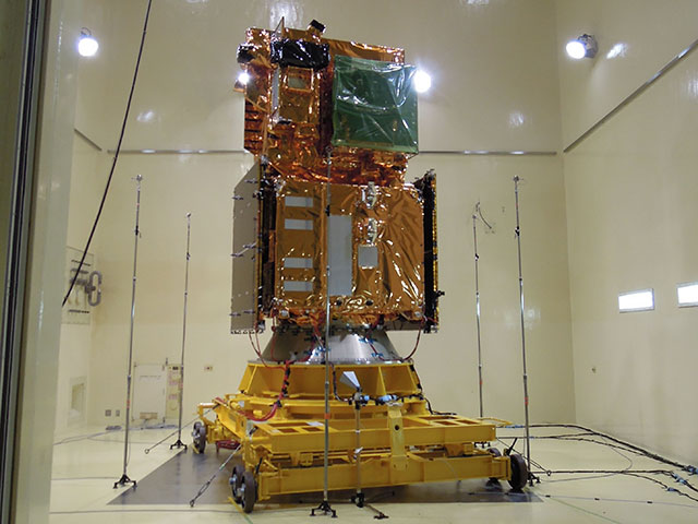
RAPIS-1 Completion of Critical Operations Phase
|
JAXA received telemetry data from the Rapid Innovative Payload Demonstration Satellite 1 (RAPIS-1), launched aboard the fourth Epsilon Launch Vehicle (Epilon-4) earlier at 9:50 a.m. (Japan Standard Time, JST), January 18 , 2019 from the JAXA Uchinoura Space Center. The RAPIS-1 telemetry confirmed that the satellite's solar panels started generating electricity, which is essential for the RAPIS-1 operation. The telemetry also shows communication with the satellite via ground stations proceeded well. This concludes the critical operations phase. |

|
|---|
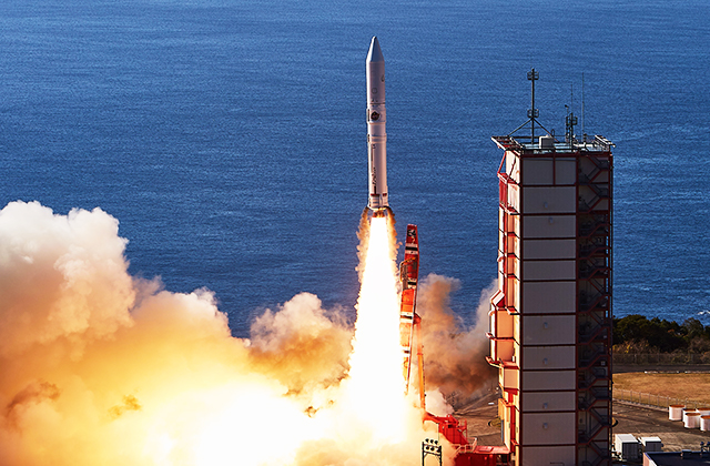
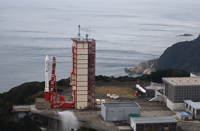
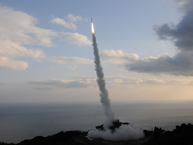
Jan. 18, 2019 Updated
Successfully of Epsilon-4 Launch With The Innovative Satellite Technology Demonstartion-1 Aboard
|
At 9:50:20 a.m. (Japan Standard Time) January 18, 2019 JAXA launched Epsilon-4, the Fourth Epsilon launch vehicle With The Innovative Satellite Technology Demonstartion-1. From the JAXA Uchinoura Space Center. The launch occurred on time. The launch and flight of Epsilon-4 took place normally. Approximately 51 minutes 55 seconds into the flight, the separation of "The Innovative Satellite Technology Demonstartion-1" proceeded, with confirmation as successful. |
|
|---|
Jan. 16, 2019 Updated
[HAYABUSA2 PROJECT] Mission Manager Yoshikawa selected for "Nature's 10" in 2018
|
Our Mission Manager, Makoto Yoshikawa, has been chosen by the science journal, Nature, as one of the "ten people who mattered in science this year" in "The 2018 Nature's 10". |
![[HAYABUSA2 PROJECT] Mission Manager Yoshikawa selected for "Nature's 10" in 2018](https://global.jaxa.jp/projects/images/topics_20190116_Nature_e.jpg)
|
|---|
Jan. 16, 2019 Updated
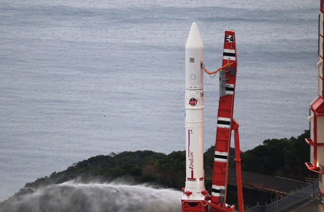
The Innovative Satellite Technology Demonstartion-1 aboard Epsilon-4 launch time decided! Live broadcast from 9:25 a.m. on January 18 (Fri.)
|
The launch time of the Epsilon-4 with the Innovative Satellite Technology Demonstartion-1 was set for 9:50:20 a.m. on January 18 (Fri.), 2019 (Japan Standard Time.) |
|
|---|
Jan. 15, 2019 Updated
The Innovative Satellite Technology Demonstartion-1 launch postponed to Jan. 17 (Fri., JST)
|
The Innovative Satellite Technology Demonstartion-1 launch postponed to Jan. 18 (Fri., JST) |
|
|---|
Dec. 25, 2018 Updated
[HAYABUSA2 PROJECT] Astrodynamics and the Gravity Measurement Descent Operation
|
Until now, "astrodynamics" has been one of the less frequently reported operations for Hayabusa2. In space engineering, the movement, attitude, trajectory and overall handling of the flight mechanics of the spacecraft is referred to as "astrodynamics". For example, astrodynamics played an active role in the gravity measurement descent operation in August 2018. While this was a short time ago, let's look at a few of the details. |
![[HAYABUSA2 PROJECT] Astrodynamics and the Gravity Measurement Descent Operation](https://global.jaxa.jp/projects/images/topics_20181225_AstroDynamics_e.jpg)
|
|---|
Dec. 25, 2018 Updated
[HAYABUSA2 PROJECT] Spacecraft orbit during solar conjunction
|
From late November 2018 until the end of December, the solar conjunction operation is underway for Hayabusa2. Solar conjunction refers to the situation where the direction to the spacecraft almost overlaps with that to the Sun when viewed from the Earth. This is the same "conjunction" as in astronomy, whereby planets and stars appear to line up on the sky. During this time, communication with Hayabusa2 is disrupted due to radio waves emitted from the Sun and from its surrounding plasma. We therefore do not perform operations such as descending towards Ryugu during this period. |
![[HAYABUSA2 PROJECT] Spacecraft orbit during solar conjunction](https://global.jaxa.jp/projects/images/topics_20181225_Conjunction_e.jpg)
|
|---|
Dec. 13, 2018 Updated
[HAYABUSA2 PROJECT] Naming our MINERVA-II1 rovers
|
On September 21, 2018 (JST), the two MINERVA-II1 rovers (Rover-1A and Rover-1B) separated from the Hayabusa2 spacecraft to land on the surface of asteroid Ryugu, where they successfully imaged and hopped across the asteroid surface autonomously. These two rovers have now been given names.
|
![[HAYABUSA2 PROJECT] Naming our MINERVA-II1 rovers](https://global.jaxa.jp/projects/images/topics_20181213_MNRV-II1_e.jpg)
|
|---|
Nov. 1, 2018 Updated
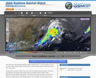
Extention of the domain of JAXA Realtime Rainfall Watch (GSMaP_NOW)
|
JAXA has operated the "JAXA Realtime Rainfall Watch" website and the product "GSMaP_NOW" from November 2015, which provides "realtime" rainfall information within GEO-satellite Himawari domain. 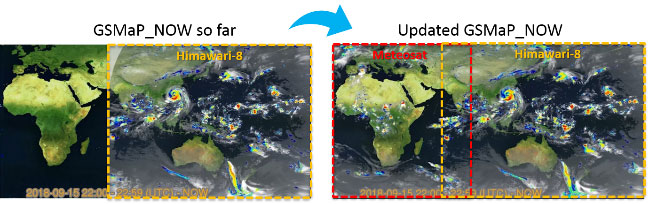
Fig.1 Domain of GSMaP_NOW. |
|
|---|
Oct. 30, 2018 Updated
[HAYABUSA2 PROJECT] Small Monitor Camera captures ‘cool’ images!
|
During the operation for Touchdown 1 Rehearsal 3 (TD1-R3), we attempted to capture images using CAM-H (small monitor camera) as the spacecraft approached the surface of Ryugu. CAM-H was manufactured and installed on Hayabusa2 by donations received from the general public and it is attached near the lower edge of the side of the spacecraft. The camera can photograph the tip of the sampler horn, but it can also capture the surrounding area and background. |
![[HAYABUSA2 PROJECT] Small Monitor Camera captures ‘cool’ images!](https://global.jaxa.jp/projects/images/topics_20181030_TD1R3_CAMH_e.jpg)
|
|---|
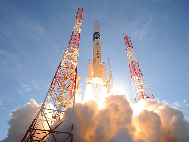
Oct. 29, 2018 Updated
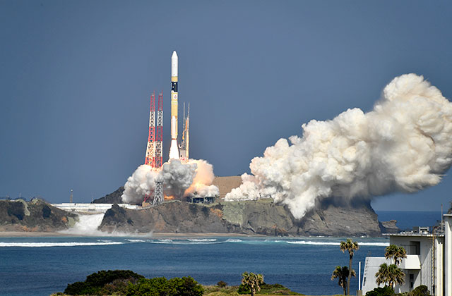
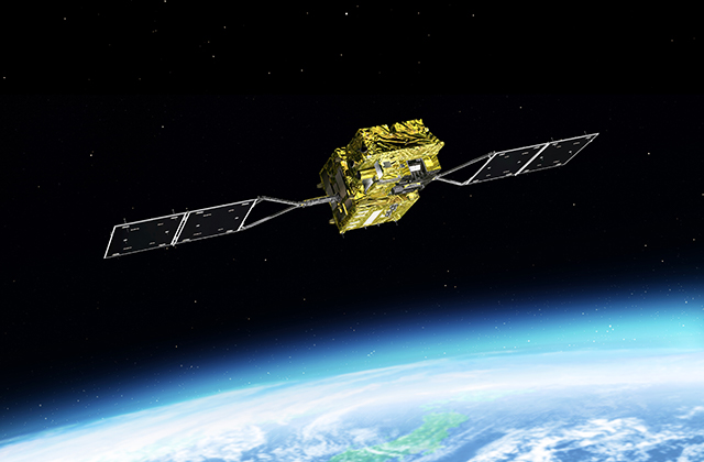
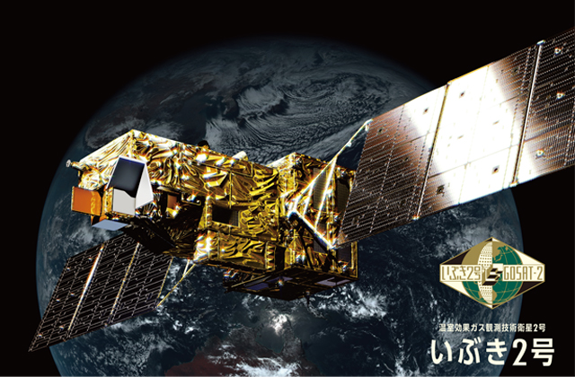
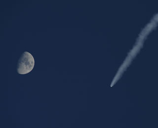
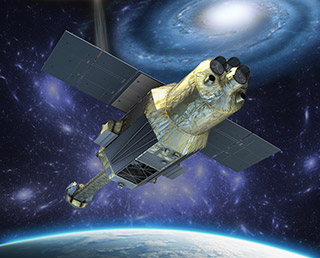
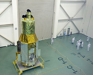
Successful Launch, H-IIA Launch Vehicle No. 40 Encapsulating "IBUKI-2"(GOSAT-2) and KhalifaSat
|
The H-IIA Launch Vehicle No. 40 with the Greenhouse gases Observing SATellite-2 "IBUKI-2"(GOSAT-2) and KhalifaSat, a remote sensing Earth observation satellite onboard lifted off at 13:08:00 p.m. on October 29, 2018 (Japan Standard Time) from the Tanegashima Space Center. |
|
|---|
Oct. 27, 2018 Updated
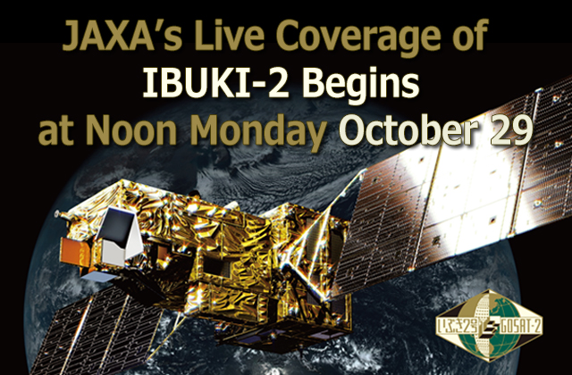
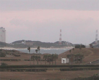
IBUKI-2(GOSAT-2)/H-IIA F40 launch time decided! Live broadcast from 12:30 p.m. on October 29 (Mon.)
|
The launch time of the H-IIA Launch Vehicle No. 40 with the Greenhouse gases Observing SATellite-2"IBUKI-2"(GOSAT-2) was set for 1:08:00 p.m. on October 29 (Mon.), 2018 (Japan Standard Time.) JAXA will broadcast a live launch report from the Tanegashima Space Center from 12:30 p.m. on the 29th. You can watch it through the Internet. Please have a look! |
|
|---|
Oct. 26, 2018 Updated
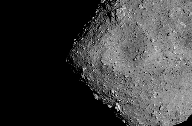
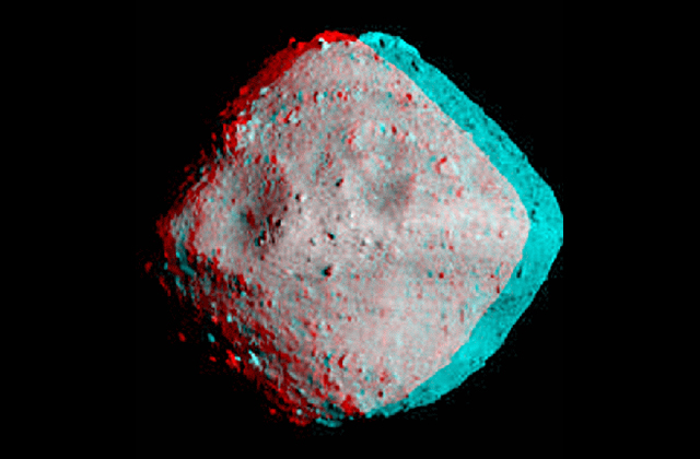
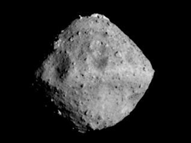
[HAYABUSA2 PROJECT] The highest resolution image of Ryugu (resolution update : the highest resolution image to date)
|
The second touchdown rehearsal (TD1-R1-A) was performed from October 14 to 16. On October 15, just before 22:44 JST when the spacecraft reached a new low altitude of 22.3m, we successfully photographed the surface of Ryugu using the Optical Navigation Camera – Telescopic (ONC-T). This is the highest resolution image to date (Figure).
|
![[HAYABUSA2 PROJECT] The highest resolution image of Ryugu (resolution update : the highest resolution image to date)](https://global.jaxa.jp/projects/images/topics_20181025_hayabusa2_e.jpg)
|
|---|
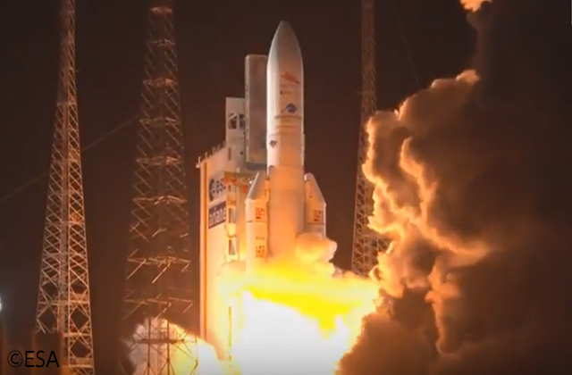
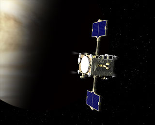
Oct. 20, 2018 Updated
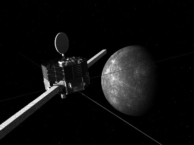
MIO En Route to Mercury
|
BepiColombo mission successfully took off at 10:45:28 am, October 20, in Japan Time, 2018. From the Guiana Space Center in French Guiana, the ESA's Mercury Planetary Orbiter (MPO) and JAXA's MIO, Mercury Magnetospheric Orbiter were launched aboard the Ariane 5 rocket at 10:45:28 pm in local time, 2018.
|
|
|---|
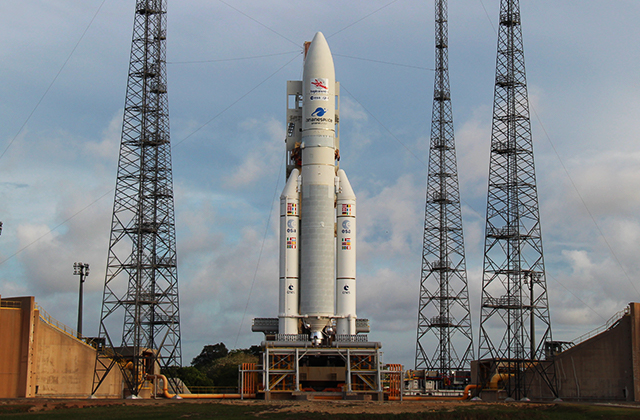
Oct. 19, 2018 Updated
BepiColombo Live Launch Coverage Starts at 10 AM Saturday, October 20
|
MPO, Mercury Planetary Orbiter, developed by the ESA, European Space Agency and MIO, JAXA’s Mercury Magnetospheric Orbiter will launch onboard Ariane 5 rocket at 10:45:28 am, October 20 in Japan Time. (10:45:28 pm in local French Guiana Time) |
|
|---|
Oct. 15, 2018 Updated
Sample Data of GCOM-C Standard Product Available on G-Portal
|
Launched on December 23, 2017 from the JAXA Tanegashima Space Center, Global Change Observation Mission – Climate (GCOM-C) entered and completed its in-orbit checkout phase, during which the science instruments and satellite systems are evaluated. The in-orbit checkout mission was through by March 2018, ensuring the product verification. |
|
|---|
Aug. 28, 2018 Updated
Launch schedule set for Greenhouse gases Observing SATellite-2"IBUKI-2"(GOSAT-2) !
|
The launch schedule of the H-IIA Launch Vehicle No.40 with JAXA's Second Greenhouse gases Observing SATellite-2"IBUKI-2"(GOSAT-2) has been decided 1:08 p.m. through 1:20 p.m. on October 29 (Mon.), 2018 (Japan Standard Time). |
|
|---|
Jul. 25, 2018 Updated
Imaging Ryugu from an altitude of 6km
|
Hayabusa2 arrived at asteroid Ryugu on June 27, after which the spacecraft remained at a distance of about 20km (the Home Position) to continue to observe the asteroid. During this time, the spacecraft was maintaining a hovering altitude of 20km above the asteroid surface. Figure 1: ※Please use the displayed credit when reproducing these images. In the case where an abbreviated form is necessary, please write "JAXA, University of Tokyo & collaborators". |
|
|---|
Jul. 17, 2018 Updated
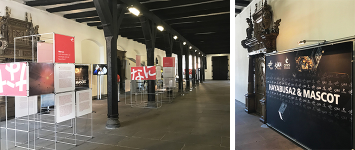
Bremen Town Hall Exhibits Hayabusa2 and Mascot, July 10 to October 14
|
The Bremen City Hall, Bremen, Germany houses on exhibit the JAXA asteroid explorer Hayabusa2, and MASCOT, the onboard lander MASCOT, developed by DLR (Deutsches Zentrum für Luft- und Raumfahrt, English: The German Aerospace Center) and CNES (The Centre National d’Etudes Spatiales, English: French National Centre for Space Studies). The City Hall, UNESCO World Heritage Site accommodates the exhibits July 10 through October 14. At 9:35 am Japan Time, June 27, Hayabusa2 rendezvoused with Ryugu, the target asteroid. Keeping its 20-kilometer distance away from the asteroid, or its home position, Hayabusa2 is being confirmed of its function that performs future operations. MASCOT will land on the asteroid around October this year for observations of the surface using four instruments. 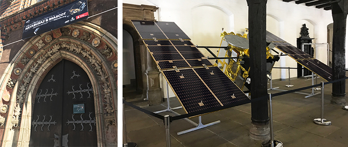
|
Jul. 6, 2018 Updated
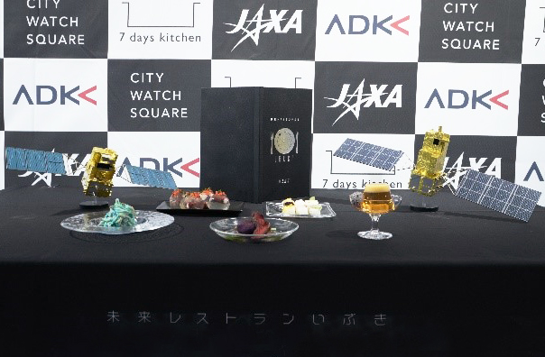
Bronze Lion to Future Cuisine Restaurant Ibuki in 65th Cannes PR Lions
|
Slated for launch in Japanese fiscal 2018, JAXA's GOSAT-2, Greenhouse Gases Observing Satellite: later renamed Ibuki is designed to accurately measure carbon dioxide and methane concentrations. This high-resolution satellite data is expected to offer consistent information that helps identify the sources of emission and absorption of atmospheric carbon monoxide. 
|
|
|---|
Jul. 4, 2018 Updated
Stereo image of asteroid Ryugu by Dr. Brian May
|
Brian May, the lead guitarist from the British rock band, Queen, has created a stereoscopic image of Ryugu from photographs captured with the ONC-T camera onboard Hayabusa2, so that the asteroid can be viewed in three dimensions. Brian May is an astronomer, with a doctoral degree in astrophysics from Imperial College London. He has a strong interest in planetary defense or space guard, which considers the potential threat to the Earth from meteorites. As part of this, May is a core member of "Asteroid Day", that began about three years ago to increase awareness of asteroids and action that can be taken to protect the Earth. |
|
|---|
Jul. 3, 2018 Updated
Introduction to Polarization observation and Near Ultraviolet observation by SGLI
|
The Second Generation Global Imager (SGLI) instrument aboard the JAXA satellite Global Change Observation Mission-Climate (GCOM-C) is an optical sensor capable of observations at wavelengths ranging from near ultraviolet to thermal infrared (380nm to 12µm). SGLI can observe the polarization state of light in red and near infrared band by switching to directional angles from +45deg (forward) and -45deg (backward). Polarization measurement can provide the properties of light including the oscillation direction of electromagnetic waves, in addition to the magnitude of light.
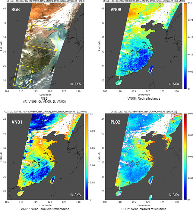
Images: |
Jun. 29, 2018 Updated
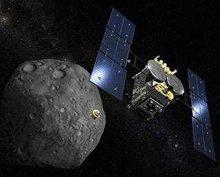
Arrival at Ryugu!
|
1302 days after the launch from Tanegashima Space Center on December 3, 2014, 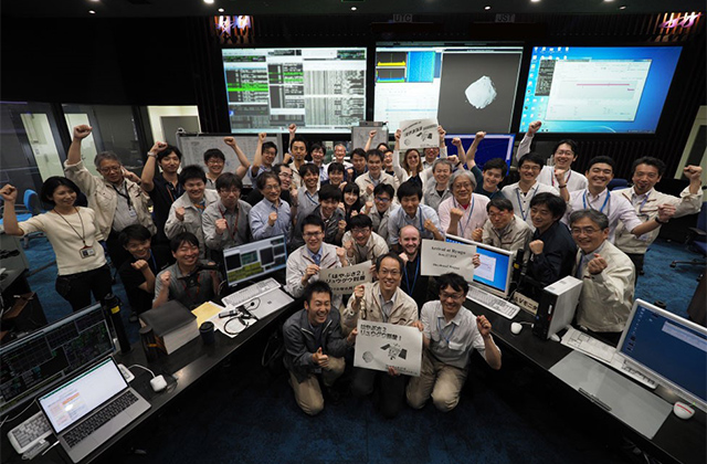
Figure: Group photo commemorating arrival at Ryugu. This is our triumphant pose (known as the "guts pose" / ガッツポーズ in Japanese). |
Jun. 25, 2018 Updated
Asteroid Ryugu seen from a distance of around 40km
|
Hayabusa2 is close to arriving at asteroid Ryugu. After a journey of around 3.2 billion km since launch, our destination is finally near. Two small objects will soon meet in outer space 280 million km from the Earth. |
|
|---|
Jun. 19, 2018 Updated
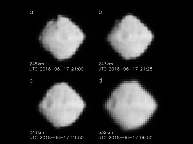
Ryugu seen from 330-240km
|
The ONC-T (Optical Navigation Camera - Telescopic) captured images of Ryugu on June 17, 2018 at around 15:00 JST and June 18 at around 06:00 JST. At 15:00 JST on June 17, the distance to Ryugu was approximately 330 km, which had decreased to 240 km by June 18 at 06:00 JST. |
|
|---|
Jun. 16, 2018 Updated
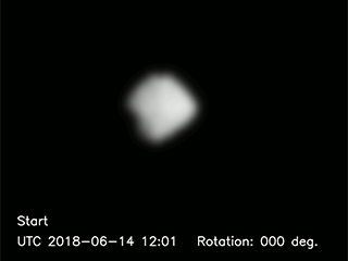
From a distance of about 700km, Ryugu's rotation was observed.
|
Using the ONC-T (Optical Navigation Camera - Telescopic), asteroid Ryugu was photographed continuously from June 14, 2018 at around 21:00 JST through to June 15, 2018 at around 05:10 JST. Figure 1 shows a looped animation of the 52 captured images. |
|
|---|
Jun. 14, 2018 Updated
Ryugu seen from a distance of 920km
|
Hayabusa2 is steadily approaching asteroid Ryugu. Figure 1 shows a photograph of Ryugu taken on June 13, 2018 with the ONC-T (Optical Navigation Camera-Telescopic) from a distance of about 920km. The celestial body shining brightly in the center of the frame is Ryugu. The movement of Ryugu (in comparison to the background stars) can be seen by comparing this image with those taken on June 6 and June 10. The brightness of Ryugu is now about -6.6 mag (astronomical magnitude: a logarithmic scale for the apparent brightness for an object). |
|
|---|
Jun. 8, 2018 Updated
MIO, MMO' s New Name
|
JAXA selected MIO as new name for the Mercury Magnetospheric Orbiter (MMO) to be launched this Japanese fiscal year through March 2019. 6,494 responded to the two-month-long MMO renaming project. JAXA conveys gratitude for their participation. Starting this month, JAXA is giving the godparents a token of appreciation. Namesake and Background
Image: An artist rendering of MIO and Mercury |
|
|---|
Jun. 7, 2018 Updated
Ryugu seen from a distance of 2600km
|
On June 3, 2018, ion engine operation was completed and the final approach to the asteroid begun. By photographing the asteroid with the Optical Navigation Camera, optical navigation (precisely “hybrid navigation using optical and radiometric observations”) can be used to approach Ryugu while accurately estimating the trajectory of the spacecraft and asteroid. |
|
|---|
Apr. 19, 2018 Updated
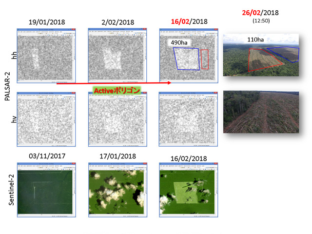
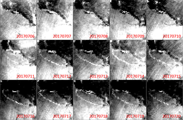
JJ-FAST stops deforestation first time at rainy season in Brazil!
|
JJ-FAST team is developing a next-generation deforestation detection algorithm (version 2) to increase number of deforestation detection, and improve detection accuracy. To validate deforestation sites detected by the new algorithm, a JJ-FAST team visited some sites in Brazil on Feb. 22, 2018. When the team accompanied by IBAMA (Instituto Brasileiro do Meio Ambiente e dos Recursos Naturais Renovaveis) arrived at one site, a bulldozer was mowing down trees. Two forest loggers were caught red-handed, and the bulldozer was legally seized on site by IBAMA. The team and IBAMA officers also visited another site with ongoing deforestation on Feb. 26, 2018. When the team reached the site around noon, they found two large bulldozers connected with a massive metal chain left unattended. Bulldozers and chain mowing down trees is the typical method to clear-cut large areas quickly. Soon, three workers returned and stood in amazement when they found we waiting for them next to their bulldozers. The men were seized, and the machinery was confiscated on site by IBAMA. Being aware of the possible detection by optical satellites, they looked like they were wondering how their illegal deforestation activities were found under the cloud cover in rainy season. This validation activity was supported by two kind IBAMA researchers, Dr. Edson Sano and Dr. Daniel Freitas, and IBAMA local staffs in Sinop and Junia. The JJ-FAST team is very grateful for this wonderful cooperation with our counterparts in Brazil. |
|
|---|
Mar. 26, 2018 Updated
Name the Mercury Magnetospheric Orbiter (MMO) and send your message to Mercury onboard MMO!
|
We are looking for the right name for the Mercury Magnetospheric Orbiter (MMO)*, whose upcoming launch is in October 2018, that will give a
relatable and familiar nickname so that everyone can follow our journey to Mercury. The person who suggests the selected name will recieve a
certificate and souvenir!
|

|
|---|
Feb. 9, 2018 Updated
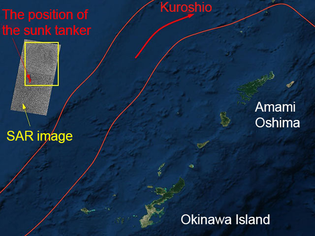
DAICHI-2 captures tanker oil spill in the East China Sea
|
In January 6, 2018, Iranian company's tanker "SANCHI" (Panama flag) collided with a cargo ship (Hong Kong flag) in the East China Sea off the east coast of China and a fire broke out. The tanker drifted into Japan's exclusive economic zone (EEZ) not being extinguished and exploded and sank at the sea about 315 km west of Amami Oshima in the afternoon of 14th. Oil is draining from the sunk tanker. |
|
|---|
Jan. 12, 2018 Updated
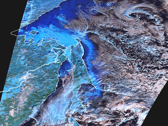
SHIKISAI Observation Data Acquired by SGLI
|
JAXA has released some observation images on the Earth acquired by the Global Change Observation Mission - Climate "SHIKISAI" (GCOM-C). The SHIKISAI was launched from the Tanegashima Space Center at 10:26:22 on December 23, 2017 (Japan Standard Time). These images are obtained by using the test radio wave transmitted from GCOM-C/SGLI on January 1st to 6th, 2018 (JST). |
|
|---|
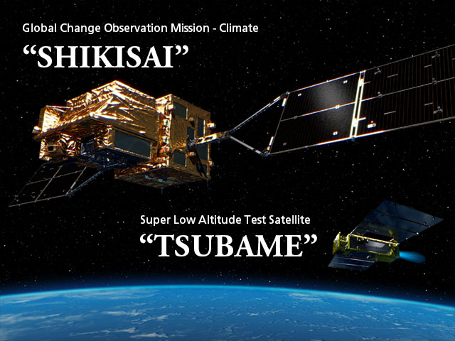
Dec. 24, 2017 Updated
SHIKISAI and TSUBAME critical operation phase successfully completed! Initial function verification starts!
|
JAXA received telemetry data from SHIKISAI and TSUBAME, confirming that their satellite attitude control system had transitioned to the steady state. Current status of both satellites is stable. |
|
|---|
Dec. 23, 2017 Updated
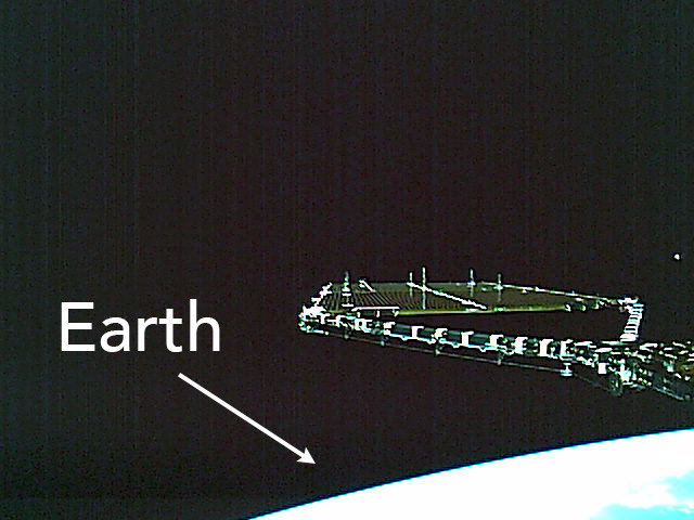
SHIKISAI Solar Array Deployment – Images
|
The reception of telemetry data from JAXA's SHIKISAI satellite was made at 10:44 a.m. at the JAXA Mingenew Station, Australia, confirming SHIKISAI’s solar array deployment above Australia. Images Captured by the SHIKISAI onboard Cameras Following Solar Array Deployment
SHIKISAI Solar Arrays before Deployment in Computer Graphics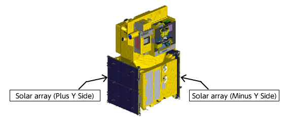
Image – Viewing Angle of SHIKISAI onboard Cameras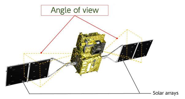
|

|
|---|
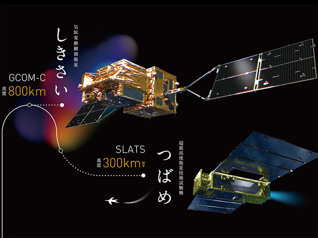
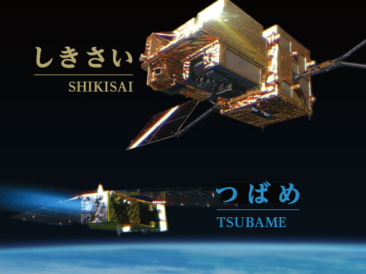
Dec. 23, 2017 Updated
Successful Launch, H-IIA Launch Vehicle No. 37 Encapsulating SHIKISAI and TSUBAME
|
The H-IIA Launch Vehicle No. 37 with the Global Change Observation Mission - Climate "SHIKISAI" (GCOM-C) and the Super Low Altitude Test Satellite "TSUBAME" (SLATS) onboard lifted off at 10:26:22 a.m. on December 23, 2017 (Japan Standard Time) from the Tanegashima Space Center. |
|
|---|
Oct. 27, 2017 Updated
H-IIA F37 with SHIKISAI/TSUBAME onboard to be launched on December 23
|
The launch schedule of the H-IIA Launch Vehicle No. 37 (H-IIA F37) has been decided to be between 10:26:22 thru 10:48:22 a.m. on December 23 (Sat), 2017 (Japan Standard time). The launch will be performed by Mitsubishi Heavy Industries and JAXA. |
|
|---|
Oct. 18, 2017 Updated
Detection of intact lunar lava tubes in the data from Kaguya radar sounding
|
The international research team investigated the analysis of the SELENE Lunar Radar Sounder (LRS) data and confirmed that multiple lunar lava tubes exist extending a few to several tens of meters in depth underneath the volcanic region. One floor of the holes extended several tens of kilometers westward of the east end of the lava tube that LRS detected. The results from the LRS data analysis are valuable from science and future exploration perspectives, as they offer evidence for the existence of previously hypothesized subsurface lava tubes. Since the insides of lunar lava tubes are believed to be in pristine state, careful study of the interior provides insight regarding the evolutionary history of the Moon. Intact lava tubes, shielded from the hostile outside environment, offer potential sites for lunar base construction. Though lava tube caves can be buried beneath the holes, few such holes have been discovered. This suggests that underground void is limited which can accommodate the lunar base for science and exploration. |
|
|---|
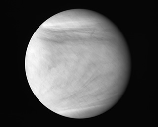
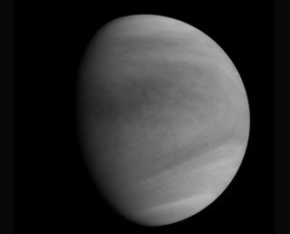
Sep. 5, 2017 Updated
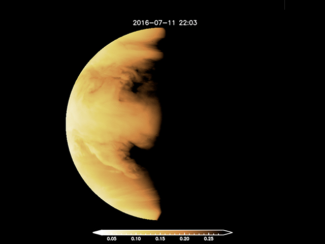
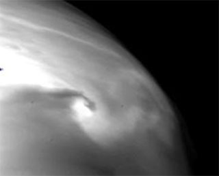
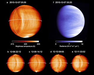
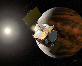
Venus: Jet-setting atmosphere
|
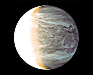
Data from JAXA's Venus Climate Orbiter Akatsuki reports the evidence of a fast atmospheric flow near the planet's equator.
|
|
|---|
Aug. 22, 2017 Updated
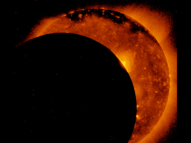
Great American Eclipse on 21 August 2017: public release of images and videos taken by the "Hinode" satellite
|
The Japan Aerospace Exploration Agency (JAXA), the National Astronomical Observatory of Japan (NAOJ/NINS), and the US National Aeronautics and Space Administration (NASA), release partial eclipse images and videos taken on August 22 (JST) with the solar observation satellite "Hinode".
|
|
|---|
Aug. 7, 2017 Updated
KODAMA Ends Operations
|
At 2:45 p.m. (Japan Standard Time), August 5, 2017, JAXA sent a set of commands to shut down the operations of KODAMA, JAXA’s data relay test satellite.
|
|
|---|
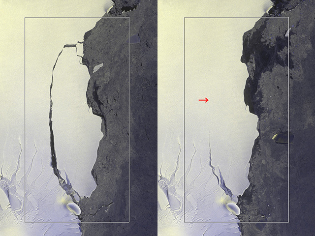
Jul. 26, 2017 Updated
Huge Iceberg Breaks away from Antarctic Ice Sheet — Shizuku Satellite Observations Detect
|
An iceberg about the size of Mie Prefecture of Japan split off from Antarctica’s Larsen C iceberg on July 12, 2017. The second Advance Microwave Scanning Radiometer (AMSR2) on JAXA’s Shizuku satellite captured the calving of the close to 5,800-square kilometer chunk of ice. The nascent iceberg created by the rift is estimated to weigh over a trillion ton kilograms.
|
|
|---|
Jul. 25, 2017 Updated
ALOS-2 Captures Massive Iceberg's Breakoff from Antarctica
|
On July 12, 2017, an iceberg split off from Antarctica’s Larsen C iceberg. With use of ALOS-2’s wide-area observatory mode, JAXA was able to capture the entire calving image. |
|
|---|
Jul. 14, 2017 Updated
GCOM-C renamed SHIKISAI
|
JAXA had the public come up with an excellent nickname for the Global Change Observation Mission – Climate (GCOM-C) for almost a month. The GCOM-C nickname project was couple with SLAT’s. The project was met with quite a response – 12,895 applications. As a result of careful examination, SHIKISAI, meaning colors in Japanese was chosen. |
|
|---|
Jul. 14, 2017 Updated
SLATS renamed TSUBAME
|
JAXA launched a month-long campaign to have the public suggest a new name of the SLATS, acronym for the Super Low Altitude Test Satellite. The SLATS renaming campaign, coupled with GCOM-C’s, was responded by 12,895 applications. |
|
|---|
Jul. 6, 2017 Updated
MMO Development Progress
|
The Mercury Magnetospheric Orbiter (MMO) was shipped from the JAXA Sagamihara Campus in mid-April 2015 and safely arrived at its destination, the European Space Agency (ESA).
|
|
|---|
Jun. 2, 2017 Updated
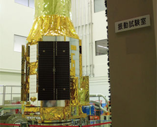
SLATS Comes through Shock and Vibration Testing
|
SLATS, JAXA’s super low altitude test satellite has successfully completed shock (April 11, 2017) and vibration (April 25 through May 12, 2017) testing, a set of ground testing configured to simulate impact and vibration induced by launch and the following separation of the payload fairing.
SLATS, like all other spacecraft, is exposed to extreme conditions to prove the integrity of its control systems.
|
|
|---|
May 26, 2017 Updated
GCOM-C Completes Environmental Testing
|
JAXA’s GCOM-C satellite, Global Change Observation Mission – Climate, to be launched in Japanese fiscal 2017, undergoes environmental testing at the JAXA Tsukuba Space Center. Environmental Test flow includes sinusoidal vibration and acoustics, which JAXA collectively calls mechanical and environmental testing. The testing, which aims at ensuring that the satellite will endure rigorous shock and sound pressure during ascent, was conducted in March and April, 2017 (Image) and came to successful completion. GCOM-C is entering electrical testing, which will determine if the satellite systems, after being subjected to environmental testing, operate properly. |
|
|---|
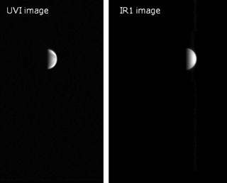
Mar. 3, 2017 Updated
Two cameras on Akatsuki pause observations
|
JAXA decides that two of five cameras on-board Akatsuki (1-μm and 2-μm cameras) pause scientific observations. Other cameras (longwave-infrared camera, ultraviolet imager, and lightening and airglow camera) continue normal operation. |
|
|---|
Feb. 22, 2017 Updated
QZS-1 off to the Cabinet Office's Control
|
On February 28, 2017, JAXA discontinues the operation of QZS-1, the First Quasi-Zenith Satellite MICHIBIKI. Control will be transferred to the Cabinet Office. For details, please refer to: |
|
|---|
Feb. 21, 2017 Updated
GCOM-W: Sea Ice Hits Record Low
|
Global sea ice extent hit record low, according to observations from Shizuku on Global Change Observation Mission on January 14, 2017. It is all time low in the history of satellite operation that started in 1978, JAXA continues operation of Shizuku and GCOM-C and monitoring arctic sea ice extent, off the coast of Greenland Sea and the rest of the arctic circle. |

|
|---|
Jan. 25, 2017 Updated
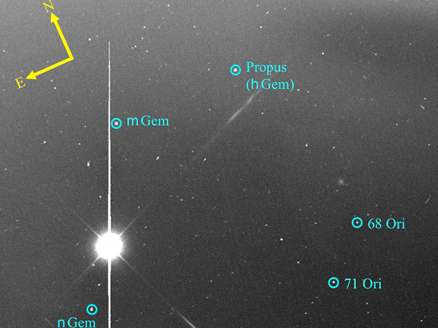
Is there little metallic iron in the universe?
|
Solid particles containing iron (dust particles) act to promote the formation of molecules in interstellar space, and are key to understanding physical and chemical processes there. |
|
|---|
Jan. 25, 2017 Updated
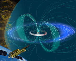
HISAKI, to Prove Solar Wind’s Influence on the Inner Magnetosphere of Jupiter
|
HISAKI, JAXA’S Spectroscopic Planet Observatory for Recognition of Interaction of Atmosphere presents the monitoring data that show solar wind influences Jupiter's inner magnetosphere, the most powerful in the solar system. The finding contradicts the previous hypothesis that solar wind influence on the planet’s inner part is negligible, since its magnetosphere is huge and is rotationally dominated. Research on the response of Jupiter's inner magnetosphere to solar wind requires long, continuous monitoring, just the type of observation HISAKI makes. Its one month long spectroscopic observation on Jupiter updates the theory. |
|
|---|
Jan. 17, 2017 Updated
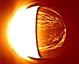
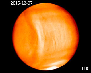
Finding the cause of a bow-shaped feature on Venus
|
In December 2015, the longwave-infrared (LIR) camera mounted on the Venus Climate Orbiter "Akatsuki" discovered a bow-shaped feature stretching about 10,000 km in a north-south direction. This pattern remained in nearly the same place over the observation period of four days, without being affected by the easterly wind (super-rotation) in the Venus atmosphere. Examination using numerical simulations suggested that turbulence in the lower atmosphere generates waves that propagate through the atmosphere. The waves propagate north and south through the sky, creating a bow-like temperature distribution passing through the upper end of clouds at an altitude of about 65 km. This study showed that the state of Venus' lower atmosphere can be inferred from observations of its cloud tops. |
|
|---|
Jan. 15, 2017 Updated
SS-520 No. 4 Launch Results
|
At 8:33 a.m., (Japan Standard Time) January 15, 2017, SS-520 No. 4, JAXA's sounding rocket launched from the Uchinoura Space Center. Through SS-520 No. 4 launch, JAXA sought for research and development of launch vehicles and satellites and the launch demonstration of TRICOM-1, its onboard nanosat that weighs about 3 kilograms. The launch was part of Japanese government's program for development of launch vehicles and satellites in public-private partnerships. The first stage flight of SS-520 No. 4 proceeded according to schedule. Thereafter, however, ground teams could not receive telemetry from the launch vehicle and the call was made to abort the second stage ignition. |
|
|---|
Jan. 11, 2017 Updated
Completion of KIKU No. 8 Operation
|
At 3:25 p.m., (Japan Standard Time) January 10, 2017, JAXA terminated its Engineering Test Satellite-VIII KIKU No.8 (ETS-VIII) transmission, thus brought a closure to the satellite’s operation. |
|
|---|
Oct. 27, 2016 Updated
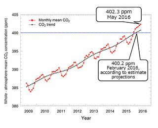
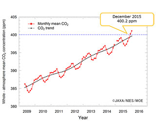
Whole-atmospheric Monthly CO2 Concentration Tops 400 ppm based on IBUKI observation
|
The Ministry of Environment, National Institute of Environmental Studies and JAXA monitor CO2 level by JAXA's Greenhouse gases Observing SATellite IBUKI (GOSAT). The Provisional analysis was done of IBUKI's observational data obtained until May 2016. The results show that the global atmospheric monthly mean CO2 concentration observed vertically through the whole atmosphere exceeded 400 ppm for the first time in February 2016. In addition, the monthly CO2 concentration, after hitting the 400 ppm mark in December 2015, reached the unprecedented level of 402.3 ppm in December 2015. It is the highest record since GOSAT was launched in 2009. |
|
|---|
Sep. 26, 2016 Updated
Full release of the SELENE (KAGUYA) High Definition Television (HDTV) data
|
All the data taken by the high definition television (HDTV) onboard the SELENE (KAGUYA) lunar orbiter have been released. The SELENE HDTV, developed in cooperation with JAXA and NHK, captured the full HD images all around the Moon. The raw data, extracted right from more than 600 HD images that the SELENE HDTV acquired over the period of 21 months, are now available as they are of high scientific value.
|
|
|---|
Sep. 7, 2016 Updated
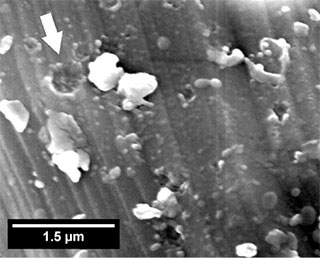
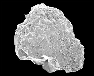
Submicrometer craters in samples returned from the asteroid Itokawa
|
It is previously reported that precious few Itokawa particles show submicrometer craters on their surface. An international research team led by Dr. Dennis Harries (Friedrich Schiller University Jena) has investigated these craters in details using scanning electron microscopy and transmission electron microscopy. As a result of their observations, 15 craters were confirmed on a new particle. Though particles showing such craters had also been found in previous studies, those particles showed only 1-2 craters on their surface. Thus, the new particle found by the research team shows unusual number of craters on the surface of one particle. |
|
|---|
Aug. 12, 2016 Updated
AJISAI marked 30th anniversary on Aug. 13, 2016, and its operation still continues
|
The Experimental Geodetic Satellite "AJISAI" (EGS)" was launched at 5:45 a.m. on Aug 13, 1986 (JST) from the Tanegashima Space Center and it was put into a circular orbit at an altitude of 1,500 km by the maiden H-I Launch Vehicle. |
|
|---|
Jul. 29, 2016 Updated
Happy Birthday, Akatsuki!
|
On July 19, Akatsuki celebrated 1st Venus's year anniversary (a year on Venus is 225 Earth days). Akatsuki keeps working well and continues to gather lots of data. The four cameras aboard the Venus Climate Orbiter "Akatsuki" keep sending down images. |
|
|---|
Jul. 7, 2016 Updated
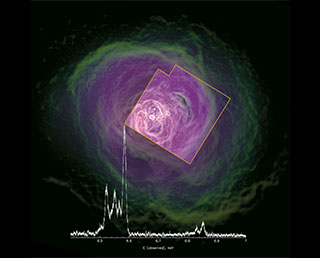
An Unexpectedly Calm Hot Gas in the Center of the Perseus Cluster
|
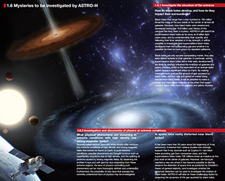
An international team observed the hot gas in the Perseus cluster with the Soft X-ray Spectrometer (SXS) on board the X-ray Astronomy Satellite ASTRO-H ("Hitomi") during its initial operation phase, which started one week after liftoff. The total integration time was 230,000 s. |
|
|---|
Jul. 1, 2016 Updated
Ryugu Observation Campaign (for expert observers)
|
The target asteroid of Hayabusa2 is (162173) Ryugu, 1999 JU3 in the provisional designation. Hayabusa2 will arrive at this asteroid in June - July 2018. In this summer, we have a opportunity to observe Ryugu, so we set up "Ryugu Observation Campaign" from July 1 to August 15, 2016. This is the last chance to observe Ryugu before Hayabusa2 arrives there. However the maximum apparent magnitude will be just 18th mag, so it is rather dark. Maybe you need a telescope with the diameter of 1m or so. Or you must follow the motion of Ryugu with your telescope. Therefor the observation will be rather difficult, but please try it if you can. Good luck! |
|
|---|
Jun. 22, 2016 Updated
Trace of Itokawa's Four Billion Years of History Found on Particles
|
A research team led by Aerospace Project Research Associate Toru Matsumoto of JAXA found that traces of more than four billion years of history up until now of the Asteroid "Itokawa" were recoded on the surface of particles that were recovered from Itokawa by the Asteroid Explorer “Hayabusa” to bring back to the Earth, and their surface patterns and marks were analyzed by the research team. |
|
|---|
Jun. 15, 2016 Updated
JAXA Executives Take Pay Cut Due to ASTRO-H (Hitomi) Anomaly
|
Due to the anomaly experienced with X-Ray Astronomy Satellite ASTRO-H (Hitomi), three of the Japan Aerospace Exploration Agency’s executive employees have decided to take a 10% pay cut to their monthly salary for four months, to be effective July 2016. |
Jun. 10, 2016 Updated
Hitomi Experience Report - Handout for the Specialists advisory panel meeting called by MEXT.
|
(MEXT : Ministry of Education, Culture, Sports, Science
and Technology).
|
Jun. 3, 2016 Updated
Handout for the Specialists advisory panel meeting called by MEXT (Ministry of Education, Culture, Sports, Science and Technology).
May 27, 2016 Updated
Handout for the Specialists advisory panel meeting called by MEXT (Ministry of Education, Culture, Sports, Science and Technology).
May 23, 2016 Updated
A movie of the Venus' night-side produced by IR2
|
This movie is produced from the IR2 2.26-μm images, acquired on 29 March 2016 at a distance of 0.36 million km. Original 4 images were acquired with 4-hour intervals from 16:03 JST (07:03 UT). |
|
|---|
May 20, 2016 Updated
Whole-atmospheric monthly CO2 concentration tops 400 ppm based on observations by IBUKI
|
A recent provisional analysis of IBUKI (GOSAT) observational data shows that the global atmospheric monthly mean CO2 concentration observed vertically through the whole atmosphere exceeded 400 ppm in December 2015 for the first time since GOSAT was launched in 2009.
|
|
|---|
May 11, 2016 Updated
HINODE captured the transit of Mercury across the Sun
|
Mercury marched in front of the Sun from 11:11 UT to 18:44 UT on May 9. Hinode, which is on a Sun-synchronous orbit around the Earth, was able to observe this event without atmospheric distortion.
|
|
|---|
Apr. 28, 2016 Updated
AKATSUKI onboard instruments to move to regular operation
|
JAXA decided to shift the operation mode of the five onboard instruments
of AKATSUKI to the regular operation mode, namely 1μm camera (IR1), 2μm
camera (IR2), Longwave IR camera (LIR), Ultraviolet image (UVI), and
Ultra-stable Oscillator (USO). |
|
|---|
Apr. 28, 2016 Updated
Operation Plan of ASTRO-H (Hitomi)
|
JAXA established the emergency headquarters and has been doing its utmost to understand the anomaly of ASTRO-H (“Hitomi”). We have made every effort to confirm the status of ASTRO-H and to regain its functions. Unfortunately, based on our rigorous technical investigation, we had to conclude. JAXA have determined that we cannot restore the ASTRO-H’s functions.
Accordingly, JAXA will cease the efforts to restore ASTRO-H and will focus on the investigation of anomaly causes. We will carefully review all phases from design, manufacturing, verification, and operations to identify the causes that may have led to this anomaly including background factors. |
Apr. 21, 2016 Updated
GSMap received the MEXT science and technology award
|
Development and research members of the Global Satellite Mapping of Precipitation (GSMaP) received the JFY2016 minister’s science and technology award (science and technology promotion section) of the Ministry of Education, Culture, Sports, Science and Technology (MEXT). |
|
|---|
Apr. 21, 2016 Updated
DAICHI-2 received the MEXT science and technology award
|
The Ministry of Education, Culture, Sports, Science and Technology (MEXT) recognizes remarkable achievements of R&D and the promotion of understanding in the science and technology field by presenting an award, the MEXT minister’s award in the field of science and technology. |
|
|---|
Apr. 21, 2016 Updated
Handout of press briefing (April 15)
|
On April 15 (JST), JAXA held a press briefing to explain the status of the X-ray Astronomy Satellite "Hitomi” (ASTRO-H) and our activities to re-establish communications with “Hitomi.”
|
Apr. 13, 2016 Updated
Handout of press briefing (April 8)
|
On April 8 (JST), JAXA held a press briefing to explain the status of the X-ray Astronomy Satellite "Hitomi” (ASTRO-H) and our activities to re-establish communications with “Hitomi.”
|
Apr. 7, 2016 Updated
Handout of press briefing (April 1)
|
On April 1 (JST), JAXA held a press briefing to explain the status of the X-ray Astronomy Satellite "Hitomi” (ASTRO-H) and our activities to re-establish communications with “Hitomi.”
|
Apr. 1, 2016 Updated
AKATSUKI regular observation to begin in mid April
|
AKATSUKI has been performing test observations by turning on its onboard
observation instruments one by one. The instruments are starting up normally, and we have already conducted successful observations that are equivalent to a “minimum success” (*), thus we will move to regular operations in mid April.
|
|
|---|
Mar. 31, 2016 Updated
Hayabysa2 mission logo color change
|
It has been a year since Hayabusa2 was launched, and we changed the color of the mission logo while moving to the Transfer orbit* phase. |
|
|---|
Mar. 29, 2016 Updated
Current Status of Communication Anomaly of X-ray Astronomy Satellite “Hitomi” (ASTRO-H) (Mar. 29)
|
JAXA has been trying to communicate with the X-ray Astronomy Satellite “Hitomi” (ASTRO-H), using ground stations both in Japan and overseas.
|
Mar. 27, 2016 Updated
Communication anomaly of X-ray Astronomy Satellite “Hitomi” (ASTRO-H) (Mar. 27)
|
JAXA found that communication with the X-ray Astronomy Satellite “Hitomi” (ASTRO-H), launched on February 17, 2016 (JST), failed from the start of its operation originally scheduled at 16:40, Saturday March 26 (JST). Up to now, JAXA has not been able to figure out the state of health of the satellite. While the cause of communication anomaly is under investigation, JAXA received short signal from the satellite, and is working for recovery. Under this circumstance, JAXA set up emergency headquarters, headed by the President, for recovery and investigation. The headquarters held its first meeting today, and has been working for recovery and the investigation of the cause. Updates will be announced as available, at the JAXA website. |
Mar. 24, 2016 Updated
“Hisaki” (SPRINT-A) captures the powerful Jovian auroras caused by the solar winds
|
“Hisaki” (SPRINT-A), in cooperation with NASA’s Chandler X-ray telescope and XMM Newton, observed Jovian auroras for 2 weeks. |
|
|---|
Mar. 17, 2016 Updated
DAICHI-2 honored by central emergency communications council
|
DAICHI-2 received an award for its contributions to anti-disaster operations by the council (*) on March 16, 2016. DAICHI-2 performs emergency observations in response to requests from disaster preparation agencies, and swiftly provides data to understand signs of disasters and their status. |
|
|---|
Mar. 10, 2016 Updated
HINODE captured partial solar eclipse
|
JAXA, NAOJ/NINS, and NASA, release partial eclipse images and videos taken on March 9 with the Solar Physics Satellite “Hinode”.
|
|
|---|
Feb. 29, 2016 Updated
Hitomi critical operation phase successfully completed!
|
JAXA confirmed the completion of a sequence of important operations of the X-ray Astronomy Satellite “Hitomi” (ASTRO-H), including turning the cooling system on, test operation of the Soft X-ray Spectrometer (SXS), and extending the Extensible Optical Bench (EOB). With this confirmation, the critical operation phase of Hitomi was completed.
|
|
|---|
Feb. 17, 2016 Updated
ASTRO-H successfully launched and named “Hitomi”.
|
H-IIA F30 with the "ASTRO-H" onboard launched at 5:45 p.m. on Feb 17, 2016 (JST) from the Tanegashima Space Center.
The rocket flew smoothly, and, at about 14 minutes after liftoff, "ASTRO-H" was separated from the H-IIA F30. |
|
|---|
Feb. 14, 2016 Updated
ASTRO-H Launch rescheduled to 5:45 p.m. on Feb 17 (Wed. ,JST)
|
The launch of the The X-ray Astronomy Satellite "ASTRO-H" by the H-IIA Launch Vehicle No. 30 was rescheduled at 5:45 p.m. on Feb 17 (Wed. Japan
Standard Time, JST) after carefully studying the weather conditions. |
|
|---|
Feb. 12, 2016 Updated
The X-ray Astronomy Satellite "ASTRO-H" launch postponement
|
H-IIA Launch Vehicle No.30 with the X-ray Astronomy Satellite "ASTRO-H" onboard, which was originally scheduled for February 12 (Fri.), 2016 (Japan Standard Time), has been rescheduled because bad weather is expected. The new launch day will be announced as soon as it is determined. Your warm support messages are welcomed at the support site. |
|
|---|
Feb. 3, 2016 Updated
ASTRO-H Press Kit
|
As the launch day approaches, JAXA has released the press kit for the X-ray Astronomy Satellite “ASTRO-H”. It covers ASTRO-H’s satellite and mission overview, scientific missions, and observation instruments. Please have a look. |
|
|---|
Jan. 21, 2016 Updated
ASTRO-H's development and preparation status is updated on the ASTRO-H diary site
|
Aiming at the launch and success of the mission, for some years the
Astro-H team members have been hard at work at research and
development, making steady progress. They have faced many tough
obstacles along this long road. They have had many moments of success. |
|
|---|
Jan. 12, 2016 Updated
ASTRO-H Satellite Shown to the Public
|
On the day marking exactly one month to launch, the ASTRO-H spacecraft was exhibited to the public at the Tanegashima Space Center. Many questions were asked both about the science goals of ASTRO-H and about its engineering. |
|
|---|
Dec. 25, 2015 Updated
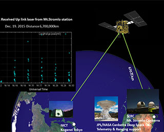
The Optical Link Experiment with the Laser Altimeter (LIDAR)
|
Before and after the Earth swing-by, the laser altimeter (LIDAR) on Hayabusa2 attempted to receive laser light from the satellite laser ranging (SLR) ground stations. |
|
|---|
Dec. 24, 2015 Updated
Photographing the Earth just before Hayabusa2's swing-by : Complete version
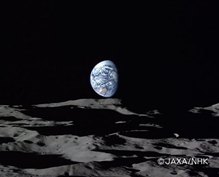
|
In our previous post, we shared images of the Earth taken by Hayabusa2, as the spacecraft approached for the Earth swing-by. There, we showed the Earth from 09:00 JST (00:00 UT) through to 17:45 JST (08:45 UT). In this post, we extend the animation to show all the images that were taken of the Earth from the ONC-W2 camera during the Earth approach which runs to 18:30 JST (09:00 UT) (Figure 1). Figure 2 shows the images individually that comprise the animation, totaling 19 separate frames. |
|
|---|
Dec. 14, 2015 Updated
Hayabusa2: Successful Earth swing-by and heading to Ryugu
|
JAXA confirmed that the Asteroid Explorer “Hayabusa2” entered its target orbit to travel to an asteroid Ryugu after the Earth-swing-by on Dec. 3.
|

|
|---|
Dec. 11, 2015 Updated
X-ray Astronomy Satellite "ASTRO-H" to be launched on Feb. 12
|
The new generation X-ray astronomy satellite ASTRO-H is set for launch on February 12 (Fri.), by the H-IIA Launch Vehicle No. 30 from the Tanegashima Space Center. |
|
|---|
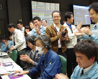
Dec. 9, 2015 Updated
AKATSUKI successfully inserted into Venus' orbit
|
As a result of measuring and calculating the AKATSUKI’s orbit after its thrust ejection on Dec. 7, JAXA found that the AKATSUKI was inserted
into the Venus orbit. |
|
|---|
Dec. 7, 2015 Updated
AKATSUKI attitude control engine thrust operation performed as scheduled
|
JAXA performed the attitude control engine thrust operation of the Venus Climate Orbiter “AKATSUKI” for its Venus orbit insertion from 8:51 a.m. on December 7 (Japan Standard Time). |
|
|---|
Dec. 7, 2015 Updated
Test image acquisition by AKATSUKI onboard cameras (on Dec. 1, 2015)
|
The AKATSUKI had been maintaining a safe posture by facing its
mounting surface of the high-gain antenna toward the sun as that surface
is relatively strong against heat. In that posture, the onboard cameras,
which were stowed in the main body of the orbiter, were not able to
change their view direction. |
|
|---|
Dec. 3, 2015 Updated
Hayabusa2 Earth Swing-by
|
JAXA performed an Earth swing-by operation of the "Hayabusa2" on the night of Dec 3 (Thu.), 2015 (Japan Standard Time). The "Hayabusa2 flew closest to the Earth at 7:08 p.m. (JST) and passed over the Pacific Ocean around the Hawaii islands at an altitude of about 3,090 km.
|
|
|---|
Dec. 2, 2015 Updated
ASTRO-H press day
|
The X-ray Astronomy Satellite “ASTRO-H” was revealed to the media on Nov. 27 at the Tsukuba Space Center. |
|
|---|
Nov. 27, 2015 Updated
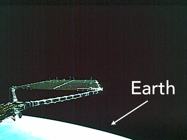
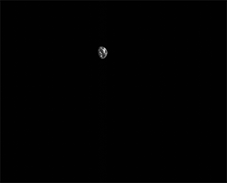
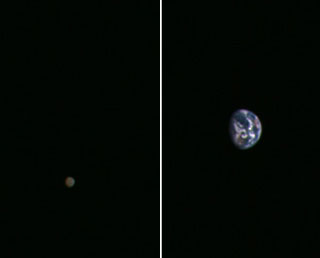
Hayabusa2 took images of the moon and Earth
|
The Hayabusa2, which is flying closer to the Earth for its
scheduled swing-by, photographed the moon and the Earth simultaneously
using its onboard Optical Navigation Camera-Telephoto (ONC-T) at 12:46
p.m. on November 26, 2015 (Japan Standard Time). |
|
|---|
Nov. 27, 2015 Updated
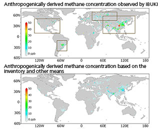
IBUKI methane observation data: close correlation between methane concentration and human activity
|
As a result of analyzing three-year observation data acquired by the Greenhouse Gas Observing Satellite “IBUKI” (GOSAT) until Dec. 2012, the concentration of methane is higher in areas where anthropogenically-derived methane emission is intense, such as densely populated areas, large-scale agricultural regions, natural gas and oil producing/refining areas, compared to other surround areas. |
|
|---|
Nov. 16, 2015 Updated
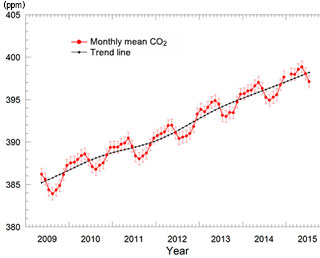
Public release of whole-atmosphere monthly mean CO2 concentration based on observations by IBUKI
|
"IBUKI" (GOSAT) has been in operation since its launch on January 23, 2009. The whole-atmosphere monthly mean concentration of carbon dioxide (CO2), calculated by using GOSAT data that reflect CO2 levels in all layers of the atmosphere, was found to have reached 398.8 ppm in May 2015, while showing seasonal oscillation and yearly rise over the analyzed period. It was also confirmed that the trend line of the whole-atmosphere CO2 mean (average seasonal cycle removed) had reached 398.2 ppm in July 2015. The trend line is expected to exceed 400 ppm within the year 2016, given that the rising trend continues. The GOSAT observation elucidates for the first time that CO2 concentration averaged over all layers of the atmosphere will soon reach the level of 400 ppm, and demonstrates the importance of global greenhouse gas monitoring from space. |
|
|---|
Nov. 9, 2015 Updated
AKATSUKI: Second attempt to enter Venus orbit
|
The Venus Climate Orbiter AKATSUKI will try to enter the orbit of Venus on Dec. 7 (Mon.) after five years of operation. We are welcoming support messages. |
|
|---|
Nov. 2, 2015 Updated
Hayabusa2 set for Earth swing-by! Your support messages welcomed.
|
The Asteroid Explorer “Hayabusa2” will fly near the Earth to perform an Earth swing-by utilizing the Earth’s gravity on Dec. 3 (Thur.) for its orbit control.
|
|
|---|
Nov. 2, 2015 Updated
Release of the JAXA Realtime Rainfall Watch
|
Earth Observation Research Center (EORC) of Japan Aerospace Exploration Agency (JAXA) has developed GSMaP realtime version (GSMaP_NOW) providing rainfall information of current hour, and released those information through a new webpage “JAXA Realtime Rainfall Watch”. |
|
|---|
Nov. 2, 2015 Updated
ASTRO-H sinusoidal vibration test
|
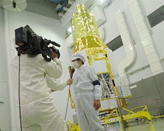
The sinusoidal vibration test of the X-ray astronomy satellite “ASTRO-H” was held between Aug. 29 and Oct. 2 at the Tsukuba Space Center. The sinusoidal vibration test aims at two major evaluation objectives, namely evaluating dynamic characteristics of a satellite structure and assessing its strength by loading vibrations equivalent to that at the launch. |
|
|---|
Oct. 20, 2015 Updated
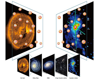
Suzaku reveals average chemical composition of our Universe on largest scales
|
All of the chemical elements that are heavier than carbon, the oxygen we breathe, the silicon that makes up the sand on the beach, were produced inside stars through nuclear fusion and released by stellar explosions called supernovae. By measuring the chemical composition of the Universe, scientists are trying to reconstruct the history of how, when, and where each of the chemical elements so necessary for the evolution of life were produced. |
|
|---|
Oct. 5, 2015 Updated
“Ryugu” was selected as name of Hayabusa2 target asteroid
|
Asteroid 1999 JU3, a target of the Asteroid Explorer “Hayabusa2,”
was named “Ryugu”. |
|
|---|
Sep. 2, 2015 Updated
Hayabusa2 additional ion engine operation for Earth swing-by
|
On Sept. 1 (Tue.) and 2 (Wed.), the ion engine of the Hayabusa2 was additionally operated in order to increase the orbit control accuracy for the Earth swing-by.
|
|
|---|
Aug. 31, 2015 Updated
AKATSUKI passed the perihelion
|
The Venus Climate Orbiter “AKATSUKI” flew at the closest point to the Sun, the perihelion, on its orbit at around 2:00 a.m. on Aug. 30, 2015. It is the ninth time of passing the perihelion since its launch in 2010. The AKATSUKI is still in a difficult state regarding the thermal environment, even after it flew away from the perihelion. |
|
|---|
Aug. 26, 2015 Updated
Suzaku completes its scientific observations
|
JAXA determined that it is difficult to resume scientific
observations of the X-ray Astronomy Satellite “Suzaku”, whose
communication functions have been intermittently failing since June 1,
2015, despite our efforts to restore the regular operation. The decision
to complete the observations was made after carefully examining the
conditions of not only communication, but also batteries and attitude
control. |
|
|---|
Aug. 5, 2015 Updated
AKATSUKI: Orbit successfully controlled
|
JAXA performed an orbit control maneuver for the Venus Climate Orbiter “AKATSUKI” in late July in preparation for its re-injection into the Venus orbit scheduled for Dec. 7, 2015. According to the analysis of telemetry data acquired up to Aug. 2, the orbit control and correction was successfully conducted as scheduled by 5:30 p.m. on August 4. (All dates and time are Japan Standard Time.) |
|
|---|
Aug. 3, 2015 Updated
ASTRO-H thermal vacuum test
|
The thermal vacuum test was held for the X-ray Astronomy Satellite “ASTRO-H” between June 24 and July 9 in a 13-meter chamber at the Tsukuba Space Center. The purposes of the thermal vacuum test are to verify the thermal model by exposing a satellite to the vacuum and thermal environment, and to confirm the function and performance of observation instruments in the on-orbit environment through an electric test. |
|
|---|
Jul. 29, 2015 Updated
Communication establishment training with satellites using KIZUNA in a prediction of the Nankai Trough earthquake
|
On July 29, 2015, JAXA and NICT offered the Internet environment with asatellite when the Japan Medical Association (JMA) conducted the “satellite use demonstration in a prediction of the Nankai Trough earthquake (Disaster preparation drill) 2015.” The communication environment was established by setting up a ground station in each JMA prefectural office under the assumption that communication lines were cut off due to a large-scale disaster. |
|
|---|
Jul. 22, 2015 Updated
Naming Proposal Campaign: Become a godparent of asteroid "1999 JU3", destination of Hayabusa2!
|
JAXA is holding a naming proposal campaign to christen the asteroid “1999 JU3",which the Hayabusa2 is scheduled to visit in June or July 2018. Why don’t you try to become a godparent of the asteroid? August 31, 2015 at 11:59 p.m. (Japan Standard Time). (Extended from 10:00) |
|
|---|
Jul. 9, 2015 Updated
AKATSUKI to perform fourth orbit control to Venus
|
The AKATSUKI will perform an orbit control for the fourth time (DV4: Delta Velocity 4) from July 17, targeting to be injected into the Venus
orbit again in December 2015. The control will be divided into three performances. |
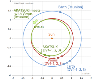
|
|---|
Jun. 22, 2015 Updated
TRMM ends its 17 years of observations
|
The Japan-U.S. joint satellite project, Tropical Rainfall Measuring Mission “TRMM” satellite, re-entered the atmosphere at 12:55 p.m. on June 16, 2015 (Japan Standard Time) over the South Indian Ocean. The TRMM satellite, launched by the H-II Launch Vehicle No. 6 on Nov. 28, 1997, far exceeded its design life of three years and two months and continued observations for 17 years to contribute to research on the study of precipitation.
TRMM achievements and heritage are succeeded by the GPM core observatory with the Dual-frequency Precipitation Radar (DPR) onboard. The DPR is the upgraded Precipitation Radar (PR) of the TRMM. |
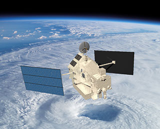
|
|---|
Jun. 12, 2015 Updated
Hopes to recover normal operation after Suzaku communication failure
|
The X-ray Astronomy Satellite “Suzaku” (ASTRO-EII) continues its
operation after exceeding its target life of about two years. However,
since June1, 2015, communication with the Suzaku has been intermittently
cut off, so that we can confirm its operational status only when
communication is established. We now assume that insufficient power is
causing the discontinued communication. Thus we are doing our best to
gather more accurate information of the operational status based on
accumulated data through sporadic communication. |
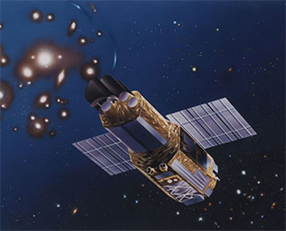
|
|---|
Jun. 8, 2015 Updated
Hayabusa2 second ion engine continuous operation completed
|
The Hayabusa2 has been continuously operating its ion engine for the
second time since June 2, and successfully completed its operations at
0:25 a.m. on June 7 (Japan Standard Time.) The second continuous
operation lasted for 102 hours as scheduled. |
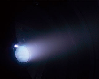
|
|---|
May 29, 2015 Updated
IKAROS enters hibernation mode for 5th time
|
JAXA has been confirming the status of the Small Solar Power Sail Demonstrator “IKAROS” by receiving data from it since April 2015, when the IKAROS woke up from its hibernation mode. We, however, could not receive radio waves from the IKAROS on May 21, thus we determined that the demonstrator had shifted to the hibernation mode
for the fifth time as we expected. |
|
|---|
May 18, 2015 Updated
World Elevation Data (30-meter mesh version) is now available at JAXA's site free of charge!
|
JAXA will begin publishing free of charge an elevation data set that can express undulations of terrain over the world with a resolution of 30 meters horizontally (30-m mesh version). The data set has been compiled with images acquired by the "DAICHI" (ALOS). As the first step, we will offer the areas in East Asia, including Japan, and South East Asia regions, and will expand the areas to all over the world (within 82 deg. of N/S latitudes). |
|
|---|
May 14, 2015 Updated
Agreement concluded with MLIT on DAICHI-2 observation data
|
JAXA concluded an agreement with the Kyushu Regional Development Bureau of the Ministry of Land, Infrastructure, Transport and Tourism (MLIT) on April 30, 2015, to provide observation data by the Advanced Land Observing Satellite-2 “DAICHI-2” (ALOS-2). The purpose of the agreement is to survey (1) secular changes of landscape and ash fall and (2) isolated islands for their up keep. We will work together to conduct surveys more efficiently with broader covering areas by mutually sharing and studying observation data possessed by the Kyushu Regional Development Bureau and JAXA's satellite data. |
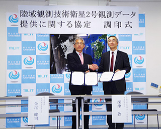
|
|---|
May 12, 2015 Updated
Mercury Magnetosphere Orbiter arrived at European Space Research and Technology Center
|
The Mercury Magnetosphere Orbiter (MMO), which left the Sagamihara Campus in mid April, arrived at the European Space Research and Technology Centre (ESTEC) in the Netherlands on April 16. The MMO will be tested there, then launched with the Mercury Planetary Orbiter (MPO) of the European Space Cagney (ESA) from the Guiana Space Center (in French Guiana) in JFY 2016. |
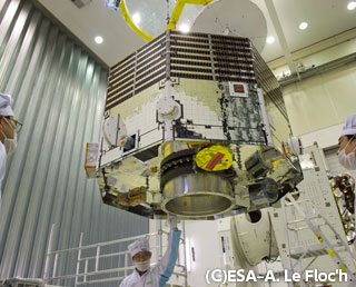
|
|---|
Apr. 30, 2015 Updated
IKAROS wakes up from hibernation mode for the 4th time
|
The IKAROS seemed to wake up from its hibernation mode in mid March 2015, and JAXA searched for it based on its attitude and orbit prediction to receive its radio waves. On April 23 (Thu.), we successfully found the IKAROS, which is flying at a distance of about 120 million kilometers from the Earth. |
|
|---|
Apr. 21, 2015 Updated
Soft Gamma-ray Detectors (SGDs) installation on ASTRO-H completed
|
Two Soft Gamma-ray Detectors (SGDs), which successfully went through the
thermal vacuum test and the cooling test, were installed onto the ASTRO-H. The photo shows the SGD2 on the ASTRO-H with a debris cover and
a radiator. A golden color MLI (multi-layer insulation) will wrap them so that they will not be seen from outside. |
|
|---|
Apr. 10, 2015 Updated
Baton pass to new Hayabusa2 project manager
|
The Hayabusa2 is stably flying in space. The new fiscal year has just started in Japan, and JAXA is taking a new step as we became a National Research and Development Agency from the previous independent administrative agency. The Hayabusa2 project is also taking a fresh step with a new team, including handing the baton over to a new project manager. All members of the project are engaged in the mission with a fresh mindset. Message from New Project Manager Yuichi TsudaThe Hayabusa2 is stably flying since its launch and smoothly continuing it interplanetary cruising. I can, therefore, take over the mission at the best condition from my predecessor, former Project Manager Hitoshi Kuninaka, who led the development of the project. With many operation experts joining the new team, we would like to successfully send the Hayabusa2 to the asteroid 1999JU3, and have it come home safely. Message from Former Project Manager Hitoshi KuninakaAs the development phase is over, Hayabusa2’s deep space exploration has started. Photo: left: New Project Manager Yuichi Tsuda, right: Former Project Manager Hitoshi Kuninaka |
|
|---|
Mar. 27, 2015 Updated
Galaxy Scale Outflow of Matter Stimulated by a Monster Black-hole
|
By the observations from the Japan-led Suzaku X-ray satellite adn the European Space Agency’s infrared Herschel Space Observatory, scientists have discovered the first proof that a fierce outward “wind” is produced when a huge black-hole consumes a large mass of material, and the wind is source of outflow of matter at the galaxy scale.
|
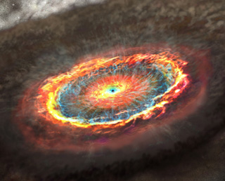
|
|---|
Mar. 25, 2015 Updated
HISAKI’s first observation of Jupiter’s magnetosphere
|
A research team led by Researcher Tomoki Kimura (researcher of the Japan Aerospace Exploration Agency as well as a research fellowship for young scientist of the Japan Society for the Promotion of Science) captured a sudden brightening (auroral expansion) through long-term continuous observations of Jupiter by the Spectroscopic Planet Observatory for Recognition of Atmosphere "HISAKI," and clarified for the first time in the world that this phenomenon was caused by the rapid rotation of Jupiter. |
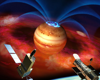
|
|---|
Mar. 19, 2015 Updated
The Mercury Magnetosphere Orbiter (MMO) was shown to the media
|
The Mercury Magnetosphere Orbiter (MMO) was shown to the media on March 15. |
|
|---|
Mar. 5, 2015 Updated
Hayabusa2 initial functional confirmation completed and moved to cruising phase to asteroid
|
The Asteroid Explorer “Hayabusa2,” launched on Dec. 3, 2014, completed its initial functional confirmation period of about three months. The
explorer was moving to the cruising phase on March 3 while heading to the asteroid “1999 JU3.” |
|
|---|
Feb. 6, 2015 Updated
AKATSUKI to be re-injected into Venus orbit on Dec. 7
|
After failing to be injected into the Venus orbit in Dec. 2010, JAXA has
been carefully considering another injection attempt opportunity for the
Venus Climate Orbiter “AKATSUK” to the Venus orbit when the orbiter
meets Venus in the winter of 2015. As a result of detailed study, JAXA
decided to inject the AKATSUKI into the orbit on December 7 (Mon.), 2015.
|

|
|---|
Feb. 3, 2015 Updated
Hayabusa2 in great shape – Initial functional confirmation going smoothly
|
The Hayabusa2, launched on Dec. 3, 2014 (JST), is now undergoing the
initial functional confirmation. Basic operations and performance of
onboard instruments and ground systems have been tested one by one as of
the end of January.
The explorer is currently in good shape.
|
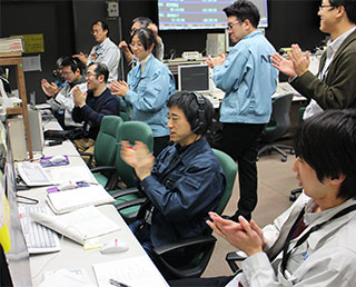
|
|---|
Jan. 25, 2015 Updated
Thermal vacuum test for Soft Gamma-ray Detectors
|
The Soft Gamma-ray Detectors (SGD) to observe the soft gamma-ray region
of 60 to 600 keV are under the thermal vacuum test in the 8-meter chamber at the Tsukuba Space Center to confirm their thermal design. |
|
|---|
Jan. 23, 2015 Updated
ALOS-2/CIRC data is open to public!
|
After the calibration and validation of ALOS-2/CIRC, JAXA confirmed the data quality of ALOS-2/CIRC is adequate. All ALOS-2/CIRC data is avaliable from CIRC observation data search, if user follows the CIRC data policy. |
|
|---|
Jan. 20, 2015 Updated
Highly detailed data of far-infrared all-sky image
|
A team led by the University of Tokyo compiled a new far-infrared all-sky image using data acquired by the Infrared Astronomical Satellite AKARI. JAXA also cooperated with the team for image data compilation and its publication. |
|
|---|
Jan. 9, 2015 Updated
AKATSUKI heading to Venus again
|
The Venus Climate Orbiter “AKATUSKI” has been flying on an orbit in
which it could meet Venus again in 2015 since it carried out orbit
control maneuvers three times in 2011 after its failure to be injected
into the target orbit due to damage to its main engine in Dec. 2010. |
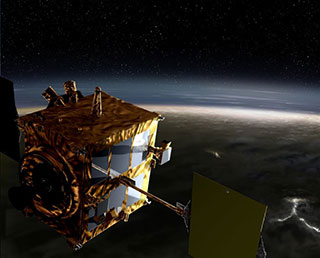
|
|---|
Dec. 26, 2014 Updated
Global Change Observation Mission – Climate (GCOM-C) mission logo
|
A mission logo for the Global Change Observation Mission – Climate
(GCOM-C) has been selected. GCOM-C is a satellite mission to clarify the climate change mechanism such as global warming, as well as to monitor the status of flying yellow sand, and to observe ocean plankton to estimate fishing points by acquiring various data on the Earth that is considered to have an impact on climate change.
|

|
|---|
Dec. 25, 2014 Updated
"IBUKI" (GOSAT) Satellite's Historically Unprecedented Observation of Anthropogenic CO2 Emissions of Mega-City Regions from Space
|
The Greenhouse gases Observing SATellite "IBUKI", developed jointly by the Ministry of the Environment (MOE), the National Institute for Environmental Studies (NIES), and the Japan Aerospace Exploration Agency (JAXA) is the world's only satellite designed specifically to monitor greenhouse gases from space. The satellite has continued to fulfill its main mission in monitoring atmospheric carbon dioxide (CO2) and methane concentrations from space to improve the accuracy of sink/source estimates, and achieve its target to contribute to precision refinement for the ongoing elucidation of carbon cycles, since its launch on January 23, 2009. |
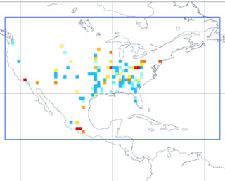
|
|---|
Dec. 5, 2014 Updated
Hayabusa2 flying smoothly!
|
JAXA confirmed the completion of a sequence of the important operations
for the "Hayabusa2" mission. With this confirmation, the critical
operation phase* of the Hayabusa2 was completed. |
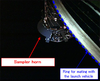
|
|---|
Dec. 3, 2014 Updated
"Hayabusa2" successfully launched!
|
H-IIA F26 with the Asteroid Explorer "Hayabusa2" onboard launched at 1:22:04 p.m. on Dec 3, 2014 (JST) from the Tanegashima Space Center.
|
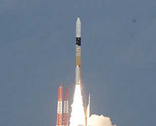
|
|---|
Nov. 30, 2014 Updated
"Hayabusa2" Launch rescheduled to 1:22:04 p.m. on December 3 (Mon.) 2014
|
Mitsubishi Heavy Industries, Ltd. and JAXA have decided to postpone the
launch of "Hayabusa2" and piggyback payloads by the H-IIA F26 to 1:22:04
p.m. on Dec 3 (Wed. JST).
|
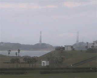
|
|---|
Nov. 29, 2014 Updated
"Hayabusa2" Launch rescheduled to 1:22:43 p.m. on December 1 (Mon.) 2014
|
The launch of the Asteroid Explorer "Hayabusa2" and three micro
piggyback payloads by the H-IIA Launch Vehicle No. 26 was rescheduled
at 1:22:43 p.m. on December 1 (Mon. Japan Standard Time, JST) after
carefully studying the weather conditions.
|
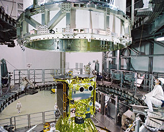
|
|---|
Nov. 28, 2014 Updated
Hayabusa2 launch postponement
|
H-IIA Launch Vehicle No.26 with the Asteroid Explorer "Hayabusa2"
onboard has been rescheduled as clouds including a freezing layer that
exceeds the restrictions for suitable weather are forecast to be
generated at around the scheduled launch time on November 30 (Sun.),
2014 (Japan Standard Time.) |
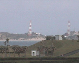
|
|---|
Nov. 27, 2014 Updated
New movie "Ready to Face New Challenges -Hayabusa2- "
|
The new video clip titled "Ready to Face New Challenges -Hayabusa2- " was uploaded to the YouTube. |
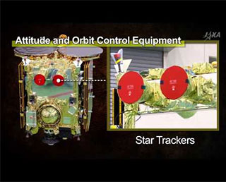
|
|---|
Nov. 25, 2014 Updated
“DAICHI-2” Regular Provision of Observation Data
|
JAXA began regular provision of the Advanced Land Observing Satellite-2 “DAICHI-2” (ALOS-2) observation data today as we have completed its initial functional confirmation and calibration operations as scheduled. |
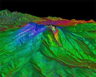
|
|---|
Nov. 4, 2014 Updated
“Hayabusa2" Launch Live Broadcast (by H-IIA F26)
|
JAXA will broadcast a live report of the Asteroid Explorer Hayabusa2’s launch by the H-IIA Launch Vehicle No.26 (H-IIA F26) from the Tanegashima Space Center. The report will cover launch events from the liftoff to the payload separation from the launch vehicle. Program summaryThe broadcast program consists of two parts. The first half mainly focuses on launch events prior to and after liftoff. Then the latter half covers events before and after the Hayabusa2’s separation from the launch vehicle. *Please be aware that the time schedule of the program is subject to change due to progress of the launch operations. Program contentsPart I
*The scheduled launch time is 1:24 p.m.
Part II
* Images of piggyback payloads’ separation will NOT be broadcast. Internet live broadcastJAXA will distribute our live report through the following Internet channels. * The copyright of the live broadcast belongs to JAXA. |
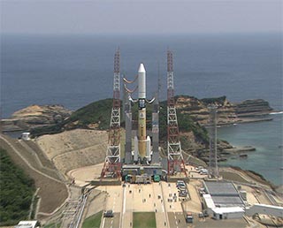
|
|---|
Nov. 1, 2014 Updated
BepiColombo MMO system thermal vacuum test
|
The thermal vacuum test for the Mercury Magnetosphere Orbiter (MMO) of the BepiColombo was performed for three weeks at JAXA Sagamihara Campus. The photos show the transportation of the MMO from a cleanroom to the thermal-vacuum chamber. For more details, pleas check the JAXA digital archives. |
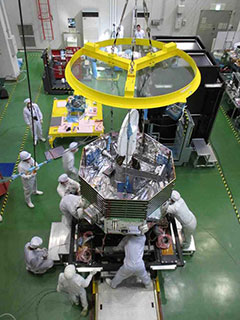
|
|---|
Oct. 27, 2014 Updated
HINODE encountered annular solar eclipse
|
On Oct. 24, 2014, the Solar Physics Satellite “HINODE” was in a straight
line with the Sun and the moon on orbit to observe the annular solar
eclipse. JAXA, the National Institutes of Natural Science, the National
Astronomical Observatory of Japan, and NASA took images of the scene and
published the X-ray solar photos and movies of the annular solar eclipse.
The HINODE flew into the shadow of the moon (in the antumbra observed
during the annular solar eclipse, the diameter of which is 187 km) while
flying over the North American continent at an altitude of 680 km at
around 6:53 a.m. on Oct. 24 (JST.) This annular solar eclipse was seen
only in orbit, and it was observed as a partial solar eclipse from the
North American continent (the U.S. and Canada) and other areas on the
23rd (universal time).
|
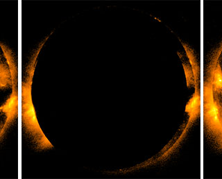
|
|---|
Oct. 8, 2014 Updated
TRMM/PR completed the post-mission operation
|
The Precipitation Radar (PR) aboard the Tropical Rainfall Measuring Mission (TRMM) satellite completed its post-mission operation on October 7, 2014 (UTC.) The TRMM has been in its 17th year of operation, well exceeding its design life expectancy of three years and two months. |
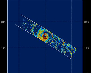
|
|---|
Sep. 30, 2014 Updated
DAICHI-2 captured Mt. Ontake eruption
|
Mt. Ontake straddling Nagano and Gifu prefectures erupted at 11:52 a.m.
on Sept. 27, 2014. JAXA has been observing the volcanic activity and its
impact by earth observation satellites. The DAICHI-2 acquired data on
Mt. Ontake on Sept. 27, 28, and 29. As it started regular observation
operations in early August and captured some images of Mt. Ontake prior
to the eruption, we can compare images taken before and after the
incident to study changes and the situation. |
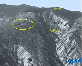
|
|---|
Sep. 30, 2014 Updated
New voyager to travel deep into space! Hayabusa2 to be launched on Nov. 30
|
The launch date and time for the H-IIA Launch Vehicle No. 26 (H-IIA F26)
with the Asteroid Explorer "Hayabusa2" onboard was decided to be at 1:24:48 p.m. on November 30 (Sunday), 2014 (Japan Standard Time)*. |
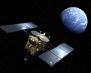
|
|---|
Sep. 26, 2014 Updated
HISAKI’s first observation of Jupiter’s magnetosphere
|
The Spectroscopic Planet Observatory for Recognition of Interaction of
Atmosphere "HISAKI" launched by the Epsilon Launch Vehicle on Sept. 14,
2013, observed Jupiter’s magnetosphere using its onboard extreme
ultraviolet spectroscope (EUV), and captured evidence that hot
electrons flow toward Jupiter. This is important proof to support
conventional theory. |
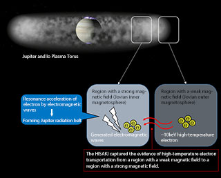
|
|---|
Sep. 5, 2014 Updated
Hayabusa2 revealed to the media
|
The Asteroid Explorer “Hayabusa2” was shown to the media at Sagamihara Campus on August 31, 2014. "I am bracing for the new voyage of the Hayabusa2." said Project Manager Kuninaka. |

|
|---|
Sep. 5, 2014 Updated
NOAA to utilize data acquired by "SHIZUKU"
|
The U.S. National Oceanic and Atmospheric Administration (NOAA) has
begun to routinely utilize observational data acquired by the Advanced
Microwave Scanning Radiometer 2 (AMSR2) aboard the Global Change
Observing Mission - Water "SHIZUKU" (GCOM-W) to monitor the land, ocean
and atmosphere globally and around the U.S. GCOM-W was launched by the
Japan Aerospace Exploration Agency (JAXA) in May 2012 and JAXA started
providing the AMSR data to NOAA in February, 2013. Image: Hurricane "Arthur" on July 3, 2014 |
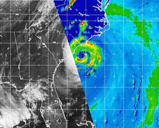
|
|---|
Sep. 2, 2014 Updated
GPM providing 3D precipitation data
|
Data acquired by the GPM Core Observatory, the JAXA/NASA joint
development mission, has been provided to the public since Sept. 2. |
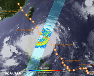
|
|---|
Aug. 11, 2014 Updated
First Image Data Acquisition by CIRC onboard DAICHI-2
|
Compact Infrared Camera (CIRC) is a technology demonstration payload onboard the DAICHI-2. CIRC is an infrared sensor intended for observing forest fires, volcanoes, and heat island phenomena. |
|
|---|
Jun. 27, 2014 Updated
First Image Data from“DAICHI-2” (ALOS-2)
|
JAXA acquired images from the PALSAR-2 aboard the "DAICHI-2" (ALOS-2). Comparison of images taken by PALSAR-2 and DAICHI PALSAR (Urayasu City)
Comparison of images taken by PALSAR-2 and the synthetic aperture radar aboard airplane (Nishinoshima Island)
PALSAR-2 movies |
|
|---|
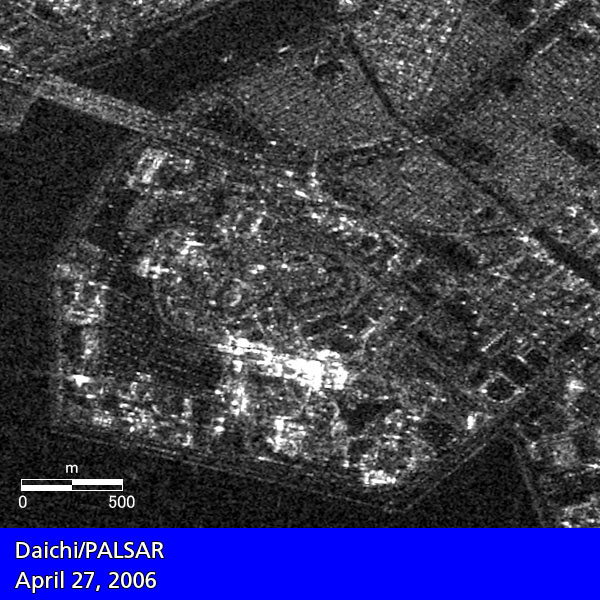
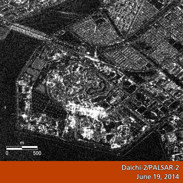
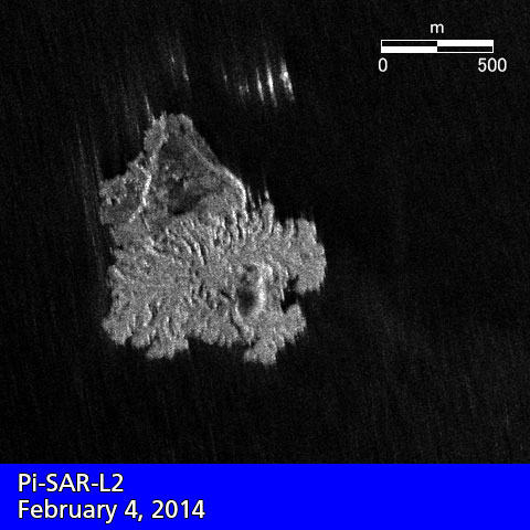
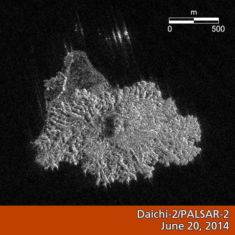
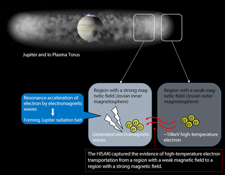
Jun. 4, 2014 Updated
IKAROS wakes up from hibernation mode for third time
|
The IKAROS seemed to wake up from its hibernation mode in mid April, and JAXA searched for it based on its attitude and orbit prediction to receive its radio waves. On May 22 (Thu.), we successfully found the IKAROS, which is flying at a distance of about 230 million kilometers from the Earth. We will continue to receive data from the IKAROS until mid June to confirm its condition and analyze the information. The IKAROS, launched in May 2010, completed its mission, and is now revolving around the sun about every 10 months. Power generation is insufficient for seven months out of 10 so the IKAROS goes into hibernation mode for this period by shutting down instruments. For the remaining three months, the IKAROS is awake with enough power so that we can receivedata from it. |
|
|---|
May 29, 2014 Updated
First Integration Test for ASTRO-H (for XRT)
|
As manufacturing of two Hard X-ray Telescopes (HXTs) and two Soft X-ray Telescopes (SXTs) has been completed and their performance has been confirmed, they are going to be subject to the first integration test. During the test, the telescopes will be mounted on an optical board to make sure that there is no interference with other structures or the satellite bus as well as that no problems arise with operations for controlling the telescope position or angle and operation tools. |
|
|---|
May 27, 2014 Updated
DAICHI-2 critical operation phase successfully completed! Initial function verification starts!
|
The DAICHI-2 launched from the Tanegashima Space Center on May 24 performed important tasks including L-band synthetic aperture radar deployment after its injection into the orbit, thus its critical operation phase was successfully completed. |
|
|---|
May 24, 2014 Updated
Successful launch of H-IIA F 24 with DAICHI-2 (ALOS-2)!
|
The launch of the H-IIA Launch Vehicle No. 24 with The Advanced Land Observing Satellite-2 "DAICHI-2" (ALOS-2) aboard was successfully performed at 12:05:14 p.m. on May 24 (Sat.) 2014 (Japan Standard Time). |
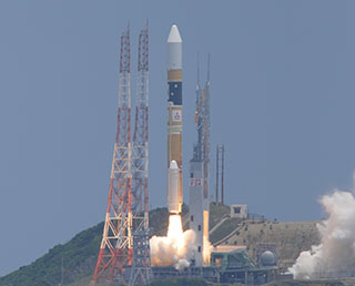
|
|---|
May 22, 2014 Updated
DAICHI-2/H-IIA F24 to be launched soon! Live broadcast from 11:15 a.m. on May 24 (Sat.)
|
The launch time of the H-IIA Launch Vehicle No. 14 (H-IIA F14) with the
DAICHI-2 onboard was set for 12:05:14 p.m. on May 24 (Sat.) 2014 (Japan
Standard Time). |
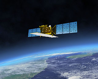
|
|---|
May 1, 2014 Updated
DAICHI-2 (ALOS-2) revealed to the media at TNSC
|
On March 28 (Fri.), the Advanced Land Observing Satellite-2 “DAICHI-2”(ALOS-2) was revealed to the press at the Spacecraft Test and Assembly Building 2 (STA-2) at the Tanegashima Space Center (TNSC.)
|
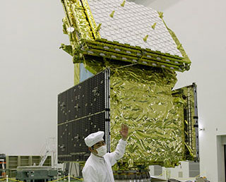
|
|---|
Mar. 31, 2014 Updated
DAICHI-2 (ALOS-2) transportation to Tanegashima
|
We would like to report to you the transportation of the DAICHI-2 (ALOS-2) from the Mitsubishi Electric's Kamakura Works, where its assembly and tests were conducted, to the Tanegashima Space Center (TNSC). |
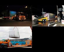
|
|---|
Mar. 25, 2014 Updated
First Images Available from JAXA-NASA Global Rain and Snowfall Satellite
|
JAXA and the NASA have released the first images captured by their newest Earth-observing satellite, GPM Core Observatory, which launched into space Feb. 28 (JST). The images show precipitation falling inside a March 10 cyclone over the northwest Pacific Ocean, east of Japan. The data were collected by the GPM Core Observatory's two instruments: JAXA's Dual-frequency Precipitation Radar (DPR), which imaged a three-dimensional cross-section of the storm; and, NASA's GPM Microwave Imager (GMI), which observed precipitation across a broad swath. |
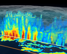
|
|---|
Mar. 20, 2014 Updated
AKARI made a step to a key to understand the material evolution in the universe
|
A team of astronomers based at the University of Tokyo has made a significant step in better understanding the material evolution of the universe. Led by Ms Tamami I. Mori, a research fellow for the Japan Society for the Promotion of Science, the study may help to give new insights into complex carbon chemistry in the galaxy. |
|
|---|
Mar. 14, 2014 Updated
Launch date set for DAICHI-2 on H-IIA F24!
|
The launch date and time for the H-IIA Launch Vehicle No. 24 (H-IIA F24) with the Advanced Land Observing Satellite-2 "DAICHI-2" (ALOS-2) onboard was decided to be at around 12:05 p.m. thru 12:20 p.m. (JST) on May 24 (Sat.,) 2014 (Japan Standard Time.) |
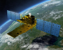
|
|---|
Feb. 28, 2014 Updated
Successful launch of H-IIA F23 with GPM core ovservatory aboard!
|
The launch of the H-IIA Launch Vehicle No. 23 with the core observatory for the Global Precipitation Measurement mission aboard was successfully performed at 3:37 a.m. on February 28 (Fri.) 2014 (JST). |
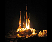
|
|---|
Feb. 24, 2014 Updated
Precise Global Digital 3D Map "ALOS World 3D" Homepage
|
JAXA is starting to process the precise global digital 3D map using some 3 million data images acquired by the Advanced Land Observing Satellite "DAICHI" (ALOS). The digital 3D map to be compiled this time has the world's best precision of five meters in spatial resolution with five meters height accuracy that enables us to express land terrain all over the world. Hence its strong character will prove useful in various areas including mapping, damage prediction of a natural disaster, water resource research etc. |
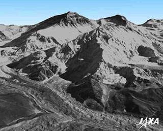
|
|---|
Feb. 3, 2014 Updated
NOAA utilizes SHIZUKU data for typhoon monitoring
|
The National Oceanic and Atmospheric Administration (NOAA) announced that it will utilize observation data acquired by the Advanced Microwave Scanning Radiometer 2 (AMSR2) aboard the Global Change Observation Mission 1-Water “SHIZUKU” (GCOM-W1) from June 1, 2014, to monitor the birth and development of a tropical low pressure system. |
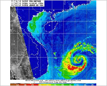
|
|---|
Jan. 17, 2014 Updated
GPM core observatory revealed to the media
|
On January 17 (Fri.), the GPM core observatory was shown to the media in the Spacecraft Test and Assembly Building 2 (STA2) at the Tanegashima Space Center (TNSC). |
|
|---|
Jan. 10, 2014 Updated
Instantaneous heater in space
|
A research group led by Researcher Hiroya Yamaguchi at the NASA Goddard
Space Center captured, for the first time in the world, proof of
instantaneous electron heating to about 200 million degrees Celsius by
shock waves of“Tycho Brahe's Supernova remnant” generated by an
explosion 422 years ago. |
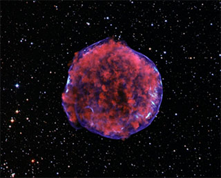
|
|---|
Dec. 2, 2013 Updated
AMSR-E Slow Rotation Data has been released
|
The AMSR-E automatically halted its observations and rotation on October 4, 2011 (UTC) due to increased rotation friction. After then NASA and JAXA began to analyze the situation and had been seeking for the way to restart AMSR-E observation. And on December 4, 2012 (UTC,) the AMSR-E restarted its observations and rotation with slow rotation (2 rotations per minute). JAXA completed initial radiometric and geometric correction for slow rotation data, and now AMSR-E Slow Rotation Data is available to public users. image: Observed area with slow rotation The detail is described in the following page. |
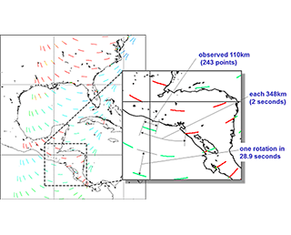
|
|---|
Nov. 28, 2013 Updated
Satoshi Kogure Awarded with Leadership Award in GPS World 2013
|
Satoshi Kogure, mission manager of the Satellite System Technology Unit, was awarded with GPS World 2013 Leadership Award (Satellite Division), hosted by GPS World. |

|
|---|
Nov. 20, 2013 Updated
Hayabusa2 Small Carry-on Impactor undergoes test
|
Hayabusa2’s Small Carry-on Impactor (SCI) underwent a test in October, 2013. Hayabusa2 SCI test [JAXA Digital Archives] |
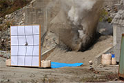
|
|---|
Oct. 31, 2013 Updated
Suzaku clarifies explosive period of heavy elements for first time
|
Researchers from Stanford University and JAXA elucidated through the observation by the X-ray Astronomy Satellite “Suzaku” that there was a period about 10 billion years ago when heavy elements including iron were spread throughout the universe, and it was confirmed that those spread elements during that explosive period are the origin of most heavy elements currently existing in the universe. |

|
|---|
Sep. 15, 2013 Updated
HISAKI (SPRINT-A) Orbit Calculation Result and Critical Operation Period Completion
|
JAXA confirmed that the Spectroscopic Planet Observatory for Recognition of Interaction of Atmosphere "HISAKI" (SPRINT-A) was injected into the planned orbit after its orbit calculation. |
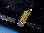
|
|---|
Jun. 26, 2013 Updated
Particles captured on asteroid Itokawa on exhibition.
|
JAXA is exhibiting particles brought back to the Earth by the asteroid explorer “Hayabusa,” which returned in June 2010, at the National Museum of Nature and Science and at the Sagamihara City Museum thanks to their cooperation. - National Museum of Nature and Science Permanent Exhibit - Sagamihara City Museum Limited-time Only Exhibit |
|
|---|
Jan. 30, 2013 Updated
Agreement signed with JMA on demonstration supporting disaster medicine
|
JAXA and the Japan Medical Association (JMA) signed an agreement to jointly conduct application experiments of the Wideband Internetworking Engineering Test and Demonstration satellite “KIZUNA” to support disaster medicine, after JAXA and JMA studied the utilization method of the KIZUNA in support activities and measures at the time of a large-scale disaster. |

|
|---|
Jan. 11, 2013 Updated
Large Magellanic Clouds near-infrared spectroscopic catalog
|
JAXA released the"Large Magellanic Clouds (LMC) near-infrared spectroscopic catalogue" to the world that was compiled by observation data acquired by the infrared imaging satellite “AKARI.” The positional light source catalog released this time is one of the largest-scale LMC catalogs, and the first data as a “spectroscopic” catalog in the world. The catalog, which categorizes celestial bodies in the LMC, is significant data for greatly advancing research on newly born stars as well as already developed ones. |
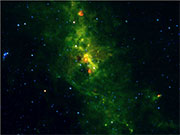
|
|---|
Dec. 27, 2012 Updated
"SPAISE" (Space-based AIS Experiment) compleded its normal oprational phase, off to late use phase
|
On November 16, JAXA completed the normal operational use of the experiments of the AIS (Automatic Identification System) receiver aboard Small Demonstration Satellite-4 (SDS-4). |
|
|---|
Dec. 20, 2012 Updated
MICHIBIKI: Current status of rubidium atomic clock 2
|
The First Quasi-Zenith Satellite “MICHIBIKI” is equipped with two rubidium atomic clocks, Clock 1 for the operation system and Clock 2 for the spare system, to construct the redundant structure. The former is currently used for generating positioning signals. |

|
|---|
Dec. 6, 2012 Updated
Public release of carbon dioxide flux estimates based on observation data by IBUKI
|
The data of global CO2 fluxes on a monthly and regional basis for the one-year period between June 2009 and May 2010 has been publicly distributed for the first time in the world. These flux values were estimated by combining ground-based CO2 monitoring data and CO2 concentration data acquired through the improved observation method of the Greenhouse gases Observing SATellite "IBUKI." (GOSAT). The calculation method has been improved for the concentration of greenhouse gases. The usefulness of the concentration data acquired by the satellite was quantitatively verified. |
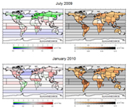
|
|---|
Dec. 3, 2012 Updated
Certificate of appreciation to Japan and US TRMM scientists from JAXA and NASA
|
Certificate of appreciation was given to eight Japan and US TRMM scientists for their outstanding contribution to the scientific activities, applications and accomplishments of 15 successful years of the TRMM, from Dr. Masanori Homma, Executive Director, JAXA, and Dr. Michael Freilich, Director, Earth Science Division, NASA. |
|
|---|
Nov. 30, 2012 Updated
IKAROS world record certified!
|
The Small Solar Power Sail Demonstrator “IKAROS” and its two separated cameras “DCAM1”and “DCAM2” have been recognized by GUINNESS World Record (TM). The IKAROS was awarded as the world's first solar sail spacecraft between planets, and the two separated cameras were recognized for the smallest size of a spacecraft flying between planets. Left: Osamu Mori, IKAROS Demonstration Team chief |
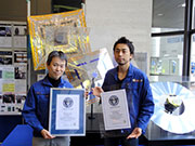
|
|---|
Nov. 29, 2012 Updated
Cloud Profiling Radar (CPR) engineering model
|
On Nov. 27, JAXA revealed to the media at the Tsukuba Space Center an engineering model* of the Cloud Profiling Radar (CPR), which will be aboard the Earth Cloud Aerosol and Radiation Explorer (Earth CARE). *An engineering model is manufactured in almost the same manner as the actual flight model in order to test technical matters. With the engineering model, we can perform a test under harsher conditions than the actual flight environment to acquire necessary data for establishing mechanical and electric designs, test methods, and the manufacturing process. After confirming if electric, structural and thermal designs of this engineering model properly perform their functions, we will move to the next development phase of flight model manufacturing. |
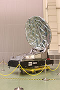
|
|---|
Nov. 19, 2012 Updated
HINODE captured total solar eclipse over Australia
|
The Solar Physics Satellite “HINODE” captured the scene of the total solar eclipse in Australia. Its onboard X-ray telescope (XRT) took images of the sun gradually being covered by the moon at around 5:25 a.m. on Nov. 14, 2012 (Japan Standard Time), while the HINODE was flying over northern Australia. The moon appeared from the south, then moved in front of the sun toward the north western direction. The images show that the black moon was traveling with a bright solar corona behind it. |
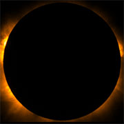
|
|---|
Oct. 25, 2012 Updated
KIKU No.8 starts data transmission test from GPS tsunami gauge
|
JAXA started a data transmission test from a GPS tsunami gauge through the Engineering Test Satellite-VIII KIKU No.8 (ETS-VIII) on Oct. 24 in cooperation with the National Institute of Information and Communications Technology (NICT), Hitachi Zosen Corporation, the Earthquake Research Institute of The University of Tokyo, and Kochi national College of Technology. |
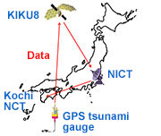
|
|---|
Oct. 17, 2012 Updated
Advanced Land Observing Satellite-2: System thermal vacuum test
|
The thermal vacuum test for the Advanced Land Observing Satellite-2 "ALOS-2" started on Oct. 16th at the Tsukuba Space Center. It is scheduled to be completed in late November. |
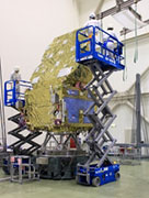
|
|---|
Sep. 10, 2012 Updated
KODAMA on-orbit operations mark 10 years
|
The KODAMA, which was launched on Sept. 10, 2002, has marked its 10-year anniversary. The KODAMA succeeded in a data relay experiment with the world's fastest speed of 278 Mbps using the Advanced Land Observing Satellite "DAICHI," and has been contributing to global land observations and disaster monitoring with the DAICHI by utilizing KODAMA’s broad view area and real-time and large-volume data relay capacity. Some 95% of DAICHI's 6.54 million scenes (or almost one PB of observation data) were received on earth through KODAMA's relays. |
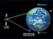
|
|---|
Jun. 6, 2012 Updated
SDS-4 received Automatic Identification System (AIS) from ships
|
The AIS receiver aboard the Small Demonstration Satellite-4 (SDS-4) launched by the H-IIA Launch Vehicle on May 18 was confirmed to receive automatic identification system (AIS) from ships cruising around Japan. The SDS-4 was launched as a secondary payload with the main payload, the Global Change Observation Mission 1st- Water “SHIZUKU”. |
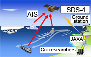
|
|---|
Jan. 31, 2012 Updated
AKATSUKI current status and future operation
|
JAXA decided to carry out orbit control of the AKATSUKI using its liquid-fuel thrusters for altitude control (or the reaction control subsystem, RCS.) Based on this decision, almost all of the unnecessary oxidizer was discarded in Oct. 2011. As a result, the satellite became lighter, and remaining fuel can be more efficiently used for orbit control.
|
Dec. 21, 2011 Updated
ASTRO-G project suspension
|
JAXA decided to suspend the Radio-Astronomical Satellite "ASTRO-G" project because we found a technological difficulty for a high-precision 9-meter deployment antenna, which is the key device for observations. The satellite has been developed to achieve high-resolution astronomical observations. The currently available antenna specular accuracy does not allow us to gain the most important scientific results. Also, even if we downgrade our scientific target to an attainable range, it became clear that we require far more time and money than for the original plan. |
Oct. 20, 2011 Updated
Last thank-you message to DAICHI from Japan Coast Guard
|
The land observing satellite "DAICHI," which completed its operations in May 2011, had contributed to the Japan Coast Guard (JCG) by providing satellite images of ocean ice for a long time. |
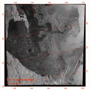
|
|---|
Jul. 11, 2011 Updated
GCOM-C1 structural model sinusoidal vibration test
|
JAXA conducted a sinusoidal vibration test for the GCOM-C1 using a structural model. This test using simulated vibrations verifies if the satellite’s structure and onboard equipment can bear sinusoidal vibrations, which are generated at the time of launch. The test was successful, and we confirmed that the satellite is strong enough. The structural model is a mechanically mocked satellite for verifying the tolerance of the satellite’s main body and onboard equipment not only against sinusoidal vibrations at the time of launch, but also against other factors including the acoustic environment, shock at the time of separation from the launch vehicle, and impact of the solar array paddle deployment. |
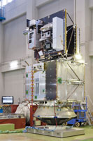
|
|---|
May 26, 2011 Updated
AJISAI received the Tsuboi Prize of the Geodetic Society of Japan (Group Prize)
|
The 25-year operation and precious observation data of the Experimental Geodetic Satellite "AJISAI" (EGS) was highly evaluated by the Geodetic Society of Japan, and, on May 23, 2011, the Tsuboi Prize (Group Prize) was awarded to a group led by former space verification team project manager Eiichi Hashimoto. The group consists of JAXA, the National Institute of Information and Communications Technology (NICT), the Japan Coast Guard (JCG), Geospatial Information Authority of Japan (GSI), and Hitotsubashi University. The AJISAI was launched on August 13, 1986, to establish the Japan's geodetic datum. The Tsuboi Prize of the Geodetic Society of Japan (Group Prize) is awarded to a group that has made outstanding contributions to geodetic studies as organizational activities are particularly important for geodetic research.
|
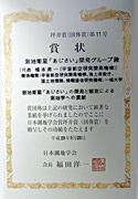
|
|---|
Jul. 5, 2010 Updated
Global distribution of olivine from the lunar interior and its origin revealed by KAGUYA
|
Spectral Profiler onboard on Japanese lunar explorer SELENE/Kaguya revealed the global distribution of olivine on the lunar surface and its origin. This new finding provides us important insight into the Moon’s origin and evolution. This result was published in the British scientific journal "Nature Geosciences" on July 4, 2010. |
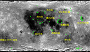
|
|---|
Sep. 24, 2009 Updated
KIRARI: Signals stopped; successful operation ends
|
At 2:48 p.m. on Sept. 24, 2009, signal transmissions to the Optical Inter-orbit Communications Engineering Test Satellite "KIRARI" (OICETS) were terminated, and its operation was completed. The KIRARI was initially scheduled to be operated in orbit for about one year, but it survived for four years, much longer than the original plan. The KIRARI was launched by the Dnepr Launch Vehicle from the Baikonur Cosmodrome, Kazakhstan, on Aug. 24, 2005, and made many achievements in the space optical communication area including bi-directional optical inter-satellite communication and links between a lower-orbit satellite and a ground optical station. |
|
|---|