Space Technology Directorate I
Get Flood Information More Than 30 Hours Ahead
Prediction System for
Water Disasters in Real Time
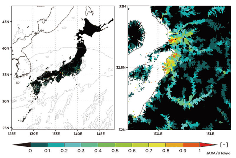
The Earth Observation Research Center has been working with Institute of Industrial Science, the University of Tokyo to develop and operate "Today's Earth ─ Japan" (TE-Japan), aiming to prevent damage caused by flooding or river overflows. This system simulates when, where and how much water accumulates on the ground due to rain, and to estimate the amount of water in rivers and to predict potential areas of flood throughout Japan. The results of these simulations are publicly available in real time on the website "Today's Earth," while prediction information is shared with relevant institutions.(*)
Originally, JAXA has been operating the global version of this system "Today's Earth - Global" designed to predict water circulation worldwide, but "with the idea that we need more detailed and near-real-time information and prediction to prevent water-related disasters in Japan that have occurred frequently in recent years, we developed TE-Japan, which exclusively focuses on Japan at a resolution of 1km," said YAMAMOTO Kosuke, involved in the development and operations.
Simulations require two types of data. "One is near-surface meteorological data that changes day to day." said KACHI Misako, also involved in the development and operations.
She continued: "Based on the data from Japan Meteorological Agency, we upgrade them adjusting the actual amount of precipitation and insolation, and replacing elements that can be observed by satellites with detailed data of observation satellites. The other type of data is ground surface information such as ground elevation, land cover (grass, asphalt or other materials covering the ground surface), and soil type. We are making active use of satellite data for these as well."
TE-Japan was also utilized in 2019 during Typhoon Hagibis and during the torrential rains of July 2020. After Typhoon Hagibis struck, it was confirmed that hazard predictions were correct in nearly 90% of the locations where the river embankments actually failed. This result was picked up by various media and received a great deal of attention. YAMAMOTO added:
"As TE-Japan gains more and more name recognition, the extent of this response has given us a deep sense of the responsibility that comes with predicting water disasters that could put people's lives at risk."
"Although we have achieved a certain level of accuracy, there are still areas that need more research and development. Predicting flood is likely to be greatly useful in evacuation and guidance planning that have become increasingly important in the coronavirus pandemic. We hope to evolve the system to produce simulations with higher accuracy."
(*) In accordance with the Meteorological Service Act, forecast information is currently provided only to collaborating research institutes.
Profile

|
|
|---|

|
|
|---|
All the images are copyrighted ©JAXA unless otherwise noticed.
- Home>
- Global Activity>
- Public Relations>
- JAXA’s>
- JAXA's No.82>
- Get Flood Information More Than 30 Hours Ahead Prediction System for Water Disasters in Real Time