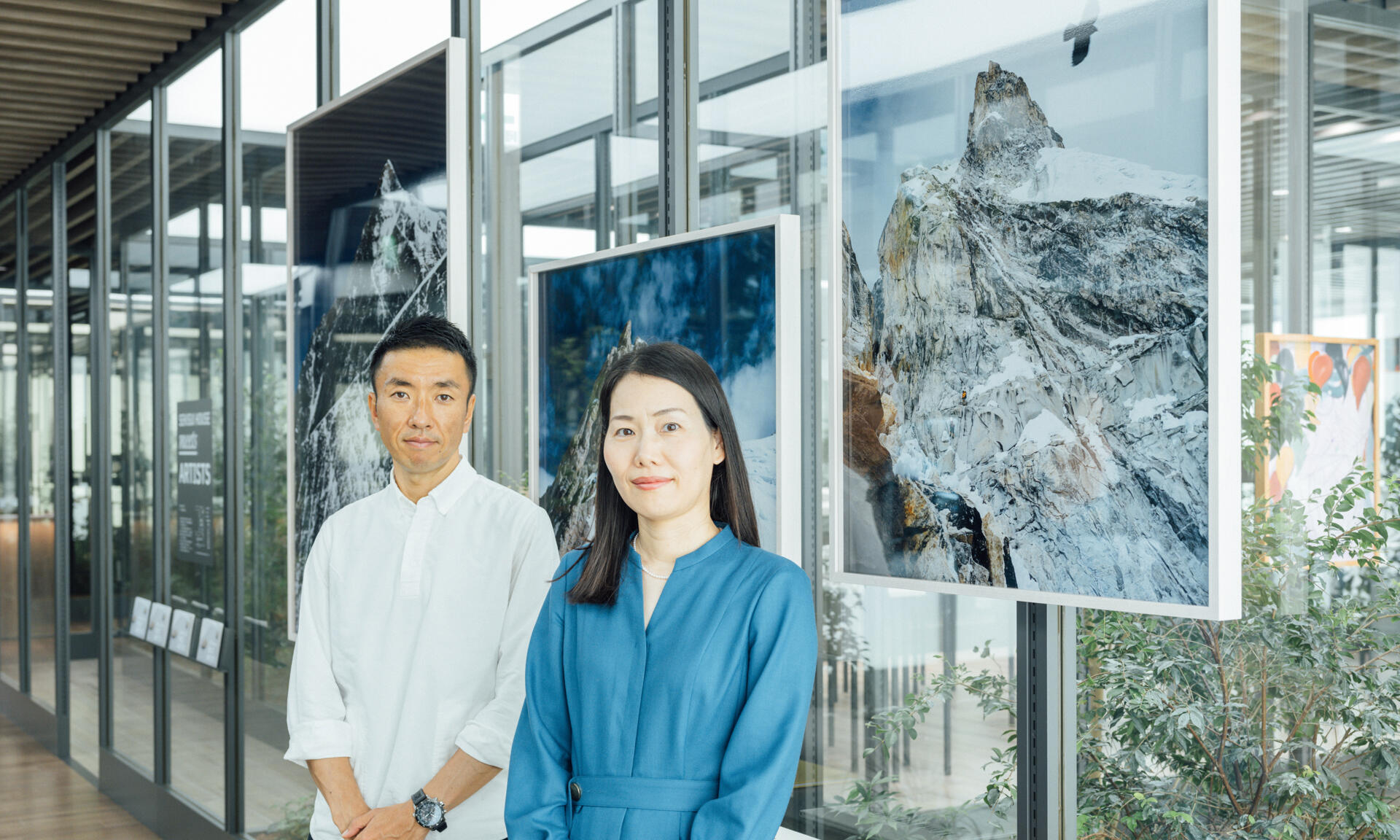
Special Talk: Space and Adventure, the Known Unknown
The dialogue took place at SUMUFUMU TERRACE AOYAMA, a model home site operated by Sekisui House ltd., where ISHIKAWA Naoki's photo exhibition THE HIMALAYAS is being held.
Special Talk
Space and Adventure, the Known Unknown
ISHIKAWA NaokiPhotographer
×
MATSUO NaokoManager, Satellite Applications and Operations Center (SAOC)
Space Technology Directorate I
This dialogue between a photographer ISHIKAWA Naoki, who faces a wide variety of objects not only the mountains especially the Himalayas, and JAXA's MATSUO Naoko, who leads the Consortium for Satellite Earth Observation (CONSEO)*, highlights the intersection between a macro perspective of satellites and a micro mindset that focuses on physicality. Rather than looking at the world as a dichotomy between seemingly polarized ideas such as “word” and “deed” or “real” and “virtual,” the two professionals explore a bright future where such disparate elements work together for the greater good.
* Consortium for Satellite Earth Observation (CONSEO) A consortium that brings together industry, academia and government under the vision, “A better future for the entire Earth,” to consolidate comprehensive strategic proposals pertaining to Japan's satellite Earth observation (SEO) and promote industry-academia-government collaboration with the aim of making SEO a growth industry in Japan.
Changes on the Earth captured by satellites
MATSUO Naoko
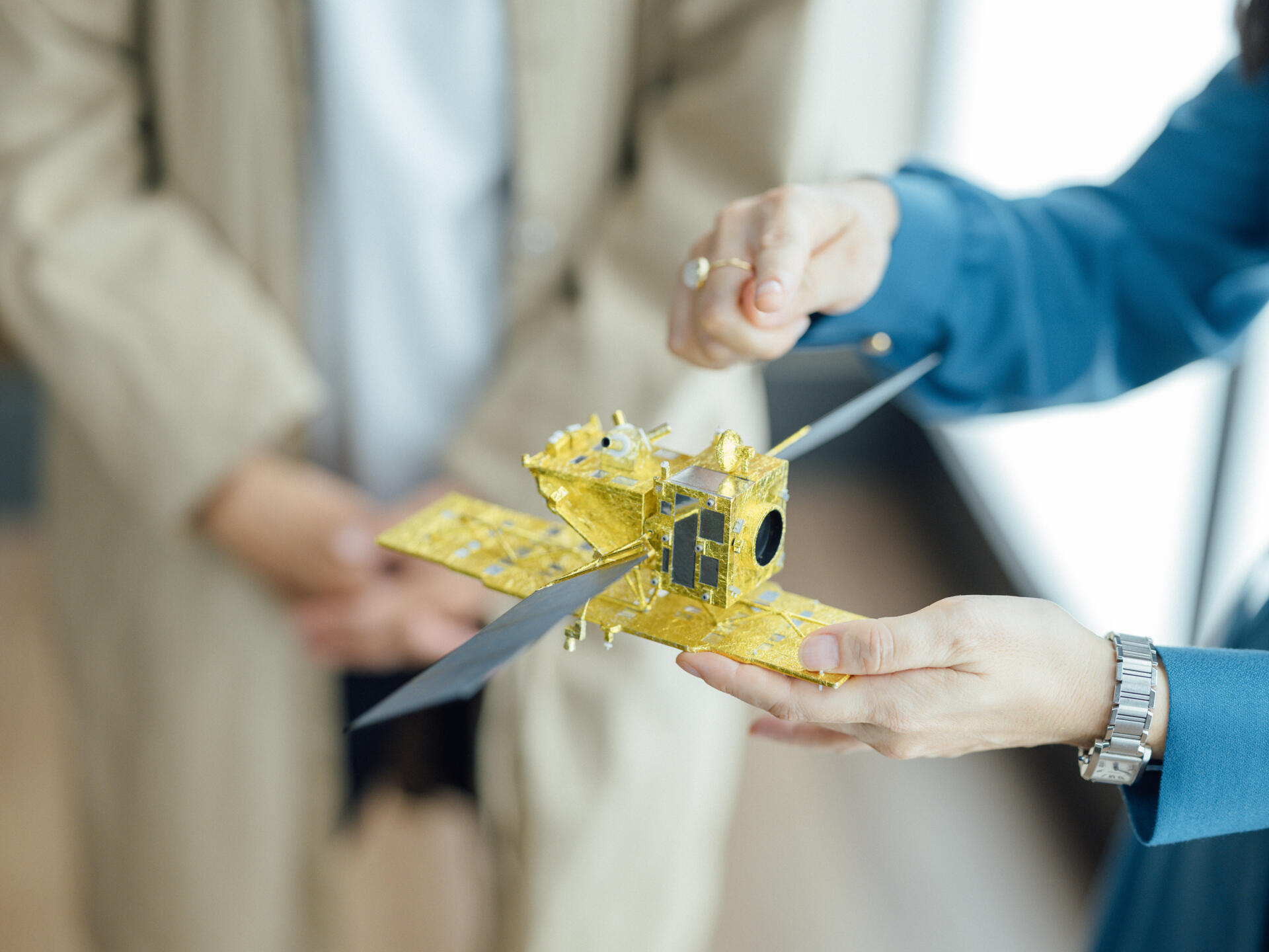
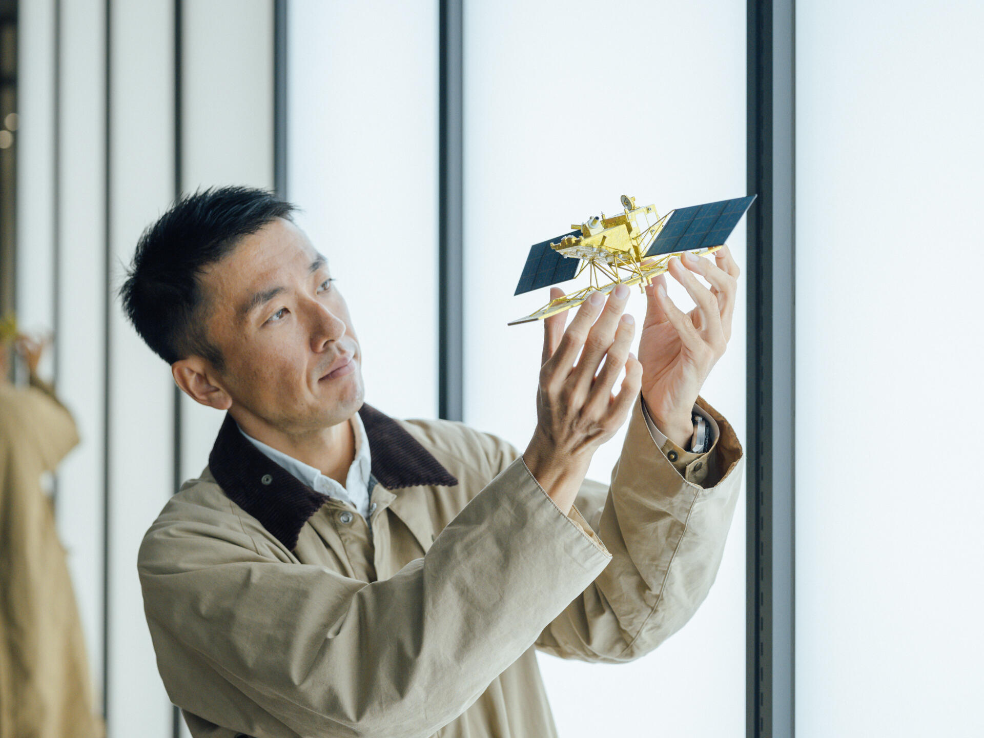
First of all, I'd like to introduce the purposes and features of JAXA's satellites. This is an image taken by the Advanced Land Observing Satellite-2 “DAICHI-2” (ALOS-2).
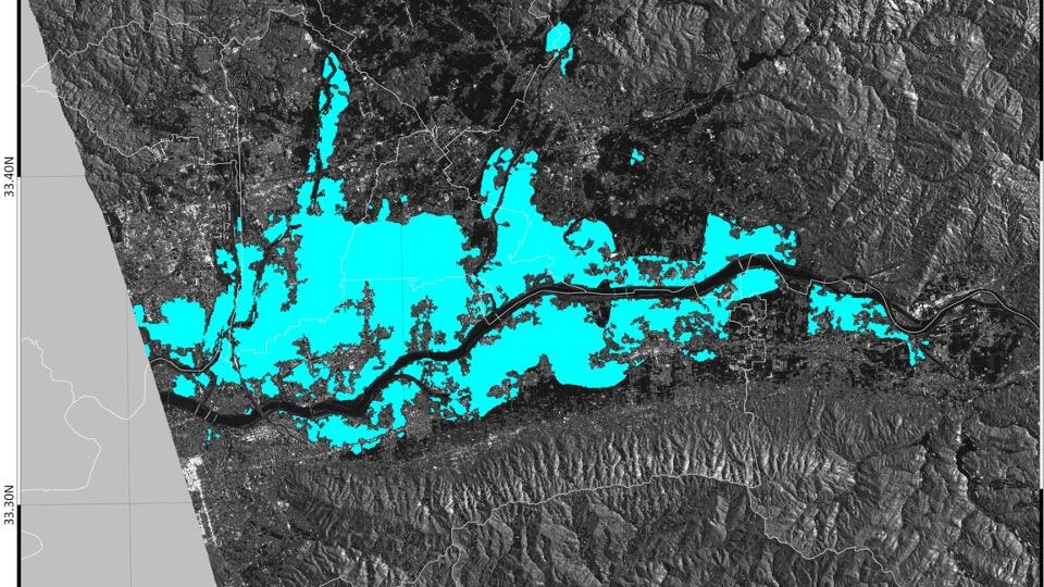
DAICHI-2 observes the entire Earth at all times, so we are able to acquire both pre-disaster and post-disaster images. By overlaying these images to identify the differences, we can estimate where the disaster is taking place. Therefore, this satellite is capable of identifying changes in detail on the Earth's surface.
ISHIKAWA Naoki
Where is the location of this image?
MATSUO
This is an image of the region in Kyushu that was hit by torrential rain in July 2020.
ISHIKAWA
So this was not created by coloring the presumed disaster area in blue. It's the actual picture taken at the time of the flood.
MATSUO
That's right. This kind of wide-area satellite imagery can be used for analysis and deciding where to send rescue helicopters and drain pump vehicles. DAICHI-2 regularly flies over Japan at either midnight or noon, so disaster areas can be observed in the middle of the night. The captured images are transmitted to us immediately and analyzed before morning so that the findings can be provided to the disaster response team before their activities. In this sense, DAICHI-2 is said to be the most hard-working of all satellites.
ISHIKAWA
Does the satellite always take pictures of the same location twice a day?
MATSUO
DAICHI-2 transmits radio waves and measures how they bounce back from the Earth's surface. The observation width being relatively narrow, so the satellite cannot always capture images of the same location every day. If we are unlucky, we may have to wait two days before making a post-disaster observation, but so far we have generally been able to obtain observation data of disaster areas once a day.
ISHIKAWA
As a photographer, when I see pictures, I'm always curious about how they were taken. In this case, the pictures aren't taken with a super-telephoto lens, but by measuring the unevenness of the ground with radio waves, right?
MATSUO
That's right. The satellite uses L-band, which is a long radio wave with a wavelength of about 25 centimeters and a frequency of about 1.2 GHz. When the wave hits a lake or the sea, it does not bounce back to the satellite, resulting in a pitch-black image, whereas when it hits a forest or a stretch of vegetation, the wave partly bounces back, resulting in a blight image. So the difference in the intensity of reflection is the key to identifying features on the surface.
ISHIKAWA
Theoretically speaking, does that mean portrait photos can be taken with a radio wave camera, that is, a camera that scans the shape of things?
MATSUO
With L-band, the antenna would be too large, meaning the camera could not be held by a human being. For example, weather radars scan clouds with radio waves, but the images produced may not be clear enough for people to comprehend. An L-band radio wave is good at perceiving objects on the Earth's surface, such as a forest. Here are images of the rain forest in Brazil taken by an earlier version of the DAICHI.
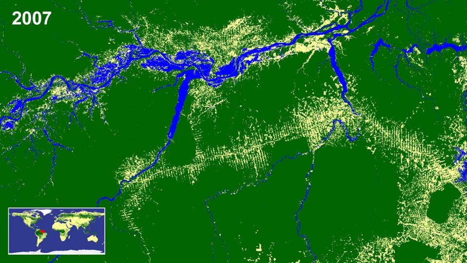
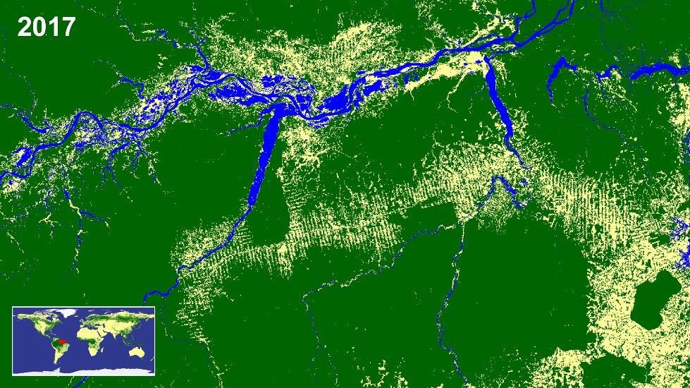
When the images taken in 2007 and 2017 are compared, you can see that the white area has expanded. The area forms a pattern of deforestation known as a “fishbone” due to its shape. The deforestation is first carried out along a long, straight road, and then along sideroads that branch off. By crosschecking this image against the government's logging application list, illegal logging can be detected. The police have actually made arrests based on the findings. Before DAICHI was adopted, images could only be taken on sunny days, so illegal logging was conducted when it was cloudy. As DAICHI is capable of taking images during the rainy season or even at night, it has helped deter illegal logging.
ISHIKAWA
Who can gain access to these satellite data?
MATSUO
Basically, the satellite data operated by JAXA can be used by anyone, free of charge.
ISHIKAWA
Do you mean the general public?
MATSUO
Yes. Only, the data currently come in a complex format for experts to analyze, so we are trying to make them easier to handle.
Profound impact of the invisible Kuroshio meander
MATSUO
What kind of data do you refer to when you climb a mountain?
ISHIKAWA
I mainly refer to the weather forecast and maps, and nothing else.
MATSUO
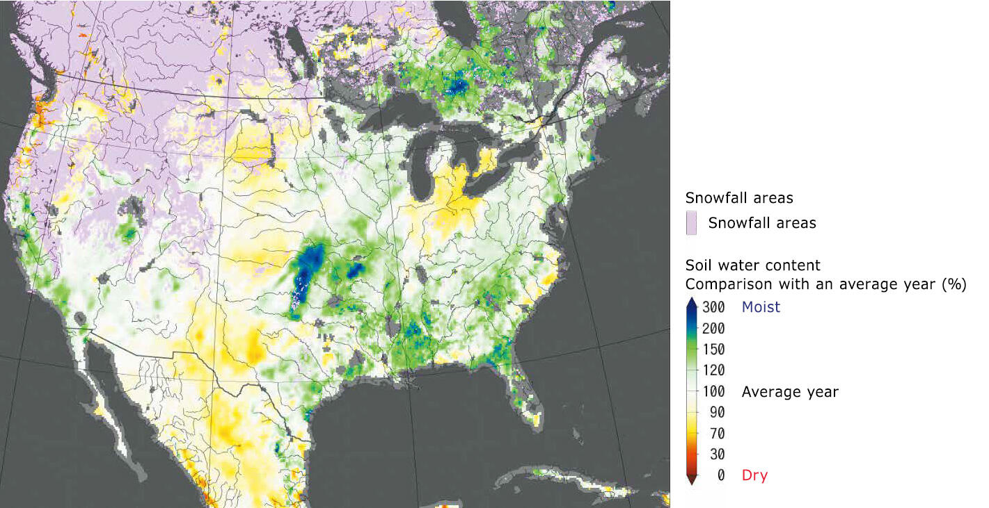
Don't you find overseas weather forecasts to be less detailed in some regions? JAXA runs a website named GSMaP, which, in combination with other countries' satellite data, provides hourly precipitation amounts for all regions on Earth. This website is used quite heavily by island countries that are not sufficiently equipped with sensors on the ground.
ISHIKAWA
With such precise data being accumulated, weather forecasting must be getting more and more accurate.
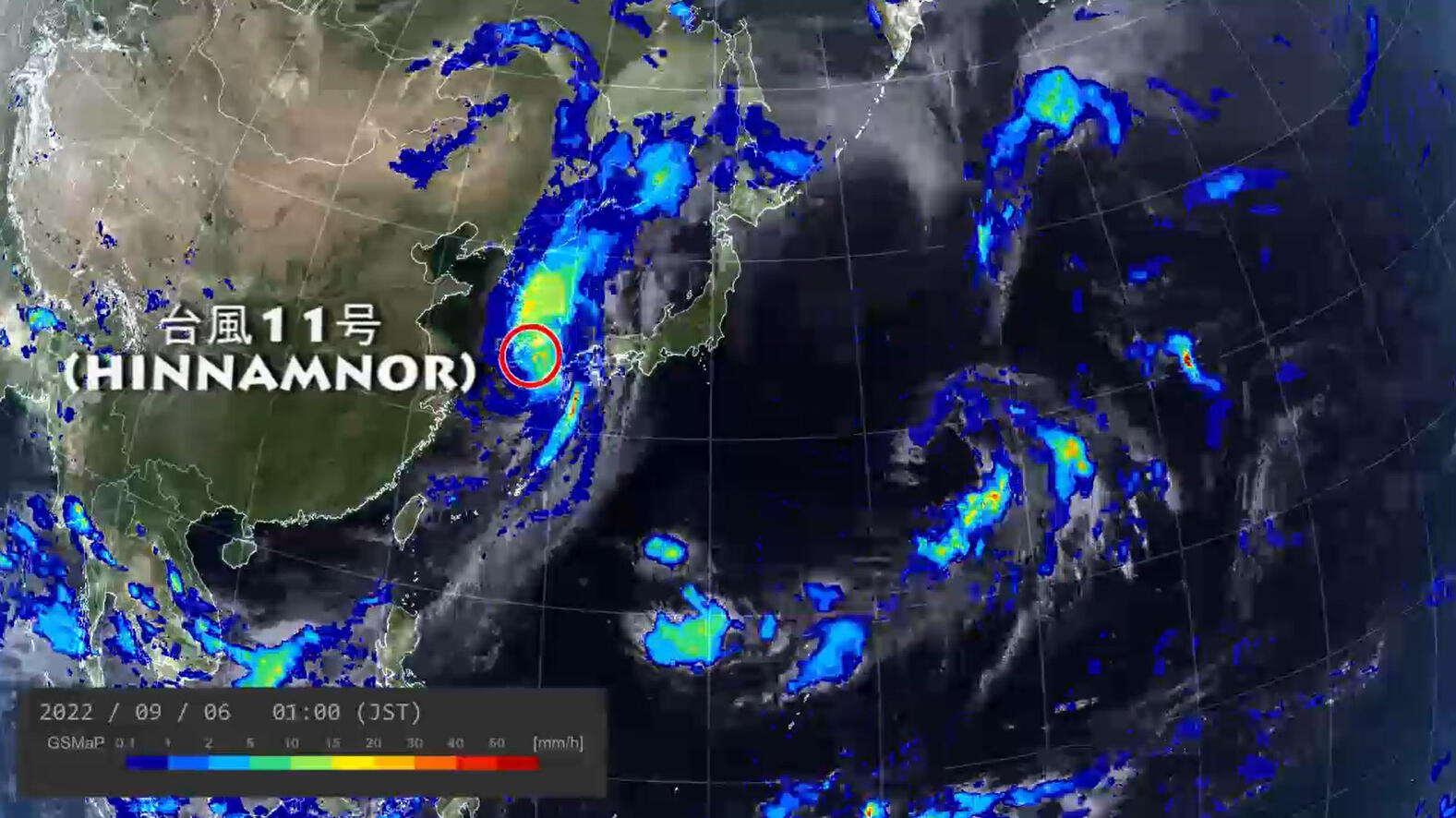
MATSUO
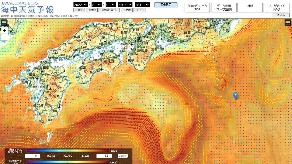
JAXA's satellite data is incorporated into the Japan Meteorological Agency's weather forecast data. In predicting the development of linear precipitation zones, which we are seeing more of lately, the key is said to be the amount of water vapor at sea. This is where satellite data comes in, because satellite sensors are capable of measuring water vapor across vast stretches of the ocean. Satellite sensors can also measure the sea surface temperature and ocean currents. Satellite data shows us that the large meander of the Kuroshio Current has been ongoing for five years.
ISHIKAWA
(Looking at the image) I didn't realize that the Kuroshio had such a big bend in it. Folklorist ORIKUCHI Shinobu once stood at the cape of Daiozaki in Mie Prefecture watching the flow of the Kuroshio and gave thought to what he called marebito, spiritual entities existing beyond the sea. If the Kuroshio had been meandering like this at the time, he may not have opened his eyes to the concept of marebito. My impression of the Kuroshio meander has changed, now that I've seen it in a visible form. I had always thought that JAXA's research area was limited to the cosmos, but I've learned now that it also observes the Earth from space, which surprises me. When you think about it, it's only natural that JAXA would observe the Earth with a bird's-eye view in addition to looking up into space.
MATSUO
In my first decade at JAXA, my work related to the International Space Station. In the decade since, I've been involved in satellite earth observation. What has surprised me the most during the latter half of my career is how closely relevant the observations from space were to society and our daily lives on Earth. For example, satellites are often used in the agricultural, forestry and fisheries industries. Farming locations have changed due to climate change, and there are some start-up companies that have been conducting studies to identify the most optimal land for growing certain crops. They even provide advice on the right time to apply agrichemicals, in addition to that provided by ground sensor data. Agriculture and space seem as though they are positioned at the opposite ends of the spectrum, but in fact they are closely related. For that matter, space is also very relevant to the fishing industry because, as I mentioned earlier, satellites can measure the sea surface temperature, which means we are able to work out where the fish are.
ISHIKAWA
And there's the Kuroshio meander too.
MATSUO
Indeed (laughs). I heard fisherman can know where and what kind of fish are gathering based on the sea surface temperature data acquired by satellites. They hope to decide on the target area in advance, and go fishing with fuel efficiency passing through the best route. To that end, fishing vessels sailing in the distant seas are carrying a system to monitor the sea surface temperature based on satellite data.
ISHIKAWA
I see, the fishing industry also uses satellite data. I often use a satellite phone while climbing mountains to gain access to weather information, post on social media, make emergency calls and whatnot. When it's cloudy, it's difficult to get a connection. I always try to find the best angle for reception by carefully moving the antenna in my tent (laughs).
MATSUO
When you're high up on a mountain, I guess you need to befriend satellites in an analog manner (laughs). However, much science and technology progresses, there still exists a world that is unknown to us.
ISHIKAWA
For me, the word “satellite” evokes Google Earth. What is your take on Google Earth? Do you think JAXA can make one too?
MATSUO
When Google Earth first appeared, I was surprised to see how successfully they managed to proliferate the use of satellite data by presenting it in that format. I often talk with researchers about our dream of developing a product that goes beyond Google Earth. The product would not only offer everything that Google Earth does, but also real-time information on precipitation and aerosol, as well as model-based predictions of the future, that is, a digital twin of the Earth itself.
ISHIKAWA
The development of such a product seems quite probable in a few years. It would be revolutionary.
MATSUO
I hear metaverse engineers are also passionate about creating an Earth that is as "real" as possible.
ISHIKAWA
So would it be like living on several versions of Earth?
MATSUO
Exactly.
ISHIKAWA
I haven't really been interested in totally fictional settings, but if there were another Earth I could live on, I would be able to live in the United States, or climb the Himalayas every day (laughs).
MATSUO
One possible way of using the metaverse is to simulate test runs for autonomous driving on different routes. Perhaps it can be used for simulating mountain climbing too.
ISHIKAWA
I would be able to try one route today and another route tomorrow. But then what would be the fun of traveling?
MATSUO
Of course, nothing is better than the real thing.
ISHIKAWA
I agree. The physical sensation is incomparable. In this day and age, everything on Earth has been revealed in detail by satellites, leaving no geographical zone unobserved. So when some people go out adventuring, they intentionally block out information in an attempt to create an unknown territory, such as by heading out into the mountains without taking their GPS, compass or map. This is because a familiar mountain can become an unexplored world when you are navigating it solely by using your own senses and observations of natural phenomena. The age of adventure--Amundsen and Scott's expeditions to the pole and UEMURA Naoki's exploits--has come to an end, and we have reached a point where we willingly impose restrictions on ourselves in order to deliberately create an uncharted world. In an age when anyone can use GPS, this kind of thinking seems out of place, but it is actually a product of technological progress.
MATSUO
It seems like a strange phenomenon.
ISHIKAWA
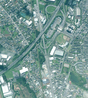
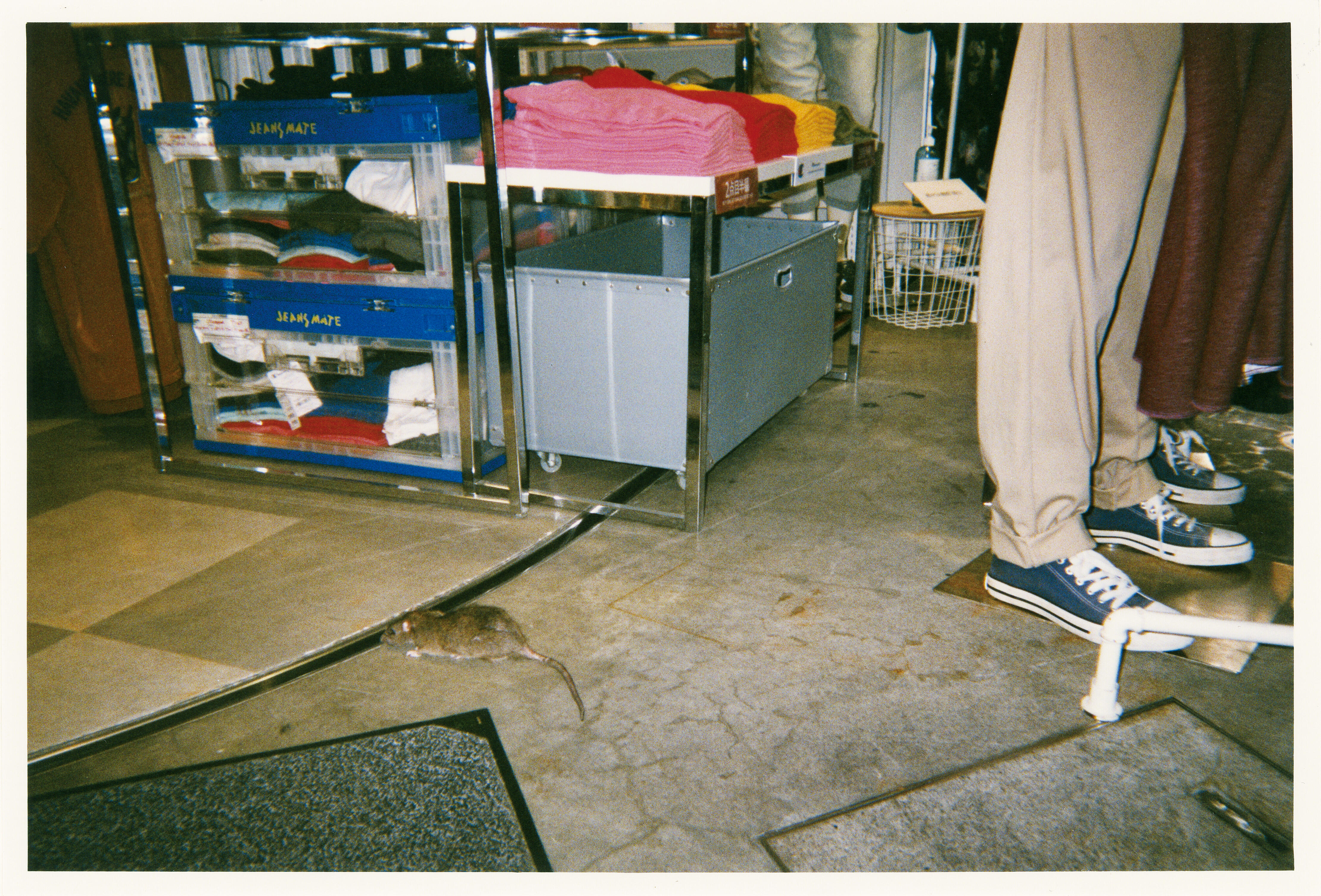
I'm not particularly eager to proceed in that direction, but if there is anything that remains unknown even if you use GPS and satellite communications in every possible way, I certainly want to explore it. During the pandemic, I took photos of rats in Shibuya City, where I was born. I was roaming around and taking a "rat's-eye" view of the area, probably because such a miniscule world cannot be captured by a satellite 500 kilometers away.
MATSUO
You're right, rats cannot be detected by satellites. Despite the advances of science and technology and the digitalization of information, some changes go unnoticed. For example, the pumice stones that erupted from the submarine volcano of the Ogasawara Islands must have been captured by satellites, but we didn't notice them until they were washed ashore. Some things we are just not aware of, so they go unnoticed. Human consciousness cannot extend to everything.
ISHIKAWA
You may think everything can be revealed today, but in fact there are a great many things that remain hidden in this world.
MATSUO
The mechanisms of a lot of things remain a mystery; for instance, the impact of climate change, super typhoons, linear precipitation zones and so forth.
ISHIKAWA
In that sense, the unknown will always continue to exist. MIYAMOTO Tsuneichi, a folklorist I deeply admire, has written something that you might call the "10 Articles of Travel." In it he says, "When you come to a new place, climb up to a high spot to get a panoramic view of the entire area. Then go and poke around in the nooks and crannies to get the particulars." Keeping this advice in mind, I have always made it a rule to first climb up a mountain or hill, take a sweeping view of where I intend to walk, and then go down to the villages. Looking from above is equivalent to gaining a bird's-eye view, which is like the satellite viewpoint. This makes me think about the idea of a whale's-eye view--Earth as seen by a whale. Islands under the sea are essentially mountains, with their heads sticking out above the water. Can radio waves travel to the bottom of the sea?
MATSUO
Unfortunately, that's not quite possible because the sea absorbs radio waves and light. However, we are trying to make vertical satellite observations, which will provide us with a new perspective. Humans are constantly in the grip of gravity, which may be why we get a thrill from pulling away from it, such as by launching rockets. The appeal of climbing mountains may also stem from the same kind of feeling. We have long been accumulating know-how about how to capture the Earth's surface in 2D. Now we are hoping to observe the clouds, precipitation, the altitudes of landforms and the heights of forest trees in 3D. We will probably launch a satellite that measures the speed of precipitous atmosphere's vertical movement in the latter half of the 2020s.
ISHIKAWA
When the concept of time is added to this, it becomes 4D, does it not? That's pretty confusing (laughs).
Off-Earth Adventuring in Space

ISHIKAWA
Have you tried mountain climbing before?
MATSUO
Not so much, but I have climbed Mt. Fuji before.
ISHIKAWA
Once?
MATSUO
Yes, just once.
ISHIKAWA
I've climbed Mt. Fuji 20 to 30 times, but some people say that Mt. Fuji is not for climbing, but for enjoying from a distance. In retrospect, I feel silly for having climbed the mountain so many times.
MATSUO
Not at all, I'm impressed (laughs).
ISHIKAWA
You may think that climbing the same mountain will only bring you a repeat of the same experience, but in fact each time is different. If you climb 30 times, you will have 30 different experiences. That's the beauty of the physical sensation of climbing. Every time I climb, I feel as though I am encountering a different mountain. It's the same with photography. You can never take the exact same photo twice. When you climbed Mt. Fuji, did you make it to the summit?
MATSUO
I thought I had reached the top, but maybe not.
ISHIKAWA
People often think the rim of the crater is the apex, so once they reach this point, they start back down. But Kengamine Peak is the actual summit of Mt. Fuji. Unless you reach this point, you can't really say that you've conquered Mt. Fuji.
MATSUO
I don't remember looking for Kengamine Peak myself.

ISHIKAWA
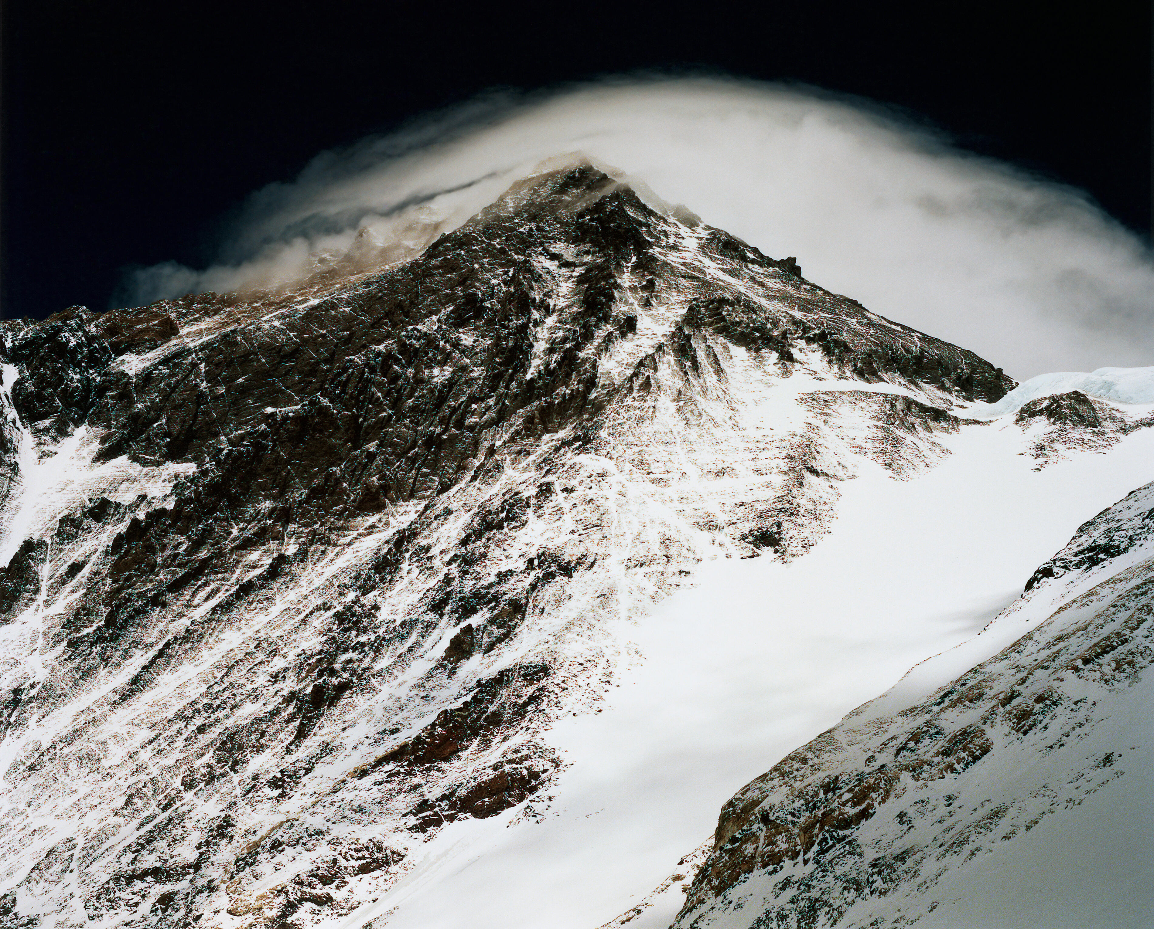
At Manaslu, the eighth-highest mountain in the world at 8,163 meters, a point about 10 meters before the real summit has been considered the peak for the past several decades. This is because the snow is soft for the last 10 meters, meaning that there is a great risk of slipping and falling. Altitude-wise, the difference is only one meter, but I felt the urge to conquer the real summit of Manaslu, so I headed back out to the mountain for the first time in a decade. The wind was gusting wildly and it was tremendously challenging, so it took me much longer than I had thought, but I conquered the real summit. We are this adamant about the summit (laughs).
MATSUO
Indeed, that kind of information about the summit cannot be acquired by a satellite. You wouldn't know unless you actually stood there. Having visited such extreme locations, have you ever felt the impact of climate change?
ISHIKAWA
Photos record everything. Dramatic changes in landscapes can sometimes be seen when you take photos of the same vista 10 or 20 years later. It's not rare for land to disappear, glaciers to recede or mountain routes to change. Being involved in data analyses, you are presumably forced to think about the Earth. Are you pessimistic about the future of this planet?
MATSUO
In the past few months, we've been discussing what our future society might look like in the years 2030 to 2040, and we certainly hope to make our future a bright one. There is no need to be pessimistic. We must develop science and technology while believing in a bright future.
ISHIKAWA
You're right. I'd like to keep an open mind on everything, so I don't have any negative views about the metaverse, for example. Nor do I think it deprives us of adventures. And yet, because I value physical sensation, I can't quite see the appeal of virtual mountain climbing, which lacks any physical feeling. But to be in a world without any danger of avalanches, falling rocks or frost bite would be a totally different experience, and it does pique my curiosity. I certainly would like to try traveling in a metaverse world and climbing to the top of Olympus Mons, the highest peak on Mars.
MATSUO
I see. You said there was no place left to go for an adventure on Earth, so naturally your next frontier is space.
ISHIKAWA
In a nutshell, I guess that's right. When you're close to the summit of the Himalayas, 8,000 meters high, the color of the sky appears to be darker, even during the day, because there is no dust to reflect the light. You are looking at the edge of the stratosphere. So if I were at the top of a 28,000-meter-high mountain on Mars, my head may be sticking into the stratosphere. It's fun to let my imagination run wild (laughs).
Profile
ISHIKAWA Naoki
Photographer
Born in Tokyo. He has traveled both horizontally and vertically to all kinds of places on Earth, from the 8,000-meter-high Himalayas to north and south islands of Japan, creating and presenting works along the way. He received the Domon Ken Award for his CORONA (Seidosha) in 2010, and the Lifetime Achievement Award from the Photographic Society of Japan for his MAREBITO (Shogakukan Inc.) and EVEREST (CCC Media House) in 2020. He has also published numerous books, including The Last Adventurer (Shueisha Inc.), for which he received the Kaiko Takeshi [Non-Fiction] Award.
Manager
Satellite Applications and Operations Center (SAOC)
Space Technology Directorate I
Born in Fukuoka Prefecture. She has been engaged in international cooperation projects for Earth observation satellites and the launch of future satellites. Currently, she heads up the secretariat of the Consortium for Satellite Earth Observation (CONSEO), which works on formulating satellite strategies based on industry-academia-government collaboration. She acquired a yoga instructor license in Singapore, but still lacks flexibility. She looks forward to her annual fasting to clear her body and mind.
All the images are copyrighted ©JAXA unless otherwise noticed.
- Home>
- Global Activity>
- Public Relations>
- JAXA’s>
- JAXA's No.90>
- Space and Adventure, the Known Unknown