Only satellites can effectively track sea ice
— What is the nature of your work?
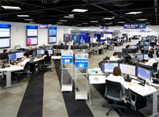 Weathernews Global Center
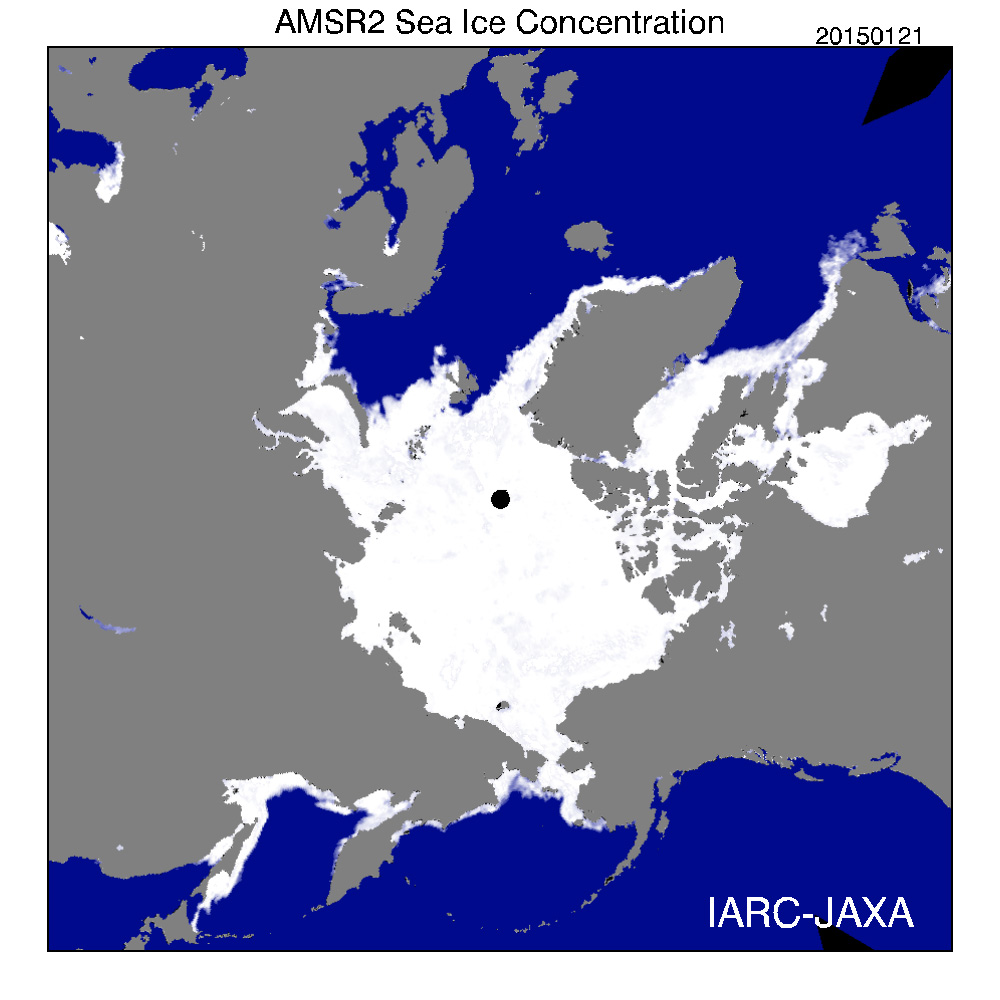
Density of sea ice concentration in the Arctic region as obtained by AMSR2 (courtesy: JAXA)
I work in the meteorological forecasting department, providing information on frozen areas of the sea. I forecast changes in sea ice around the world based on observation data from satellites, and provide this information to shipping companies. If there are strong winds, ice can move several dozen kilometers in one day, so to maintain safety in shipping, up-to-date information is needed on a daily basis. I help ships reach their destinations safely by suggesting how to avoid certain weather risks.
— Which satellite data do you use to forecast sea-ice movement?
I use data from the Advanced Microwave Scanning Radiometer 2 (AMSR2), which is installed in the JAXA satellite called Global Change Observation Mission for Water (GCOM-W), also known as SHIZUKU. In addition, I use data from NASA’s MODIS satellite. AMSR2 can obtain global information on sea ice daily, and I use this data to predict the movement of sea ice. I use forecast models to simulate the development and movement of sea ice over a 2-week period.
— How would you compare data from AMSR2 with other data?
AMSR2 has a spatial resolution of 3-5 km at 89 GHz, which is world’s highest level of resolution for a microwave radiometer. This provides very valuable data. All of the models in the AMSR series installed in Japanese Earth observation satellites have been well received. Sea-ice researchers all over the world have been able to obtain valuable information from AMSR.
— Do you also use ground-based observations for sea-ice forecasting?
Ground-based observations are not viable, as the number of ships in local areas such as the Arctic Ocean is very small. So in our forecasts, we use almost exclusively satellite data. The exception is any reports received from ships, which I use to make slight corrections as necessary. Satellites that can view the Earth’s surface from space are absolutely essential.
Improving forecast accuracy should be a priority
— The SHIZUKU satellite was launched in May 2012. What data did you use prior to that?
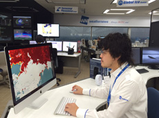 Dr. Sawaga looking at sea-ice data.
I used data from AMSR-E (Improved Advanced Microwave Radiometer), which was the predecessor to AMSR2. AMSR-E was installed in the Earth observation satellite Aqua, which was developed by JAXA and launched by NASA. I also used data from the phased array type L-band Synthetic Aperture Radar (PALSAR) installed in the Advanced Land Observing Satellite (ALOS) DAICHI. Microwave data has been available since the 1970s from NASA’s DMSP satellite and its predecessor, the SMMR satellite, but the data resolution from these satellites was poor, so only approximate forecasts could be made.
— Are there any areas of improvement for satellite data?
Microwaves are said to be unaffected by weather, but high frequencies are slightly affected by the atmosphere. For this reason, sometimes the information produces sea ice maps that indicate ice in locations where there actually isn’t any. I would like to see better accuracy to eliminate these discrepancies. But this is not something that can be improved simply by providing feedback to JAXA. There are scientists studying changes in sea ice in the Arctic Ocean, but there just aren’t many people who need detailed information on where there might be sea ice in the paths of ships. It’s a pretty unique requirement, and I hope there are improvements in accuracy in the future.
— At what size does sea ice become a problem for navigation?
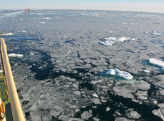 Sea ice on the Arctic Ocean as seen from a ship
Ice in the Arctic Ocean can be several dozen kilometers in length, but more than size, it is its thickness and hardness that affects navigation. Newly formed ice is thin – only 2-10 cm thick – which does not present much of a problem for navigation. Ships that travel the Arctic Ocean are purpose-built to handle this type of ice. Ice hardens over time, and the thickness can reach nearly 2 m in the winter. Ice sheets can layer together forming hills of ice that could easily puncture a ship’s hull, so it’s essential for ships to avoid this type of dangerous formation. For this reason, we provide information on the density and thickness of ice, and when it was formed.
— Can you measure the thickness of ice in addition to the positioning of ice formations?
Actually, that is one of the biggest challenges we are facing, as ice thickness cannot really be measured with satellite data. But there is a scientist who has found a method to estimate sea-ice thickness from AMSR data and developed an algorithm to produce rough estimates of ice thickness. We also use these estimates when applicable.
— Is information on the thickness of ice the most crucial type of data needed during everyday operations?
Yes, that is correct. We also need detailed information on the elevations of sea ice. Ice appears flat when seen from space, but ice hills can form, and more ice can appear from beneath the ocean surface. I have actually traveled through the Arctic Ocean on ships twice, and realized that the data produced from simulations based on satellite observations is not sufficient. There are different types and states of ice – for example, puddles of water on the surface of ice that later freeze. It would be beneficial if we could provide more accurate information describing these details. I realize that this is difficult to measure using satellites. There have been commercial voyages in the Arctic Ocean since 2009, and more information on sea ice will continue to be needed. I would like to be able to do something about this.
As Arctic Ocean navigation grows, we’ll need more information on sea ice
— There are now more ships in the Arctic Ocean than ever. How is that affecting the need for sea-ice information?
Arctic ice continues to shrink year by year due to global warming, and so the Arctic Ocean can now be traversed during the summer period, from July to October. This route from Europe to Asia is about one third shorter than the typical route through the Suez Canal, and about 50 percent shorter than going around the Cape of Good Hope. This significantly lowers fuel costs, so I expect the number of vessels traveling through the Arctic Ocean to grow. We launched our own satellite to observe sea ice in an effort to support safe navigation through the Arctic Ocean.
— You launched your own satellite?
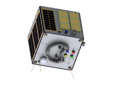 WINSAT-1R, developed to observe sea ice in the Arctic Ocean
On November 21, 2013, we launched WNISAT-1, a cube-shaped mini-satellite (27 cm on each side, weighing 10 kg) on a Russian rocket. This satellite was designed with special features to observe Arctic Ocean ice. With our own satellite, we can obtain data as needed, quickly, and on a timely basis, so that we can hopefully provide more accurate sea ice forecasts. Weathernews originally started as a company providing weather information to shipping companies, and so with this extensive history of marine meteorological research, forecasting sea ice has become one of our most important responsibilities.
Unfortunately, WINSAT-1 has lost the ability to observe arctic ice – the sensors malfunctioned – and now is only able to measure magnetic fields in the arctic, which helps detect magnetic storms that affect aircraft navigation. So we’re planning to launch another satellite, WINSAT-1R, later this year that will focus on arctic ice. This is a compact satellite with specialized features, and is only possible as a private-sector project, since JAXA’s highly advanced satellites incorporate many different technologies. I am not saying one is better than the other, or that we will only rely on one particular satellite. We can get more accurate measurements by looking at the same area from multiple satellites, each of which has a different purpose.
Satellite data used for many purposes
— Do you use JAXA satellite data in your weather forecasting service?
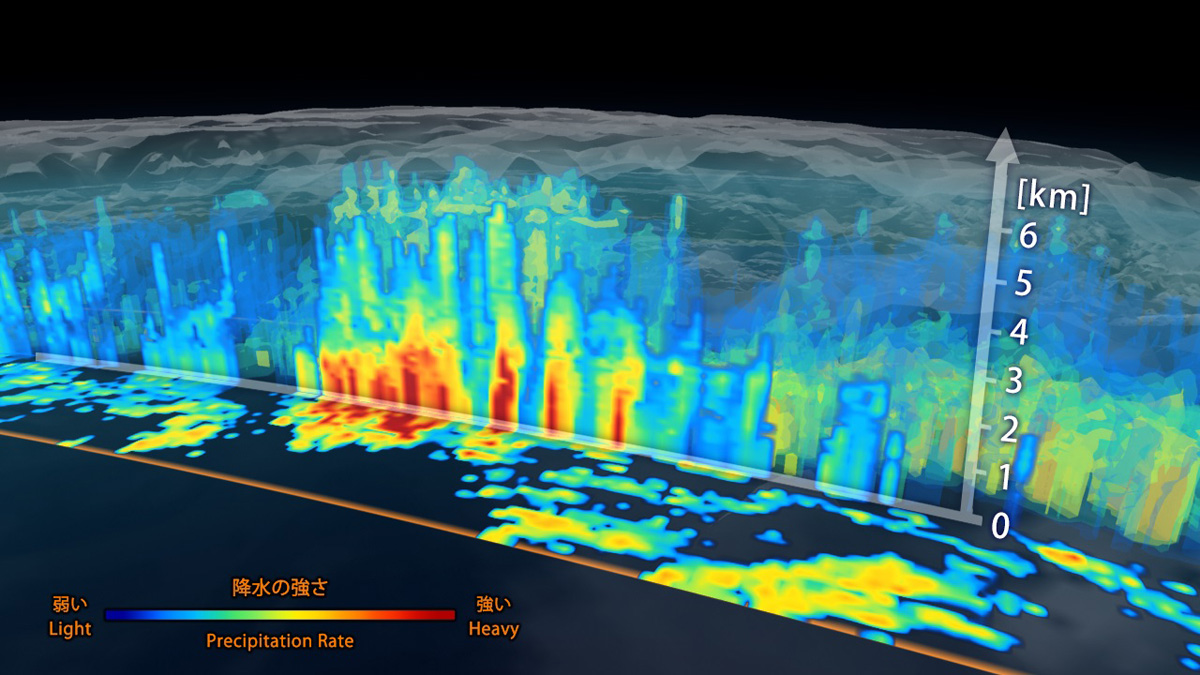
3D precipitation maps produced from GPM radar (courtesy: JAXA/NASA)
Yes, of course we use JAXA satellite data in our weather forecasts. For example, the global rainfall map produced mostly from GPM (Global Precipitation Measurement) satellite data was effective in improving accuracy in forecasting the strength of typhoons. The sea-wind velocity data obtained from AMSR2 on the SHIZUKU satellite has been very valuable. We provide information to ships traveling everywhere in the world, not just in areas with sea ice. These operators need information on wind and waves. A satellite that could help us create wide-area wind maps would have immense value. We also use satellite data when forecasting movements of volcanic ash.
— What are your expectations of JAXA?

We are happy to see the changes over time that have resulted in private companies like ours being able to use satellite data. As more and more satellites are launched, I hope we can continue using them as freely as we do now.
— JAXA has been releasing observation data obtained from the Advanced Land Observing Satellite-2 (ALOS-2) DAICHI-2 since November 2014. I hope this information is useful to you. What are your aspirations for the future?
We plan to develop new data analysis methods to extract even more information accurately. The new AMSR2 retrieves data at various wavelengths, and our own satellites will also allow us to see different things. Improvements in estimating ice thickness continue to be made, so now we need to develop methods to analyze this data. Various data can be collected from simulations as well, which can help improve forecasting models if we can develop appropriate analysis methods. We are currently building a sea-ice forecasting model with a resolution of 25 km for the Arctic Ocean, and we hope to incorporate the new functionality of AMSR2 to improve the resolution to 10 km.
- Photos courtesy:
- Weathernews Inc., except as indicated
Genki Sagawa, Ph.D.

Leader, Global Ice Center, Weathernews Inc.
Dr. Sagawa joined Weathernews in 2008, after obtaining a Ph.D. in Engineering from the University of Tokyo Graduate School, focusing on sea-ice forecasting simulations. At the Global Ice Center, which was established the same year, he develops and builds global sea-ice analysis and forecasting systems. In the summer of 2012, he had the opportunity to travel through the Arctic Ocean on a commercial vessel. He has used this experience to research better technologies for the Arctic Ocean Route Navigational Support Service.
[ Mar. 13, 2015 ]
- Using Satellites to Prevent Accidents on Earth
- Satellites Watch Over the Northern Sea Route
- A Digital 3D Map to Support Life Around the World
- A Learning Program by Using Satellite Data
- Using Satellites to Make Art on Earth